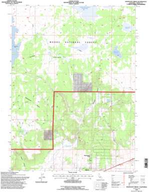
Mahogany Ridge Topo Map California
To zoom in, hover over the map of Mahogany Ridge
USGS Topo Quad 41120e5 - 1:24,000 scale
| Topo Map Name: | Mahogany Ridge |
| USGS Topo Quad ID: | 41120e5 |
| Print Size: | ca. 21 1/4" wide x 27" high |
| Southeast Coordinates: | 41.5° N latitude / 120.5° W longitude |
| Map Center Coordinates: | 41.5625° N latitude / 120.5625° W longitude |
| U.S. State: | CA |
| Filename: | o41120e5.jpg |
| Download Map JPG Image: | Mahogany Ridge topo map 1:24,000 scale |
| Map Type: | Topographic |
| Topo Series: | 7.5´ |
| Map Scale: | 1:24,000 |
| Source of Map Images: | United States Geological Survey (USGS) |
| Alternate Map Versions: |
Mahogany Ridge CA 1990, updated 1990 Download PDF Buy paper map Mahogany Ridge CA 1993, updated 1996 Download PDF Buy paper map Mahogany Ridge CA 2012 Download PDF Buy paper map Mahogany Ridge CA 2015 Download PDF Buy paper map |
| FStopo: | US Forest Service topo Mahogany Ridge is available: Download FStopo PDF Download FStopo TIF |
1:24,000 Topo Quads surrounding Mahogany Ridge
> Back to 41120e1 at 1:100,000 scale
> Back to 41120a1 at 1:250,000 scale
> Back to U.S. Topo Maps home
Mahogany Ridge topo map: Gazetteer
Mahogany Ridge: Canals
Rattlesnake Ditch elevation 1338m 4389′Mahogany Ridge: Dams
Big Dobe South 129-002 Dam elevation 1510m 4954′Mahogany Ridge: Populated Places
Daphnedale Park elevation 1356m 4448′Mahogany Ridge: Reservoirs
Emigrant Spring Reservoir elevation 1487m 4878′Indian Spring Reservoir elevation 1514m 4967′
Pretty Tree Reservoir elevation 1508m 4947′
Raker and Thomas Reservoirs elevation 1510m 4954′
Wood Flat Reservoir elevation 1492m 4895′
Mahogany Ridge: Ridges
Hog Ridge elevation 1541m 5055′Mahogany Ridge elevation 1574m 5164′
Mahogany Ridge: Springs
Emigrant Spring elevation 1491m 4891′Hidden Spring elevation 1513m 4963′
Hillside Springs elevation 1381m 4530′
Indian Spring elevation 1517m 4977′
Kelley Springs elevation 1481m 4858′
Mahogany Ridge: Streams
West Rock Creek elevation 1386m 4547′Mahogany Ridge: Valleys
Swanson Canyon elevation 1344m 4409′Mahogany Ridge digital topo map on disk
Buy this Mahogany Ridge topo map showing relief, roads, GPS coordinates and other geographical features, as a high-resolution digital map file on DVD:


