Whittemore Ridge Topo Map California
To zoom in, hover over the map of Whittemore Ridge
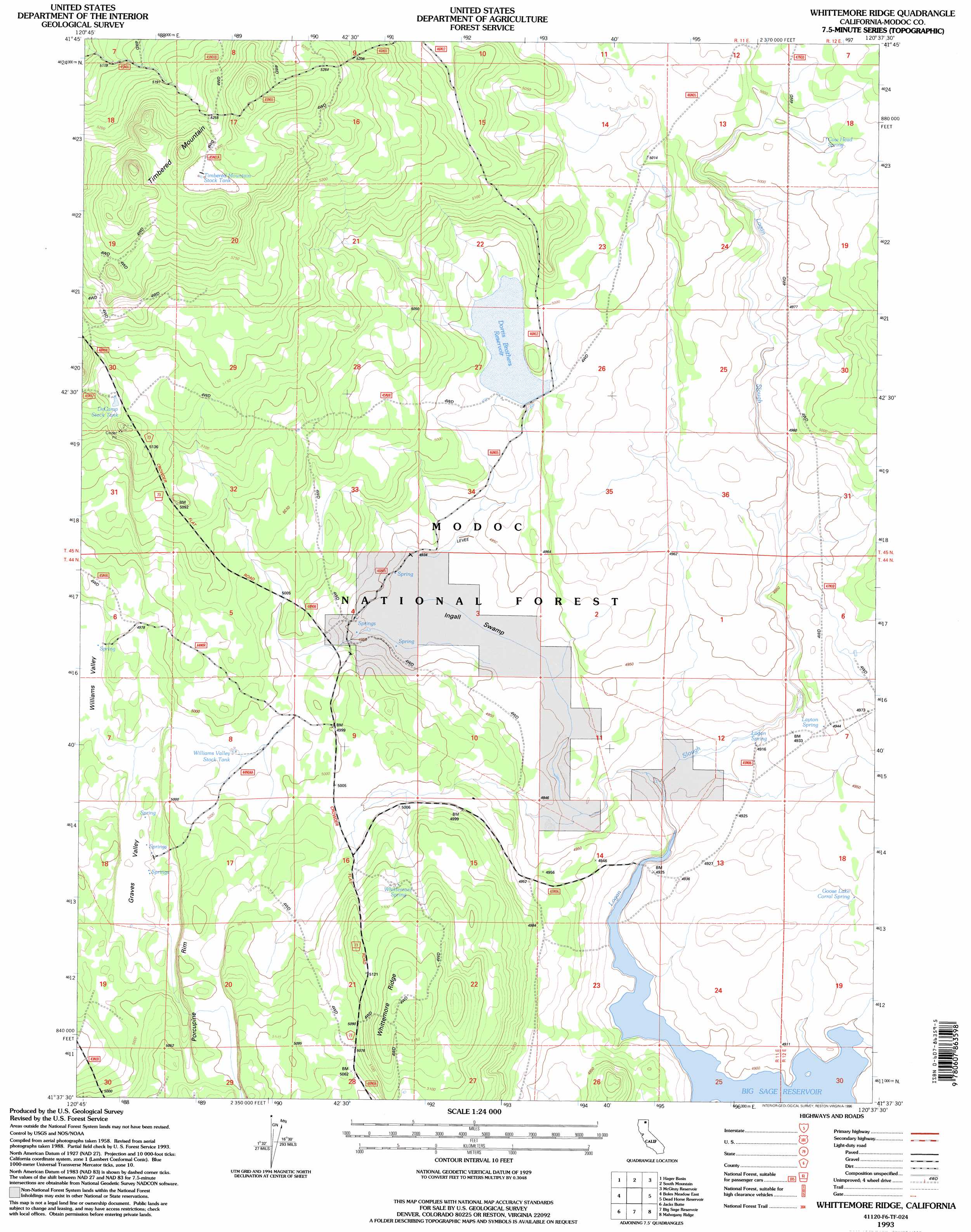
USGS Topo Quad 41120f6 - 1:24,000 scale
| Topo Map Name: | Whittemore Ridge |
| USGS Topo Quad ID: | 41120f6 |
| Print Size: | ca. 21 1/4" wide x 27" high |
| Southeast Coordinates: | 41.625° N latitude / 120.625° W longitude |
| Map Center Coordinates: | 41.6875° N latitude / 120.6875° W longitude |
| U.S. State: | CA |
| Filename: | o41120f6.jpg |
| Download Map JPG Image: | Whittemore Ridge topo map 1:24,000 scale |
| Map Type: | Topographic |
| Topo Series: | 7.5´ |
| Map Scale: | 1:24,000 |
| Source of Map Images: | United States Geological Survey (USGS) |
| Alternate Map Versions: |
Whittemore Ridge CA 1990, updated 1990 Download PDF Buy paper map Whittemore Ridge CA 1993, updated 1996 Download PDF Buy paper map Whittemore Ridge CA 2012 Download PDF Buy paper map Whittemore Ridge CA 2015 Download PDF Buy paper map |
| FStopo: | US Forest Service topo Whittemore Ridge is available: Download FStopo PDF Download FStopo TIF |
1:24,000 Topo Quads surrounding Whittemore Ridge
Steele Swamp |
Weed Valley |
Beaver Mountain |
Pease Flat |
West Of Willow Ranch |
Pothole Valley |
Hager Basin |
South Mountain |
Mcginty Reservoir |
Mcginty Point |
Boles Meadows West |
Boles Meadows East |
Whittemore Ridge |
Dead Horse Reservoir |
Lauer Reservoir |
Ambrose |
Jacks Butte |
Big Sage Reservoir |
Mahogany Ridge |
Surprise |
Washington Mountain |
Canby |
Rattlesnake Butte |
Alturas |
Dorris Reservoir |
> Back to 41120e1 at 1:100,000 scale
> Back to 41120a1 at 1:250,000 scale
> Back to U.S. Topo Maps home
Whittemore Ridge topo map: Gazetteer
Whittemore Ridge: Cliffs
Porcupine Rim elevation 1541m 5055′Whittemore Ridge: Dams
Ingals Swamp 141-002 Dam elevation 1520m 4986′Whittemore Ridge: Lakes
Goose Lake (historical) elevation 1500m 4921′Whittemore Ridge: Reservoirs
DeCamp Stock Tank elevation 1560m 5118′Dorris Brothers Reservoir elevation 1520m 4986′
Timbered Mountain Stock Tank elevation 1615m 5298′
Williams Valley Stock Tank elevation 1522m 4993′
Whittemore Ridge: Ridges
Whittemore Ridge elevation 1581m 5187′Whittemore Ridge: Springs
Corral Spring elevation 1503m 4931′Cow Head Spring elevation 1526m 5006′
Layton Spring elevation 1507m 4944′
Logan Spring elevation 1498m 4914′
Whittemore Spring elevation 1548m 5078′
Whittemore Ridge: Streams
Logan Slough elevation 1498m 4914′Whittemore Ridge: Summits
Timbered Mountain elevation 1651m 5416′Whittemore Ridge: Swamps
Ingalls Swamp elevation 1505m 4937′Whittemore Ridge: Valleys
Graves Valley elevation 1512m 4960′Whittemore Ridge digital topo map on disk
Buy this Whittemore Ridge topo map showing relief, roads, GPS coordinates and other geographical features, as a high-resolution digital map file on DVD: