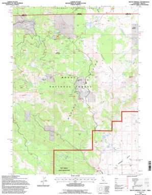
Mount Bidwell Topo Map California
To zoom in, hover over the map of Mount Bidwell
USGS Topo Quad 41120h2 - 1:24,000 scale
| Topo Map Name: | Mount Bidwell |
| USGS Topo Quad ID: | 41120h2 |
| Print Size: | ca. 21 1/4" wide x 27" high |
| Southeast Coordinates: | 41.875° N latitude / 120.125° W longitude |
| Map Center Coordinates: | 41.9375° N latitude / 120.1875° W longitude |
| U.S. States: | CA, OR |
| Filename: | o41120h2.jpg |
| Download Map JPG Image: | Mount Bidwell topo map 1:24,000 scale |
| Map Type: | Topographic |
| Topo Series: | 7.5´ |
| Map Scale: | 1:24,000 |
| Source of Map Images: | United States Geological Survey (USGS) |
| Alternate Map Versions: |
Mount Bidwell CA 1990, updated 1990 Download PDF Buy paper map Mount Bidwell CA 1993, updated 1996 Download PDF Buy paper map Mount Bidwell CA 2012 Download PDF Buy paper map Mount Bidwell CA 2015 Download PDF Buy paper map |
| FStopo: | US Forest Service topo Mount Bidwell is available: Download FStopo PDF Download FStopo TIF |
1:24,000 Topo Quads surrounding Mount Bidwell
> Back to 41120e1 at 1:100,000 scale
> Back to 41120a1 at 1:250,000 scale
> Back to U.S. Topo Maps home
Mount Bidwell topo map: Gazetteer
Mount Bidwell: Airports
Fort Bidwell Airport elevation 1396m 4580′Mount Bidwell: Areas
Indian Meadow elevation 2198m 7211′Mount Bidwell: Basins
North Star Basin elevation 2136m 7007′Mount Bidwell: Flats
Coyote Flat elevation 1691m 5547′Indian Meadow elevation 2198m 7211′
O'Connors Flat elevation 1872m 6141′
O'Leary Flat elevation 1919m 6295′
Mount Bidwell: Lakes
Cave Lake elevation 2024m 6640′Lily Lake elevation 2045m 6709′
Poison Lake elevation 2195m 7201′
Rack Lake elevation 1874m 6148′
Snow Lake elevation 2473m 8113′
Mount Bidwell: Mines
Blue Bell Mine elevation 2226m 7303′Consolidated Mine elevation 2282m 7486′
Klondyke Mines elevation 2323m 7621′
Little Lily Mine elevation 2255m 7398′
Modoc Mines elevation 2294m 7526′
Moonlight Mines elevation 2346m 7696′
Morrel Mine elevation 2122m 6961′
Sunshine Mine elevation 2321m 7614′
Mount Bidwell: Reservoirs
Burger Reservoir elevation 1616m 5301′Mount Bidwell: Springs
Highgrade Spring elevation 2328m 7637′Mineral Spring elevation 2331m 7647′
Mount Bidwell: Streams
Harper Creek elevation 1481m 4858′Mill Creek elevation 1512m 4960′
South Fork Twelvemile Creek elevation 2147m 7043′
Mount Bidwell: Summits
Mount Bidwell elevation 2529m 8297′Mount Vida elevation 2500m 8202′
Yellow Mountain elevation 2460m 8070′
Mount Bidwell: Swamps
Dismal Swamp elevation 2215m 7267′Mount Bidwell: Trails
Crane Mountain National Recreation Trail elevation 2381m 7811′Highgrade Trail elevation 2378m 7801′
Mill Creek Trail elevation 1917m 6289′
Mount Bidwell digital topo map on disk
Buy this Mount Bidwell topo map showing relief, roads, GPS coordinates and other geographical features, as a high-resolution digital map file on DVD:


