West Of Willow Ranch Topo Map California
To zoom in, hover over the map of West Of Willow Ranch
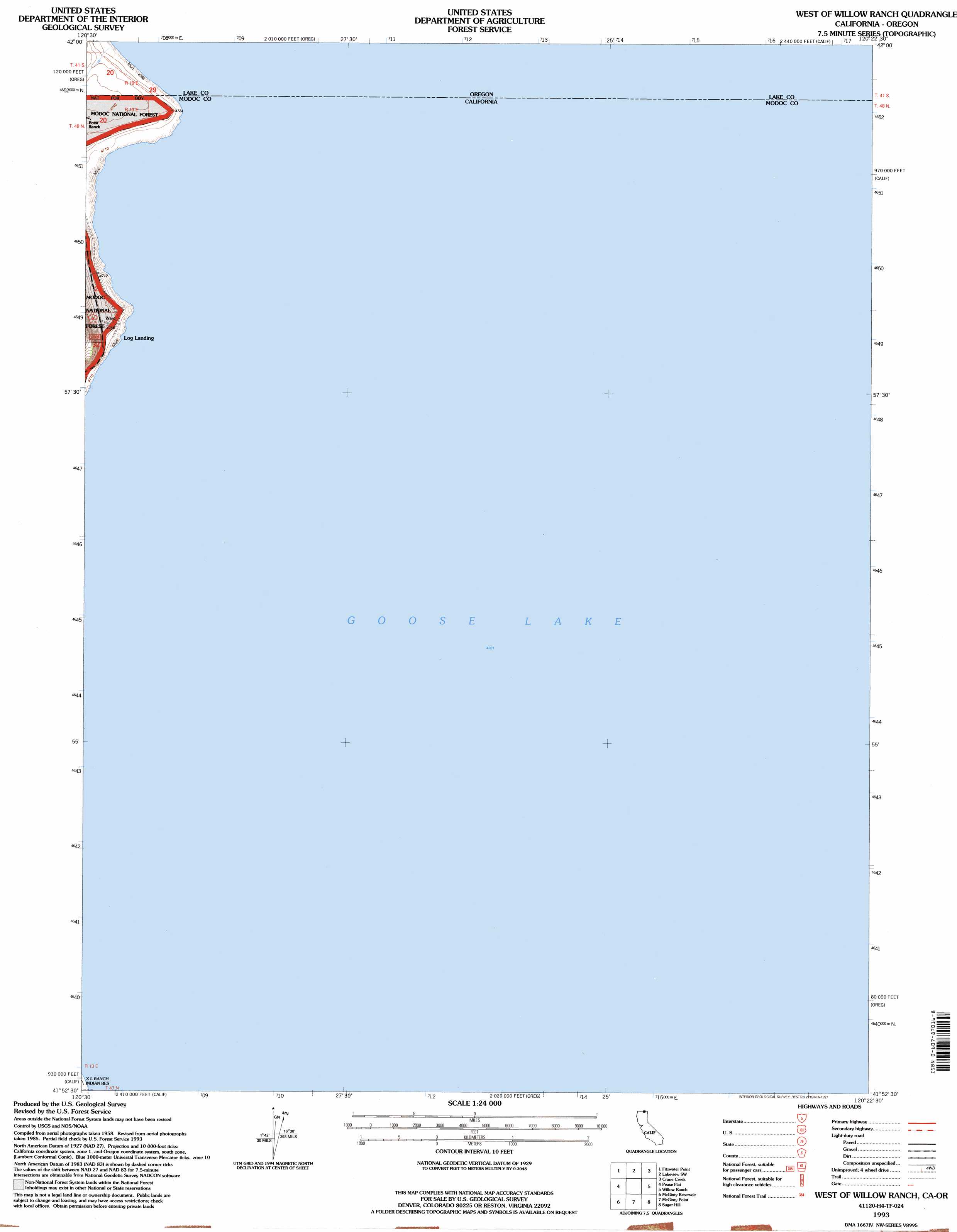
USGS Topo Quad 41120h4 - 1:24,000 scale
| Topo Map Name: | West Of Willow Ranch |
| USGS Topo Quad ID: | 41120h4 |
| Print Size: | ca. 21 1/4" wide x 27" high |
| Southeast Coordinates: | 41.875° N latitude / 120.375° W longitude |
| Map Center Coordinates: | 41.9375° N latitude / 120.4375° W longitude |
| U.S. States: | CA, OR |
| Filename: | o41120h4.jpg |
| Download Map JPG Image: | West Of Willow Ranch topo map 1:24,000 scale |
| Map Type: | Topographic |
| Topo Series: | 7.5´ |
| Map Scale: | 1:24,000 |
| Source of Map Images: | United States Geological Survey (USGS) |
| Alternate Map Versions: |
West of Willow Ranch CA 1990, updated 1990 Download PDF Buy paper map West of Willow Ranch CA 1993, updated 1997 Download PDF Buy paper map West of Willow Ranch CA 2012 Download PDF Buy paper map West of Willow Ranch CA 2015 Download PDF Buy paper map |
| FStopo: | US Forest Service topo West of Willow Ranch is available: Download FStopo PDF Download FStopo TIF |
1:24,000 Topo Quads surrounding West Of Willow Ranch
Drews Reservoir |
Drews Gap |
Lakeview Airport |
Lakeview |
Horse Prairie |
Dog Lake |
Fitzwater Point |
West Side |
Crane Creek |
Crane Mountain |
Beaver Mountain |
Pease Flat |
West Of Willow Ranch |
Willow Ranch |
Mount Bidwell |
South Mountain |
Mcginty Reservoir |
Mcginty Point |
Sugar Hill |
Fort Bidwell |
Whittemore Ridge |
Dead Horse Reservoir |
Lauer Reservoir |
Davis Creek |
Lake City |
> Back to 41120e1 at 1:100,000 scale
> Back to 41120a1 at 1:250,000 scale
> Back to U.S. Topo Maps home
West Of Willow Ranch topo map: Gazetteer
West Of Willow Ranch: Lakes
Goose Lake elevation 1434m 4704′West Of Willow Ranch digital topo map on disk
Buy this West Of Willow Ranch topo map showing relief, roads, GPS coordinates and other geographical features, as a high-resolution digital map file on DVD: