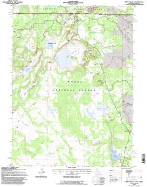
Weed Valley Topo Map California
To zoom in, hover over the map of Weed Valley
USGS Topo Quad 41120h7 - 1:24,000 scale
| Topo Map Name: | Weed Valley |
| USGS Topo Quad ID: | 41120h7 |
| Print Size: | ca. 21 1/4" wide x 27" high |
| Southeast Coordinates: | 41.875° N latitude / 120.75° W longitude |
| Map Center Coordinates: | 41.9375° N latitude / 120.8125° W longitude |
| U.S. States: | CA, OR |
| Filename: | o41120h7.jpg |
| Download Map JPG Image: | Weed Valley topo map 1:24,000 scale |
| Map Type: | Topographic |
| Topo Series: | 7.5´ |
| Map Scale: | 1:24,000 |
| Source of Map Images: | United States Geological Survey (USGS) |
| Alternate Map Versions: |
Weed Valley CA 1990, updated 1990 Download PDF Buy paper map Weed Valley CA 1993, updated 1996 Download PDF Buy paper map Weed Valley CA 2012 Download PDF Buy paper map Weed Valley CA 2015 Download PDF Buy paper map |
| FStopo: | US Forest Service topo Weed Valley is available: Download FStopo PDF Download FStopo TIF |
1:24,000 Topo Quads surrounding Weed Valley
> Back to 41120e1 at 1:100,000 scale
> Back to 41120a1 at 1:250,000 scale
> Back to U.S. Topo Maps home
Weed Valley topo map: Gazetteer
Weed Valley: Dams
Janes Flat 121 Dam elevation 1555m 5101′Weed Valley: Flats
Buchanan Flat elevation 1579m 5180′Coyote Meadow elevation 1580m 5183′
Jims Flat elevation 1684m 5524′
Weed Valley: Reservoirs
Baseball Reservoir elevation 1601m 5252′Diamond Reservoir elevation 1604m 5262′
Janes Reservoir elevation 1555m 5101′
Kellogg Tank elevation 1587m 5206′
Picnic Grove Reservoir elevation 1530m 5019′
Rock Creek Reservoir elevation 1528m 5013′
Wild Horse Reservoir elevation 1504m 4934′
Weed Valley: Springs
Buckhorn Spring elevation 1624m 5328′Dip Spring elevation 1625m 5331′
Juniper Spring elevation 1646m 5400′
Triple Spring elevation 1634m 5360′
Wilcox Spring elevation 1463m 4799′
Weed Valley: Streams
Willow Creek elevation 1549m 5082′Weed Valley: Summits
Kellogg Mountain elevation 1673m 5488′Weed Valley: Valleys
Hidden Valley elevation 1494m 4901′Weed Valley elevation 1549m 5082′
Wild Horse Valley elevation 1505m 4937′
Weed Valley digital topo map on disk
Buy this Weed Valley topo map showing relief, roads, GPS coordinates and other geographical features, as a high-resolution digital map file on DVD:


