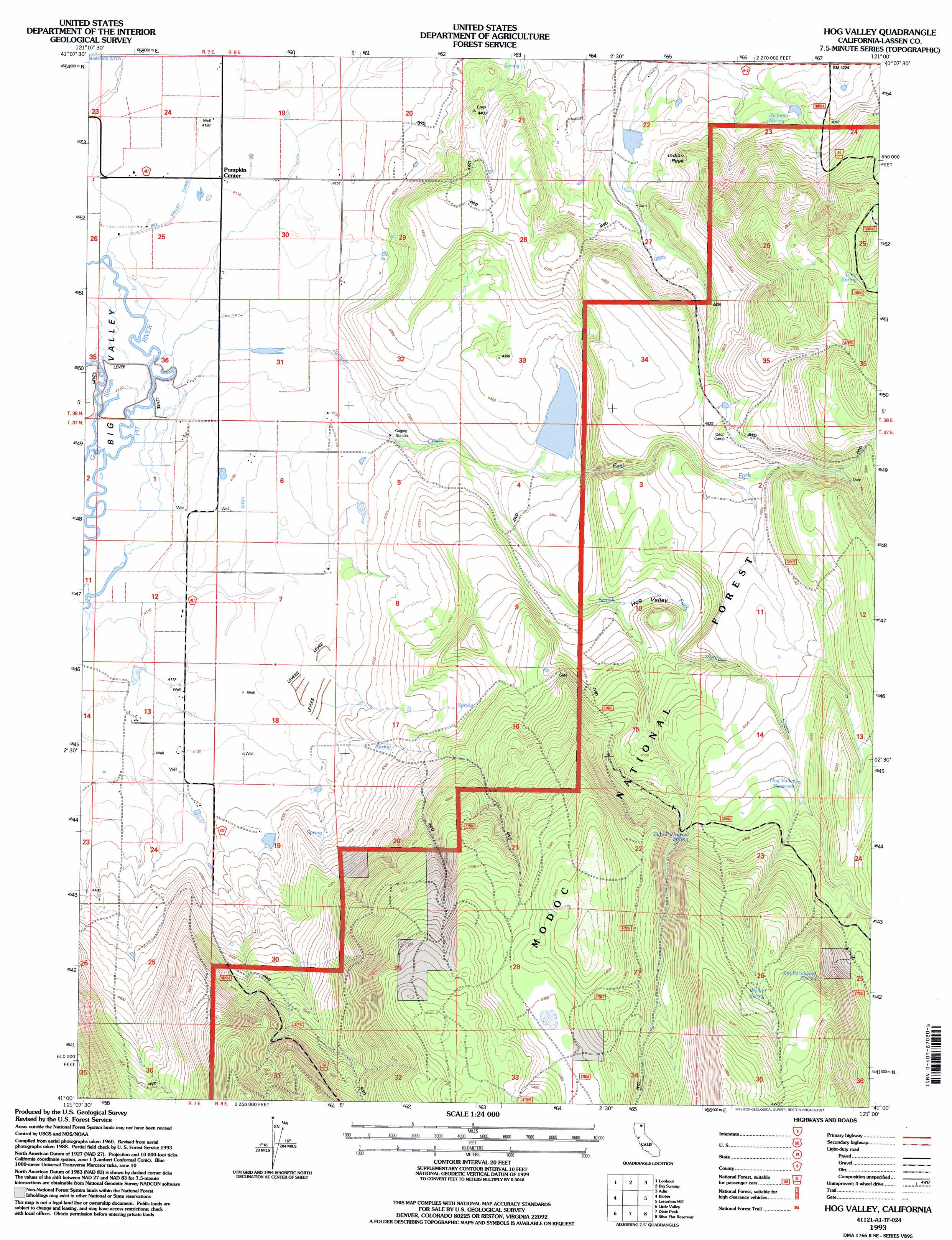
Hog Valley Topo Map California
To zoom in, hover over the map of Hog Valley
USGS Topo Quad 41121a1 - 1:24,000 scale
| Topo Map Name: | Hog Valley |
| USGS Topo Quad ID: | 41121a1 |
| Print Size: | ca. 21 1/4" wide x 27" high |
| Southeast Coordinates: | 41° N latitude / 121° W longitude |
| Map Center Coordinates: | 41.0625° N latitude / 121.0625° W longitude |
| U.S. State: | CA |
| Filename: | o41121a1.jpg |
| Download Map JPG Image: | Hog Valley topo map 1:24,000 scale |
| Map Type: | Topographic |
| Topo Series: | 7.5´ |
| Map Scale: | 1:24,000 |
| Source of Map Images: | United States Geological Survey (USGS) |
| Alternate Map Versions: |
Hog Valley CA 1990, updated 1990 Download PDF Buy paper map Hog Valley CA 1993, updated 1997 Download PDF Buy paper map Hog Valley CA 2012 Download PDF Buy paper map Hog Valley CA 2015 Download PDF Buy paper map |
| FStopo: | US Forest Service topo Hog Valley is available: Download FStopo PDF Download FStopo TIF |
1:24,000 Topo Quads surrounding Hog Valley
Egg Lake |
Donica Mountain |
Halls Canyon |
Adin Pass |
Hermit Butte |
Day |
Lookout |
Big Swamp |
Adin |
Ambrose Valley |
Pittville |
Bieber |
Hog Valley |
Letterbox Hill |
Lane Reservoir |
Coble Mountain |
Little Valley |
Dixie Peak |
Silva Flat Reservoir |
Said Valley |
Jellico |
Corders Reservoir |
Straylor Lake |
Bullard Lake |
Sheepshead |
> Back to 41121a1 at 1:100,000 scale
> Back to 41120a1 at 1:250,000 scale
> Back to U.S. Topo Maps home
Hog Valley topo map: Gazetteer
Hog Valley: Dams
Iverson 1239 Dam elevation 1299m 4261′Leonard Number 2 1252 Dam elevation 1290m 4232′
Hog Valley: Pillars
Indian Peak elevation 1374m 4507′Hog Valley: Populated Places
Pumpkin Center elevation 1260m 4133′Hog Valley: Reservoirs
Hog Valley Reservoir elevation 1451m 4760′Hog Valley: Springs
Billy Packwood Spring elevation 1472m 4829′Cary Spring elevation 1506m 4940′
Jim Packwood Spring elevation 1643m 5390′
Richman Spring elevation 1301m 4268′
Walker Spring elevation 1635m 5364′
Hog Valley: Streams
East Fork Juniper Creek elevation 1286m 4219′Juniper Creek elevation 1254m 4114′
South Fork Juniper Creek elevation 1286m 4219′
Hog Valley: Valleys
Hog Valley elevation 1322m 4337′Hog Valley digital topo map on disk
Buy this Hog Valley topo map showing relief, roads, GPS coordinates and other geographical features, as a high-resolution digital map file on DVD: