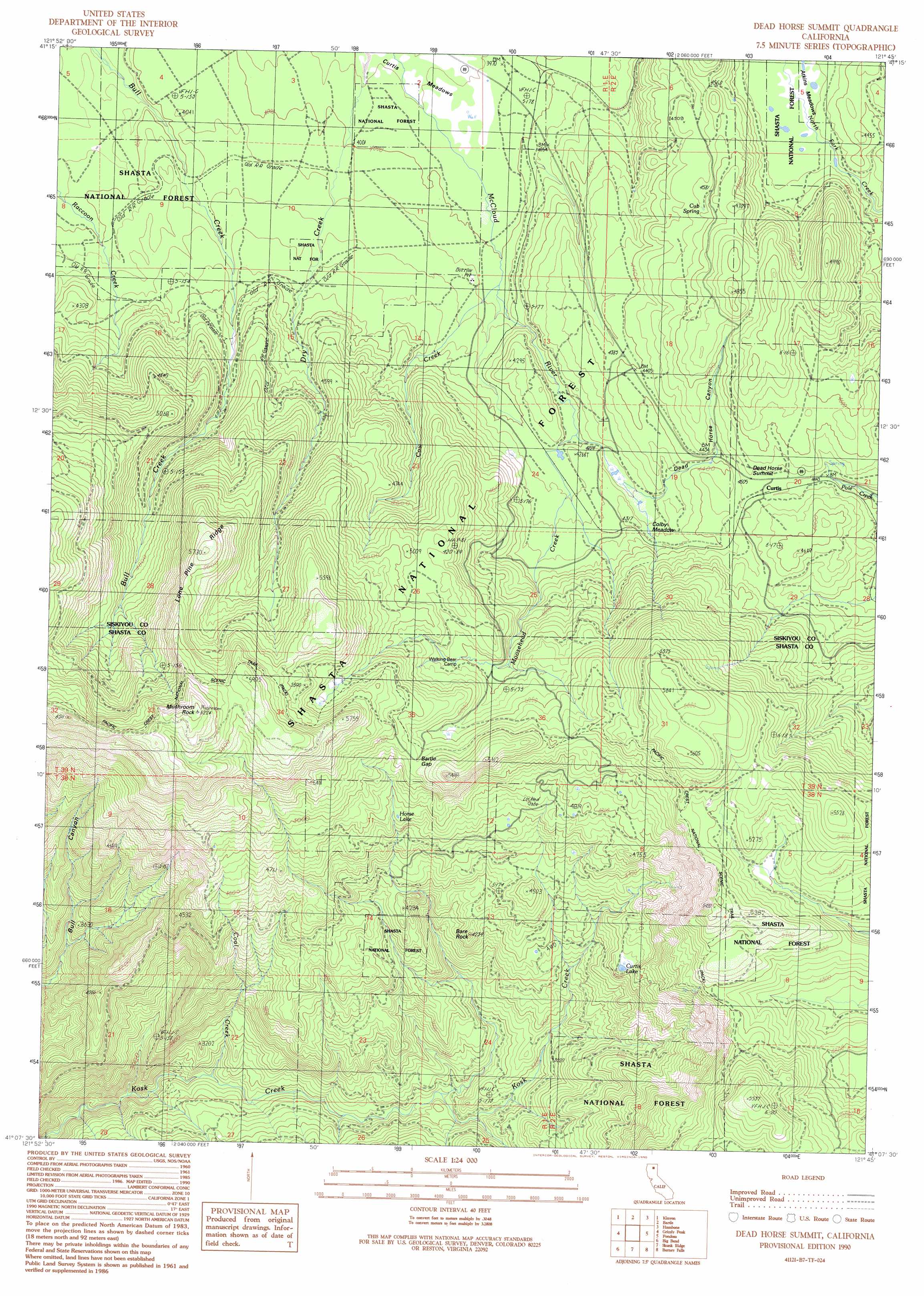
Dead Horse Summit Topo Map California
To zoom in, hover over the map of Dead Horse Summit
USGS Topo Quad 41121b7 - 1:24,000 scale
| Topo Map Name: | Dead Horse Summit |
| USGS Topo Quad ID: | 41121b7 |
| Print Size: | ca. 21 1/4" wide x 27" high |
| Southeast Coordinates: | 41.125° N latitude / 121.75° W longitude |
| Map Center Coordinates: | 41.1875° N latitude / 121.8125° W longitude |
| U.S. State: | CA |
| Filename: | o41121b7.jpg |
| Download Map JPG Image: | Dead Horse Summit topo map 1:24,000 scale |
| Map Type: | Topographic |
| Topo Series: | 7.5´ |
| Map Scale: | 1:24,000 |
| Source of Map Images: | United States Geological Survey (USGS) |
| Alternate Map Versions: |
Dead Horse Summit CA 1990, updated 1990 Download PDF Buy paper map Dead Horse Summit CA 1998, updated 2003 Download PDF Buy paper map Dead Horse Summit CA 2012 Download PDF Buy paper map Dead Horse Summit CA 2015 Download PDF Buy paper map |
| FStopo: | US Forest Service topo Dead Horse Summit is available: Download FStopo PDF Download FStopo TIF |
1:24,000 Topo Quads surrounding Dead Horse Summit
Ash Creek Butte |
Rainbow Mountain |
Horse Peak |
Snag Hill |
Porcupine Butte |
Elk Spring |
Kinyon |
Bartle |
Hambone |
Indian Spring Mountain |
Lake Mccloud |
Grizzly Peak |
Dead Horse Summit |
Pondosa |
East Of Pondosa |
Shoeinhorse Mountain |
Big Bend |
Skunk Ridge |
Burney Falls |
Dana |
Goose Gap |
Roaring Creek |
Chalk Mountain |
Burney |
Cassel |
> Back to 41121a1 at 1:100,000 scale
> Back to 41120a1 at 1:250,000 scale
> Back to U.S. Topo Maps home
Dead Horse Summit topo map: Gazetteer
Dead Horse Summit: Flats
Colby Meadow elevation 1307m 4288′Dead Horse Summit: Gaps
Bartle Gap elevation 1561m 5121′Dead Horse Summit: Lakes
Curtis Lake elevation 1293m 4242′Horse Lake elevation 1432m 4698′
Dead Horse Summit: Pillars
Bare Rock elevation 1259m 4130′Mushroom Rock elevation 1886m 6187′
Dead Horse Summit: Populated Places
Curtis elevation 1367m 4484′Dead Horse Summit: Ridges
Lone Pine Ridge elevation 1635m 5364′Dead Horse Summit: Springs
Cub Spring elevation 1390m 4560′Dead Horse Summit: Streams
Coal Creek elevation 867m 2844′Cow Creek elevation 1227m 4025′
Moosehead Creek elevation 1279m 4196′
Dead Horse Summit: Summits
Dead Horse Summit elevation 1379m 4524′Dead Horse Summit: Valleys
Dead Horse Canyon elevation 1306m 4284′Dead Horse Summit digital topo map on disk
Buy this Dead Horse Summit topo map showing relief, roads, GPS coordinates and other geographical features, as a high-resolution digital map file on DVD: