Indian Spring Mountain Topo Map California
To zoom in, hover over the map of Indian Spring Mountain
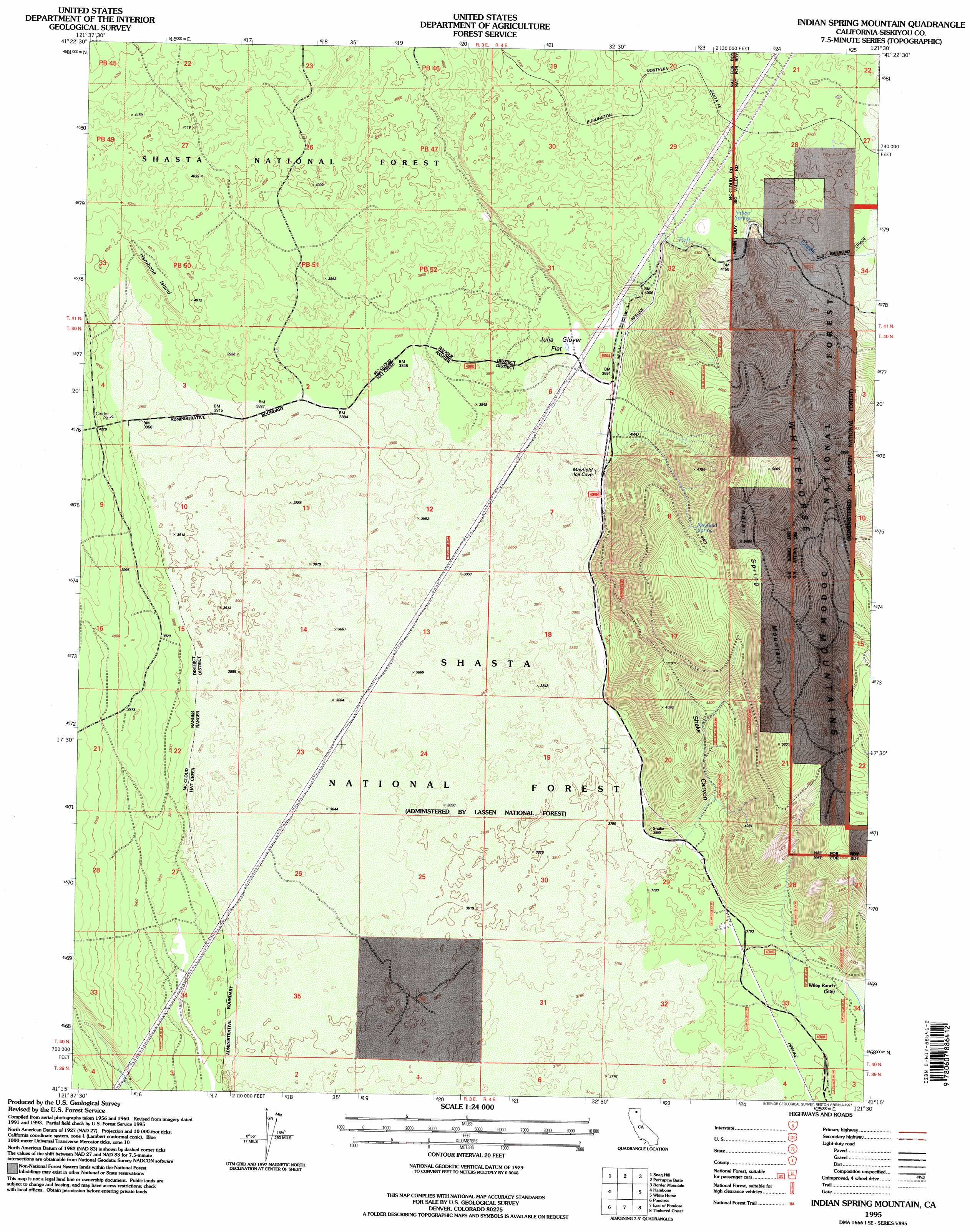
USGS Topo Quad 41121c5 - 1:24,000 scale
| Topo Map Name: | Indian Spring Mountain |
| USGS Topo Quad ID: | 41121c5 |
| Print Size: | ca. 21 1/4" wide x 27" high |
| Southeast Coordinates: | 41.25° N latitude / 121.5° W longitude |
| Map Center Coordinates: | 41.3125° N latitude / 121.5625° W longitude |
| U.S. State: | CA |
| Filename: | o41121c5.jpg |
| Download Map JPG Image: | Indian Spring Mountain topo map 1:24,000 scale |
| Map Type: | Topographic |
| Topo Series: | 7.5´ |
| Map Scale: | 1:24,000 |
| Source of Map Images: | United States Geological Survey (USGS) |
| Alternate Map Versions: |
Indian Spring Mountain CA 1990, updated 1990 Download PDF Buy paper map Indian Spring Mountain CA 1995, updated 1997 Download PDF Buy paper map Indian Spring Mountain CA 2012 Download PDF Buy paper map Indian Spring Mountain CA 2015 Download PDF Buy paper map |
| FStopo: | US Forest Service topo Indian Spring Mountain is available: Download FStopo PDF Download FStopo TIF |
1:24,000 Topo Quads surrounding Indian Spring Mountain
Garner Mountain |
Little Glass Mountain |
Medicine Lake |
West Of Kephart |
Kephart |
Horse Peak |
Snag Hill |
Porcupine Butte |
Border Mountain |
Hollenbeck |
Bartle |
Hambone |
Indian Spring Mountain |
Whitehorse |
Egg Lake |
Dead Horse Summit |
Pondosa |
East Of Pondosa |
Timbered Crater |
Day |
Skunk Ridge |
Burney Falls |
Dana |
Fall River Mills |
Pittville |
> Back to 41121a1 at 1:100,000 scale
> Back to 41120a1 at 1:250,000 scale
> Back to U.S. Topo Maps home
Indian Spring Mountain topo map: Gazetteer
Indian Spring Mountain: Flats
Julia Glover Flat elevation 1173m 3848′Indian Spring Mountain: Islands
Hambone Island elevation 1229m 4032′Indian Spring Mountain: Springs
Indian Spring elevation 1279m 4196′Mayfield Spring elevation 1456m 4776′
Indian Spring Mountain: Streams
Tuft Creek elevation 1177m 3861′Indian Spring Mountain: Summits
Indian Spring Mountain elevation 1681m 5515′Indian Spring Mountain: Valleys
Shake Canyon elevation 1165m 3822′Indian Spring Mountain digital topo map on disk
Buy this Indian Spring Mountain topo map showing relief, roads, GPS coordinates and other geographical features, as a high-resolution digital map file on DVD: