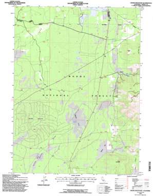
Crank Mountain Topo Map California
To zoom in, hover over the map of Crank Mountain
USGS Topo Quad 41121d2 - 1:24,000 scale
| Topo Map Name: | Crank Mountain |
| USGS Topo Quad ID: | 41121d2 |
| Print Size: | ca. 21 1/4" wide x 27" high |
| Southeast Coordinates: | 41.375° N latitude / 121.125° W longitude |
| Map Center Coordinates: | 41.4375° N latitude / 121.1875° W longitude |
| U.S. State: | CA |
| Filename: | o41121d2.jpg |
| Download Map JPG Image: | Crank Mountain topo map 1:24,000 scale |
| Map Type: | Topographic |
| Topo Series: | 7.5´ |
| Map Scale: | 1:24,000 |
| Source of Map Images: | United States Geological Survey (USGS) |
| Alternate Map Versions: |
Crank Mountain CA 1990, updated 1990 Download PDF Buy paper map Crank Mountain CA 1993, updated 1997 Download PDF Buy paper map Crank Mountain CA 2012 Download PDF Buy paper map Crank Mountain CA 2015 Download PDF Buy paper map |
| FStopo: | US Forest Service topo Crank Mountain is available: Download FStopo PDF Download FStopo TIF |
1:24,000 Topo Quads surrounding Crank Mountain
> Back to 41121a1 at 1:100,000 scale
> Back to 41120a1 at 1:250,000 scale
> Back to U.S. Topo Maps home
Crank Mountain topo map: Gazetteer
Crank Mountain: Flats
Hess Flat elevation 1460m 4790′Keeney Flat elevation 1430m 4691′
Sand Flat elevation 1380m 4527′
Service Flat elevation 1352m 4435′
Webb Flat elevation 1389m 4557′
Crank Mountain: Lakes
Mud Lake elevation 1420m 4658′Crank Mountain: Lavas
Little Lavas elevation 1391m 4563′Crank Mountain: Reservoirs
Courtright Reservoir elevation 1437m 4714′Webb Flat Reservoir elevation 1388m 4553′
Crank Mountain: Springs
Happy Camp Spring elevation 1463m 4799′Hess Spring elevation 1512m 4960′
Crank Mountain: Summits
Crank Mountain elevation 1586m 5203′Fleener Butte elevation 1572m 5157′
Webb Butte elevation 1459m 4786′
Crank Mountain digital topo map on disk
Buy this Crank Mountain topo map showing relief, roads, GPS coordinates and other geographical features, as a high-resolution digital map file on DVD:


