Border Mountain Topo Map California
To zoom in, hover over the map of Border Mountain
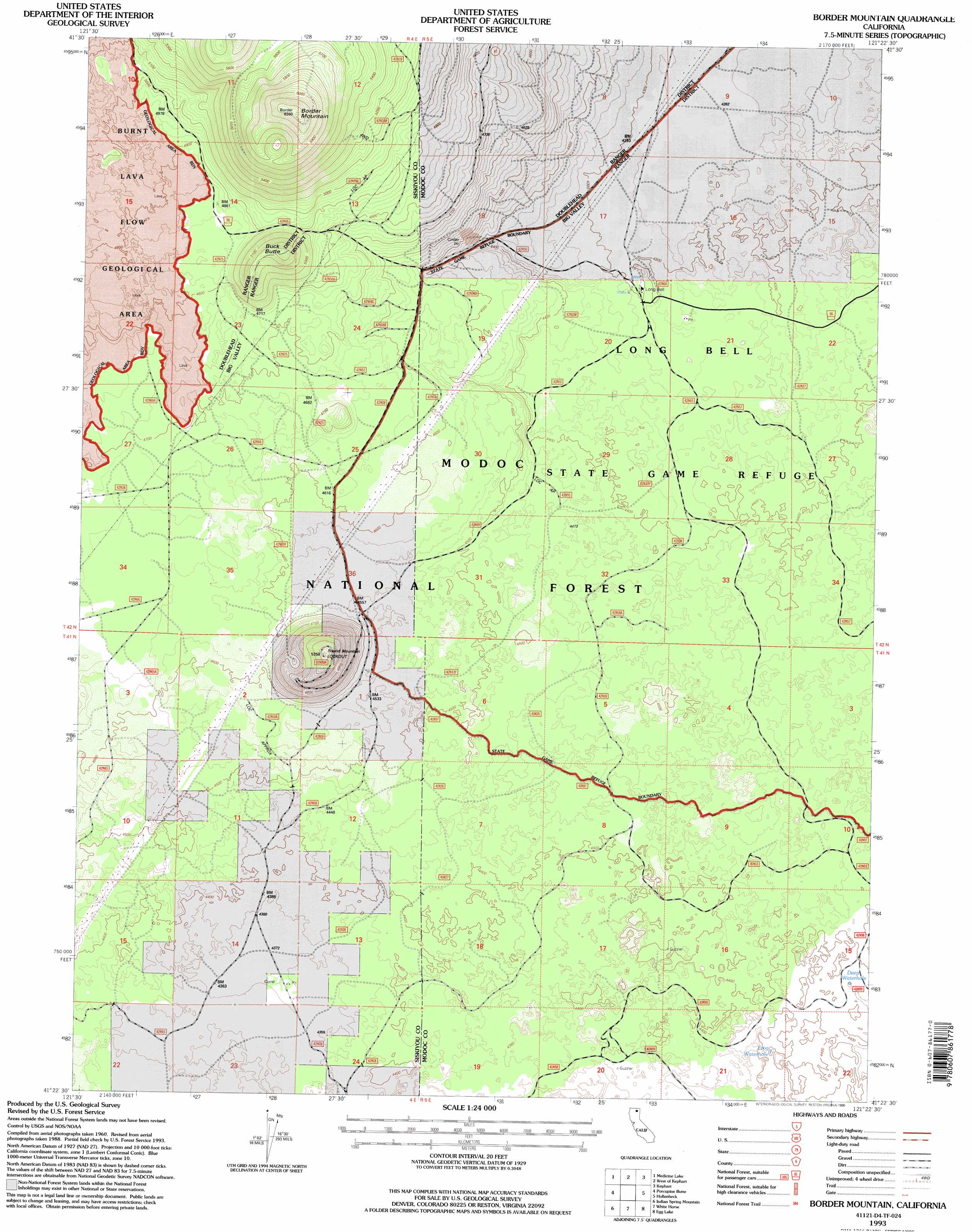
USGS Topo Quad 41121d4 - 1:24,000 scale
| Topo Map Name: | Border Mountain |
| USGS Topo Quad ID: | 41121d4 |
| Print Size: | ca. 21 1/4" wide x 27" high |
| Southeast Coordinates: | 41.375° N latitude / 121.375° W longitude |
| Map Center Coordinates: | 41.4375° N latitude / 121.4375° W longitude |
| U.S. State: | CA |
| Filename: | o41121d4.jpg |
| Download Map JPG Image: | Border Mountain topo map 1:24,000 scale |
| Map Type: | Topographic |
| Topo Series: | 7.5´ |
| Map Scale: | 1:24,000 |
| Source of Map Images: | United States Geological Survey (USGS) |
| Alternate Map Versions: |
Border Mountain CA 1990, updated 1990 Download PDF Buy paper map Border Mountain CA 1993, updated 1996 Download PDF Buy paper map Border Mountain CA 2012 Download PDF Buy paper map Border Mountain CA 2015 Download PDF Buy paper map |
| FStopo: | US Forest Service topo Border Mountain is available: Download FStopo PDF Download FStopo TIF |
1:24,000 Topo Quads surrounding Border Mountain
Bonita Butte |
Schonchin Butte |
Caldwell Butte |
Perez |
Rimrock Lake |
Little Glass Mountain |
Medicine Lake |
West Of Kephart |
Kephart |
Spaulding Butte |
Snag Hill |
Porcupine Butte |
Border Mountain |
Hollenbeck |
Crank Mountain |
Hambone |
Indian Spring Mountain |
Whitehorse |
Egg Lake |
Donica Mountain |
Pondosa |
East Of Pondosa |
Timbered Crater |
Day |
Lookout |
> Back to 41121a1 at 1:100,000 scale
> Back to 41120a1 at 1:250,000 scale
> Back to U.S. Topo Maps home
Border Mountain topo map: Gazetteer
Border Mountain: Lakes
Deep Waterhole elevation 1336m 4383′Frog Waterhole elevation 1342m 4402′
Border Mountain: Summits
Border Mountain elevation 1905m 6250′Buck Butte elevation 1627m 5337′
Round Mountain elevation 1594m 5229′
Border Mountain digital topo map on disk
Buy this Border Mountain topo map showing relief, roads, GPS coordinates and other geographical features, as a high-resolution digital map file on DVD: