Horse Peak Topo Map California
To zoom in, hover over the map of Horse Peak
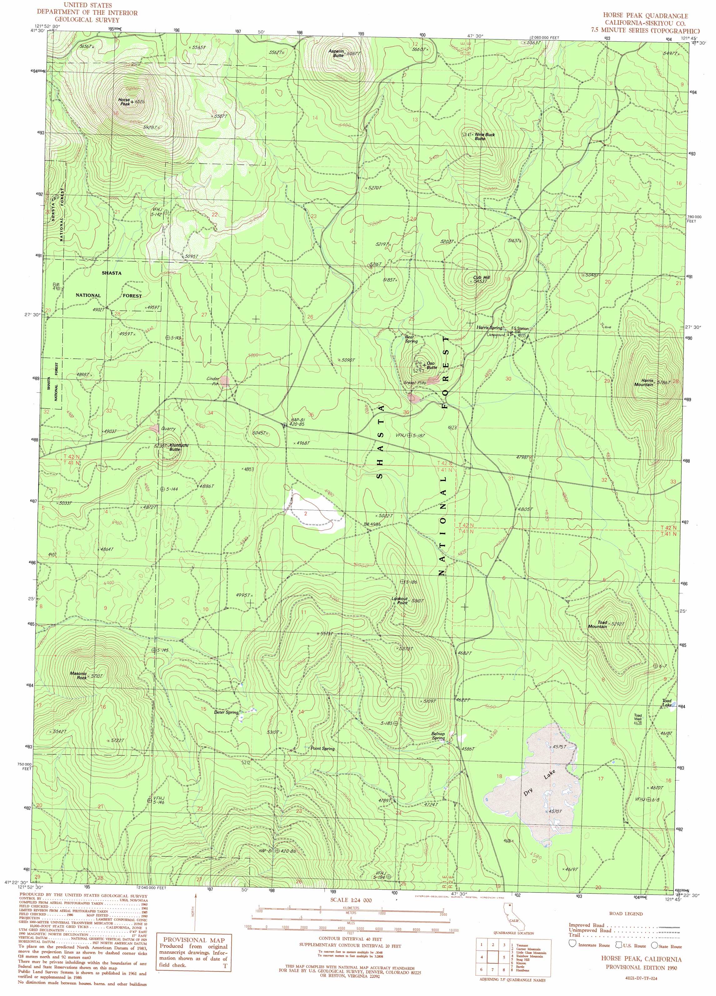
USGS Topo Quad 41121d7 - 1:24,000 scale
| Topo Map Name: | Horse Peak |
| USGS Topo Quad ID: | 41121d7 |
| Print Size: | ca. 21 1/4" wide x 27" high |
| Southeast Coordinates: | 41.375° N latitude / 121.75° W longitude |
| Map Center Coordinates: | 41.4375° N latitude / 121.8125° W longitude |
| U.S. State: | CA |
| Filename: | o41121d7.jpg |
| Download Map JPG Image: | Horse Peak topo map 1:24,000 scale |
| Map Type: | Topographic |
| Topo Series: | 7.5´ |
| Map Scale: | 1:24,000 |
| Source of Map Images: | United States Geological Survey (USGS) |
| Alternate Map Versions: |
Horse Peak CA 1990, updated 1990 Download PDF Buy paper map Horse Peak CA 1998, updated 2003 Download PDF Buy paper map Horse Peak CA 2012 Download PDF Buy paper map Horse Peak CA 2015 Download PDF Buy paper map |
| FStopo: | US Forest Service topo Horse Peak is available: Download FStopo PDF Download FStopo TIF |
1:24,000 Topo Quads surrounding Horse Peak
Penoyar |
Bray |
Sharp Mountain |
Bonita Butte |
Schonchin Butte |
West Haight Mountain |
Tennant |
Garner Mountain |
Little Glass Mountain |
Medicine Lake |
Ash Creek Butte |
Rainbow Mountain |
Horse Peak |
Snag Hill |
Porcupine Butte |
Elk Spring |
Kinyon |
Bartle |
Hambone |
Indian Spring Mountain |
Lake Mccloud |
Grizzly Peak |
Dead Horse Summit |
Pondosa |
East Of Pondosa |
> Back to 41121a1 at 1:100,000 scale
> Back to 41120a1 at 1:250,000 scale
> Back to U.S. Topo Maps home
Horse Peak topo map: Gazetteer
Horse Peak: Flats
Dry Lake elevation 1394m 4573′Horse Peak: Lakes
Toad Lake elevation 1415m 4642′Horse Peak: Pillars
Masonic Rock elevation 1733m 5685′Horse Peak: Ridges
Fisk Ridge elevation 1857m 6092′Horse Peak: Springs
Bear Spring elevation 1525m 5003′Belnap Spring elevation 1403m 4603′
Deter Spring elevation 1555m 5101′
Harris Spring elevation 1492m 4895′
Point Spring elevation 1569m 5147′
Horse Peak: Summits
Asperin Butte elevation 1857m 6092′Cub Hill elevation 1661m 5449′
Harris Mountain elevation 1748m 5734′
Horse Peak elevation 1948m 6391′
Kluntuchi Butte elevation 1581m 5187′
Lookout Point elevation 1600m 5249′
Nine Buck Butte elevation 1735m 5692′
Oso Butte elevation 1606m 5269′
Toad Mountain elevation 1610m 5282′
Horse Peak: Wells
Lost Iron Well elevation 1490m 4888′Toad Well elevation 1412m 4632′
Horse Peak digital topo map on disk
Buy this Horse Peak topo map showing relief, roads, GPS coordinates and other geographical features, as a high-resolution digital map file on DVD: