Knobcone Butte Topo Map California
To zoom in, hover over the map of Knobcone Butte
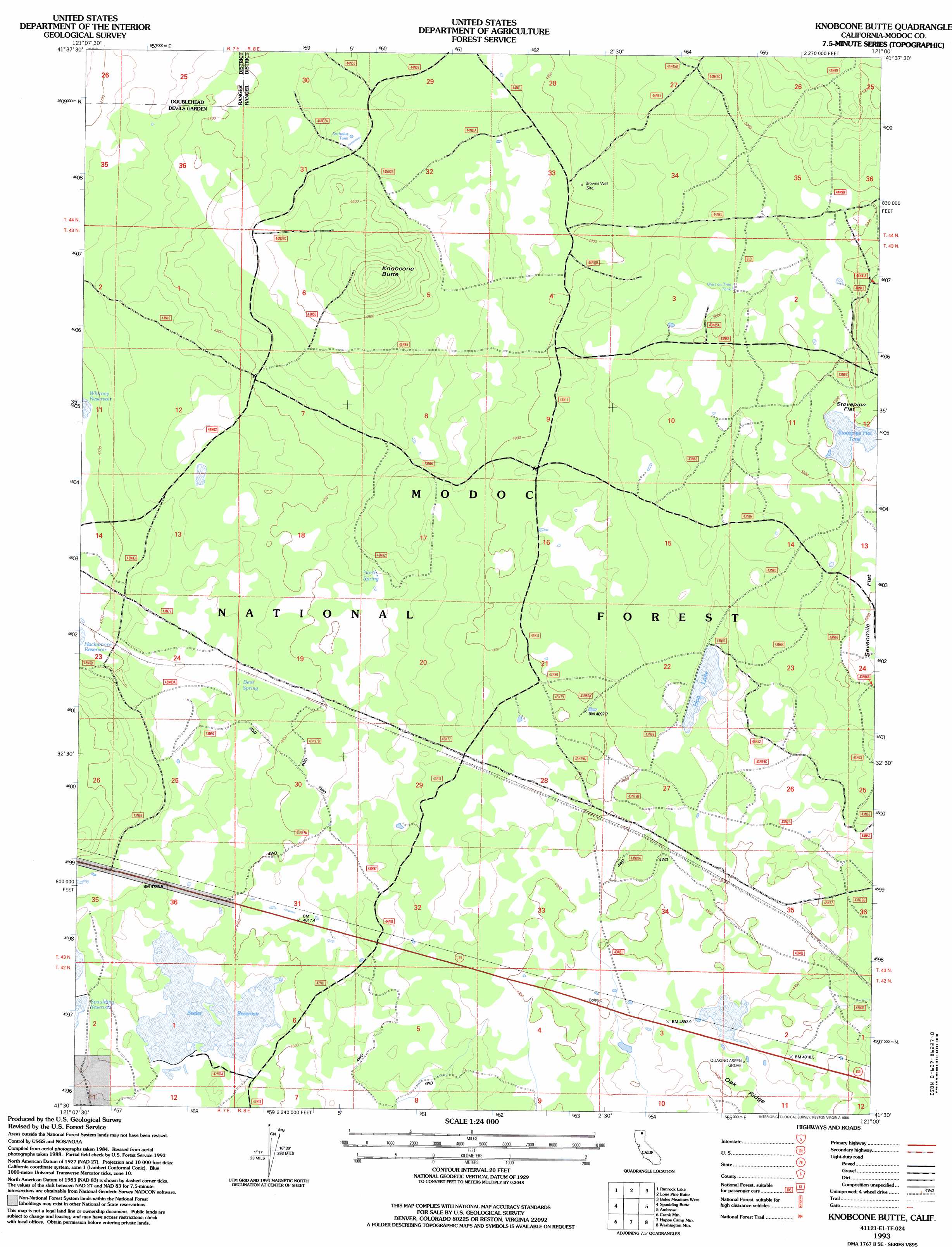
USGS Topo Quad 41121e1 - 1:24,000 scale
| Topo Map Name: | Knobcone Butte |
| USGS Topo Quad ID: | 41121e1 |
| Print Size: | ca. 21 1/4" wide x 27" high |
| Southeast Coordinates: | 41.5° N latitude / 121° W longitude |
| Map Center Coordinates: | 41.5625° N latitude / 121.0625° W longitude |
| U.S. State: | CA |
| Filename: | o41121e1.jpg |
| Download Map JPG Image: | Knobcone Butte topo map 1:24,000 scale |
| Map Type: | Topographic |
| Topo Series: | 7.5´ |
| Map Scale: | 1:24,000 |
| Source of Map Images: | United States Geological Survey (USGS) |
| Alternate Map Versions: |
Knobcone Butte CA 1988, updated 1988 Download PDF Buy paper map Knobcone Butte CA 1993, updated 1996 Download PDF Buy paper map Knobcone Butte CA 2012 Download PDF Buy paper map Knobcone Butte CA 2015 Download PDF Buy paper map |
| FStopo: | US Forest Service topo Knobcone Butte is available: Download FStopo PDF Download FStopo TIF |
1:24,000 Topo Quads surrounding Knobcone Butte
Copic |
Double Head Mountain |
Pinnacle Lake |
Pothole Valley |
Hager Basin |
Perez |
Rimrock Lake |
Lone Pine Butte |
Boles Meadows West |
Boles Meadows East |
Kephart |
Spaulding Butte |
Knobcone Butte |
Ambrose |
Jacks Butte |
Hollenbeck |
Crank Mountain |
Happy Camp Mountain |
Washington Mountain |
Canby |
Egg Lake |
Donica Mountain |
Halls Canyon |
Adin Pass |
Hermit Butte |
> Back to 41121e1 at 1:100,000 scale
> Back to 41120a1 at 1:250,000 scale
> Back to U.S. Topo Maps home
Knobcone Butte topo map: Gazetteer
Knobcone Butte: Flats
Stovepipe Flat elevation 1524m 5000′Knobcone Butte: Forests
Modoc National Forest elevation 1503m 4931′Knobcone Butte: Lakes
Hog Lake elevation 1500m 4921′Knobcone Butte: Populated Places
Boles elevation 1487m 4878′Hackamore elevation 1434m 4704′
Knobcone Butte: Reservoirs
Beeler Reservoir elevation 1455m 4773′Sorholus Tank elevation 1482m 4862′
Stovepipe Flat Tank elevation 1522m 4993′
Wart on Tree Tank elevation 1515m 4970′
Knobcone Butte: Springs
Deer Spring elevation 1450m 4757′North Spring elevation 1470m 4822′
Knobcone Butte: Summits
Knobcone Butte elevation 1546m 5072′Knobcone Butte: Wells
Browns Well elevation 1496m 4908′Knobcone Butte: Woods
Quaking Aspen Grove elevation 1490m 4888′Knobcone Butte digital topo map on disk
Buy this Knobcone Butte topo map showing relief, roads, GPS coordinates and other geographical features, as a high-resolution digital map file on DVD: