West Of Kephart Topo Map California
To zoom in, hover over the map of West Of Kephart
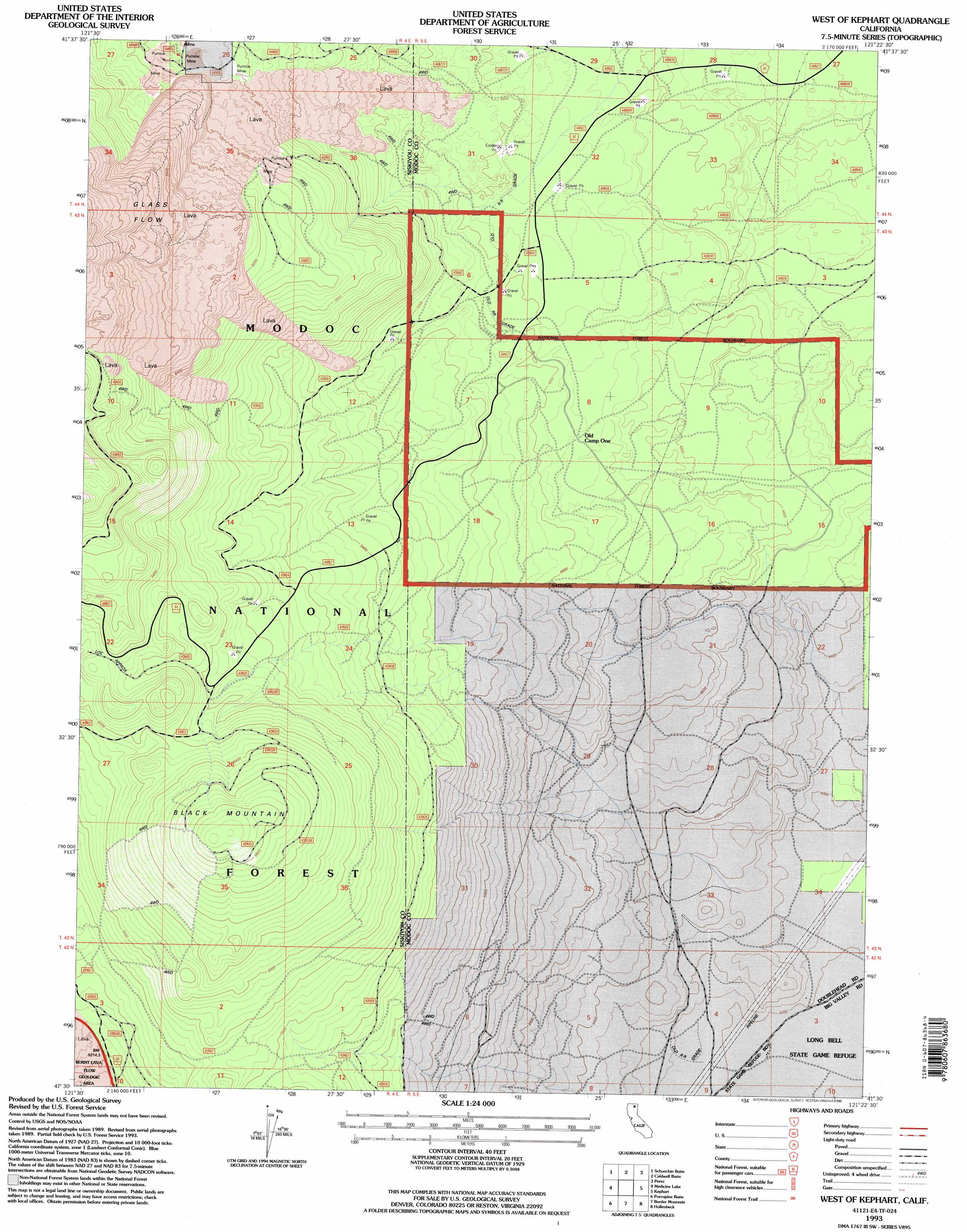
USGS Topo Quad 41121e4 - 1:24,000 scale
| Topo Map Name: | West Of Kephart |
| USGS Topo Quad ID: | 41121e4 |
| Print Size: | ca. 21 1/4" wide x 27" high |
| Southeast Coordinates: | 41.5° N latitude / 121.375° W longitude |
| Map Center Coordinates: | 41.5625° N latitude / 121.4375° W longitude |
| U.S. State: | CA |
| Filename: | o41121e4.jpg |
| Download Map JPG Image: | West Of Kephart topo map 1:24,000 scale |
| Map Type: | Topographic |
| Topo Series: | 7.5´ |
| Map Scale: | 1:24,000 |
| Source of Map Images: | United States Geological Survey (USGS) |
| Alternate Map Versions: |
West of Kephart CA 1988, updated 1988 Download PDF Buy paper map West of Kephart CA 1993, updated 1996 Download PDF Buy paper map West of Kephart CA 1993, updated 1996 Download PDF Buy paper map West of Kephart CA 2012 Download PDF Buy paper map West of Kephart CA 2015 Download PDF Buy paper map |
| FStopo: | US Forest Service topo West of Kephart is available: Download FStopo PDF Download FStopo TIF |
1:24,000 Topo Quads surrounding West Of Kephart
Mount Dome |
Captain Jacks Stronghold |
The Panhandle |
Copic |
Double Head Mountain |
Bonita Butte |
Schonchin Butte |
Caldwell Butte |
Perez |
Rimrock Lake |
Little Glass Mountain |
Medicine Lake |
West Of Kephart |
Kephart |
Spaulding Butte |
Snag Hill |
Porcupine Butte |
Border Mountain |
Hollenbeck |
Crank Mountain |
Hambone |
Indian Spring Mountain |
Whitehorse |
Egg Lake |
Donica Mountain |
> Back to 41121e1 at 1:100,000 scale
> Back to 41120a1 at 1:250,000 scale
> Back to U.S. Topo Maps home
West Of Kephart topo map: Gazetteer
West Of Kephart: Lavas
Glass Flow elevation 2057m 6748′West Of Kephart: Summits
Black Mountain elevation 2125m 6971′West Of Kephart digital topo map on disk
Buy this West Of Kephart topo map showing relief, roads, GPS coordinates and other geographical features, as a high-resolution digital map file on DVD: