Perez Topo Map California
To zoom in, hover over the map of Perez
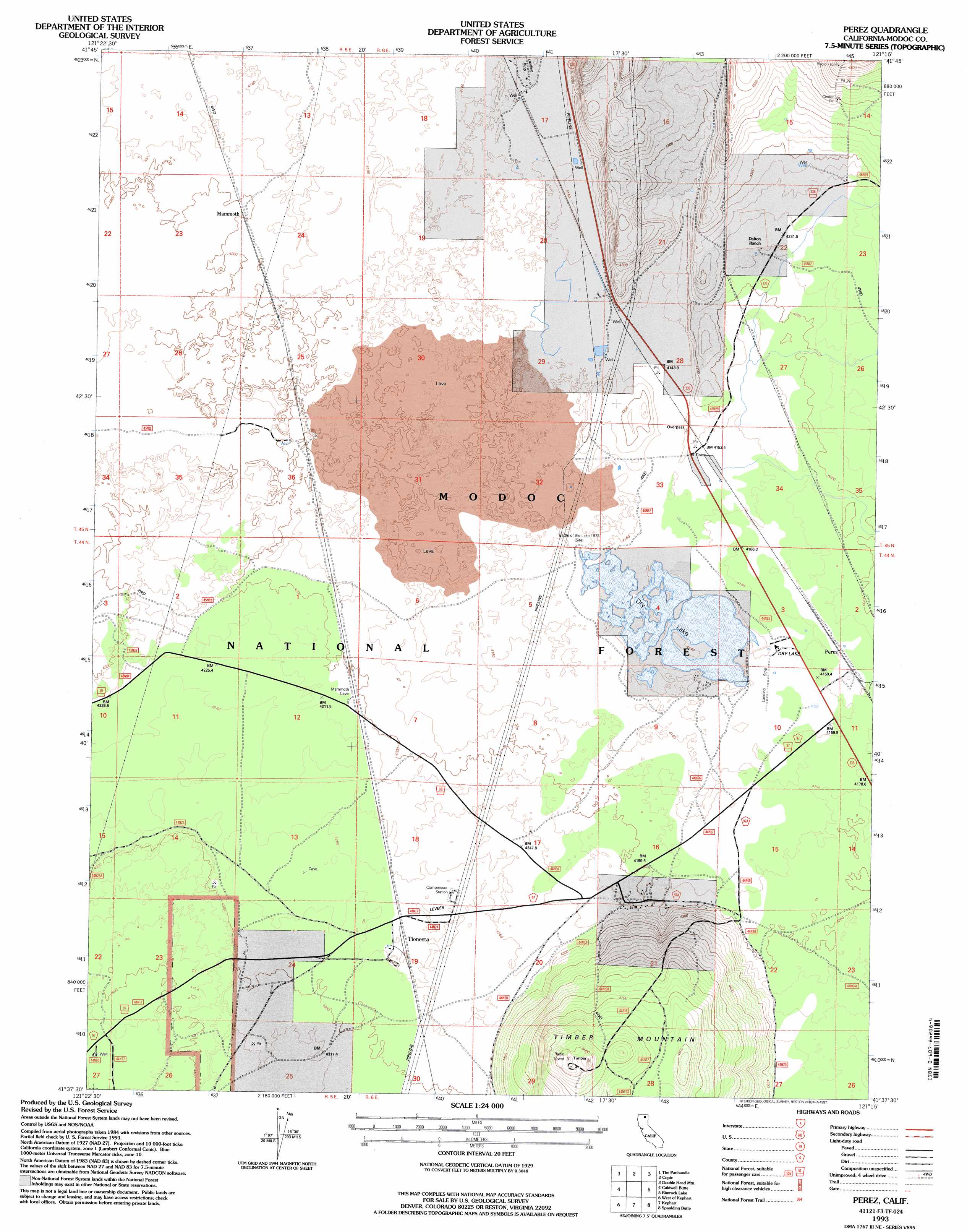
USGS Topo Quad 41121f3 - 1:24,000 scale
| Topo Map Name: | Perez |
| USGS Topo Quad ID: | 41121f3 |
| Print Size: | ca. 21 1/4" wide x 27" high |
| Southeast Coordinates: | 41.625° N latitude / 121.25° W longitude |
| Map Center Coordinates: | 41.6875° N latitude / 121.3125° W longitude |
| U.S. State: | CA |
| Filename: | o41121f3.jpg |
| Download Map JPG Image: | Perez topo map 1:24,000 scale |
| Map Type: | Topographic |
| Topo Series: | 7.5´ |
| Map Scale: | 1:24,000 |
| Source of Map Images: | United States Geological Survey (USGS) |
| Alternate Map Versions: |
Perez CA 1988, updated 1988 Download PDF Buy paper map Perez CA 1993, updated 1996 Download PDF Buy paper map Perez CA 1993, updated 1997 Download PDF Buy paper map Perez CA 2012 Download PDF Buy paper map Perez CA 2015 Download PDF Buy paper map |
| FStopo: | US Forest Service topo Perez is available: Download FStopo PDF Download FStopo TIF |
1:24,000 Topo Quads surrounding Perez
Hatfield |
Tulelake |
Newell |
Carr Butte |
Sagebrush Butte |
Captain Jacks Stronghold |
The Panhandle |
Copic |
Double Head Mountain |
Pinnacle Lake |
Schonchin Butte |
Caldwell Butte |
Perez |
Rimrock Lake |
Lone Pine Butte |
Medicine Lake |
West Of Kephart |
Kephart |
Spaulding Butte |
Knobcone Butte |
Porcupine Butte |
Border Mountain |
Hollenbeck |
Crank Mountain |
Happy Camp Mountain |
> Back to 41121e1 at 1:100,000 scale
> Back to 41120a1 at 1:250,000 scale
> Back to U.S. Topo Maps home
Perez topo map: Gazetteer
Perez: Lakes
Dry Lake elevation 1263m 4143′Perez: Populated Places
Mammoth elevation 1282m 4206′Perez elevation 1274m 4179′
Tionesta elevation 1304m 4278′
Perez: Post Offices
Tionesta Post Office elevation 1290m 4232′Perez: Springs
Negro Ben Spring elevation 1275m 4183′Perez: Summits
Timber Mountain elevation 1543m 5062′Perez digital topo map on disk
Buy this Perez topo map showing relief, roads, GPS coordinates and other geographical features, as a high-resolution digital map file on DVD: