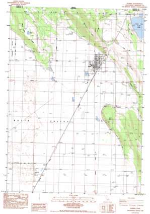
Dorris Topo Map California
To zoom in, hover over the map of Dorris
USGS Topo Quad 41121h8 - 1:24,000 scale
| Topo Map Name: | Dorris |
| USGS Topo Quad ID: | 41121h8 |
| Print Size: | ca. 21 1/4" wide x 27" high |
| Southeast Coordinates: | 41.875° N latitude / 121.875° W longitude |
| Map Center Coordinates: | 41.9375° N latitude / 121.9375° W longitude |
| U.S. State: | CA |
| Filename: | o41121h8.jpg |
| Download Map JPG Image: | Dorris topo map 1:24,000 scale |
| Map Type: | Topographic |
| Topo Series: | 7.5´ |
| Map Scale: | 1:24,000 |
| Source of Map Images: | United States Geological Survey (USGS) |
| Alternate Map Versions: |
Dorris CA 1985, updated 1985 Download PDF Buy paper map Dorris CA 2001, updated 2004 Download PDF Buy paper map Dorris CA 2012 Download PDF Buy paper map Dorris CA 2015 Download PDF Buy paper map |
| FStopo: | US Forest Service topo Dorris is available: Download FStopo PDF Download FStopo TIF |
1:24,000 Topo Quads surrounding Dorris
> Back to 41121e1 at 1:100,000 scale
> Back to 41120a1 at 1:250,000 scale
> Back to U.S. Topo Maps home
Dorris topo map: Gazetteer
Dorris: Airports
Butte Valley Airport elevation 1293m 4242′Dorris: Cliffs
Cedar Point elevation 1365m 4478′Dorris: Lakes
Indian Tom Lake elevation 1246m 4087′Mud Lake elevation 1452m 4763′
Dorris: Populated Places
Dorris elevation 1294m 4245′Dorris: Post Offices
Dorris Post Office elevation 1293m 4242′Dorris: Ridges
Mud Lake Ridge elevation 1453m 4767′Otey Ridge elevation 1324m 4343′
Dorris: Summits
D Hill elevation 1457m 4780′Dorris Hill elevation 1651m 5416′
Dorris: Valleys
Butte Valley elevation 1293m 4242′Modoc Gulch elevation 1318m 4324′
Pleasant Valley elevation 1295m 4248′
Dorris digital topo map on disk
Buy this Dorris topo map showing relief, roads, GPS coordinates and other geographical features, as a high-resolution digital map file on DVD:


