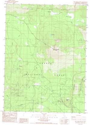
Ash Creek Butte Topo Map California
To zoom in, hover over the map of Ash Creek Butte
USGS Topo Quad 41122d1 - 1:24,000 scale
| Topo Map Name: | Ash Creek Butte |
| USGS Topo Quad ID: | 41122d1 |
| Print Size: | ca. 21 1/4" wide x 27" high |
| Southeast Coordinates: | 41.375° N latitude / 122° W longitude |
| Map Center Coordinates: | 41.4375° N latitude / 122.0625° W longitude |
| U.S. State: | CA |
| Filename: | o41122d1.jpg |
| Download Map JPG Image: | Ash Creek Butte topo map 1:24,000 scale |
| Map Type: | Topographic |
| Topo Series: | 7.5´ |
| Map Scale: | 1:24,000 |
| Source of Map Images: | United States Geological Survey (USGS) |
| Alternate Map Versions: |
Ash Creek Butte CA 1986, updated 1986 Download PDF Buy paper map Ash Creek Butte CA 1998, updated 2003 Download PDF Buy paper map Ash Creek Butte CA 2012 Download PDF Buy paper map Ash Creek Butte CA 2015 Download PDF Buy paper map |
| FStopo: | US Forest Service topo Ash Creek Butte is available: Download FStopo PDF Download FStopo TIF |
1:24,000 Topo Quads surrounding Ash Creek Butte
> Back to 41122a1 at 1:100,000 scale
> Back to 41122a1 at 1:250,000 scale
> Back to U.S. Topo Maps home
Ash Creek Butte topo map: Gazetteer
Ash Creek Butte: Flats
Harts Meadow elevation 1765m 5790′Ash Creek Butte: Lakes
Surprise Lake elevation 2058m 6751′Ash Creek Butte: Ridges
Swamp Creek Ridge elevation 1526m 5006′Ash Creek Butte: Springs
Junction Spring elevation 1438m 4717′Ash Creek Butte: Streams
Brewer Creek elevation 1565m 5134′Cold Creek elevation 1417m 4648′
Gravel Creek elevation 1798m 5898′
Inconstance Creek elevation 1803m 5915′
Ash Creek Butte: Summits
Ash Creek Butte elevation 2554m 8379′Sugar Pine Butte elevation 1627m 5337′
Ash Creek Butte digital topo map on disk
Buy this Ash Creek Butte topo map showing relief, roads, GPS coordinates and other geographical features, as a high-resolution digital map file on DVD:


