Weed Topo Map California
To zoom in, hover over the map of Weed
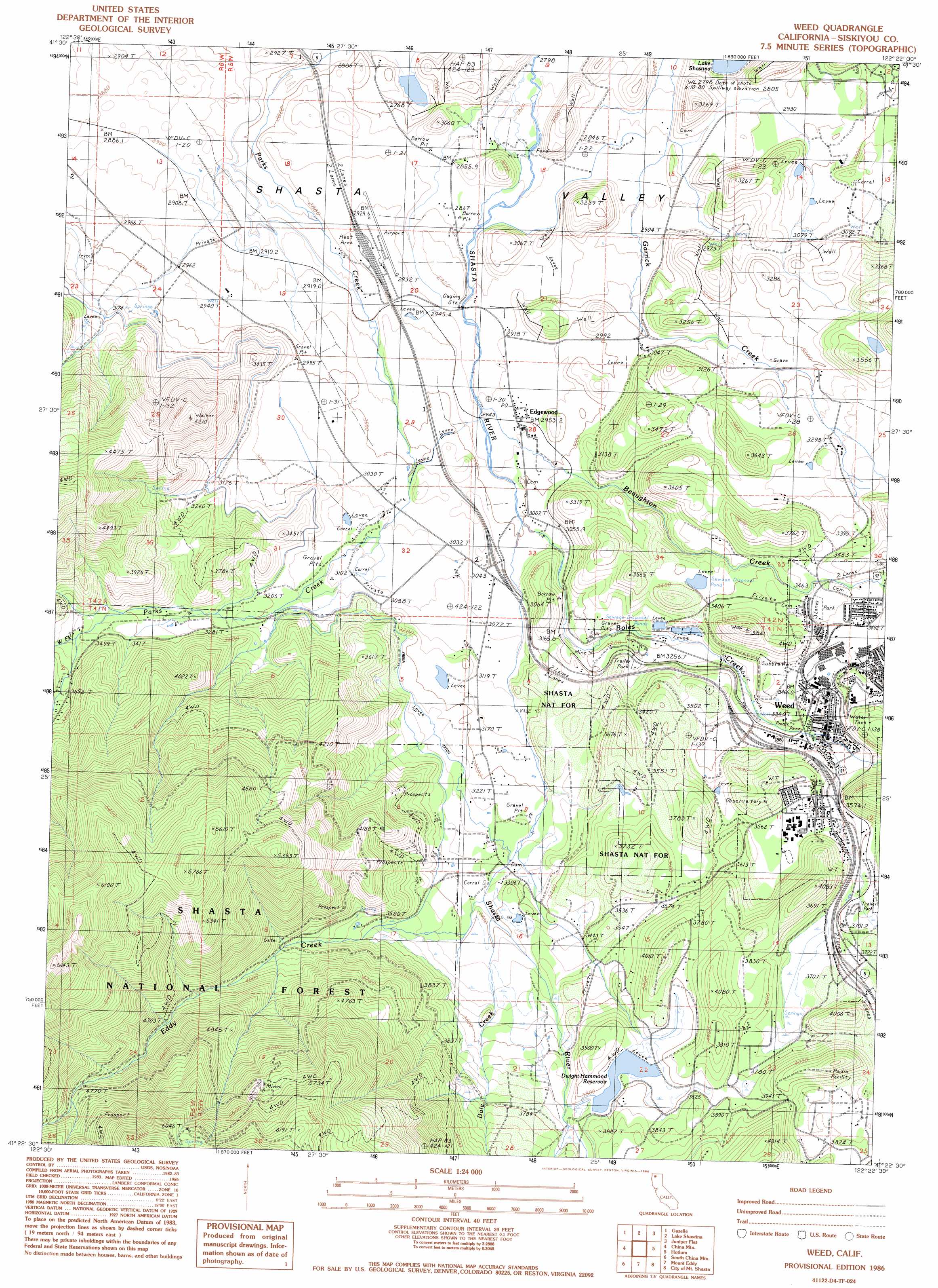
USGS Topo Quad 41122d4 - 1:24,000 scale
| Topo Map Name: | Weed |
| USGS Topo Quad ID: | 41122d4 |
| Print Size: | ca. 21 1/4" wide x 27" high |
| Southeast Coordinates: | 41.375° N latitude / 122.375° W longitude |
| Map Center Coordinates: | 41.4375° N latitude / 122.4375° W longitude |
| U.S. State: | CA |
| Filename: | o41122d4.jpg |
| Download Map JPG Image: | Weed topo map 1:24,000 scale |
| Map Type: | Topographic |
| Topo Series: | 7.5´ |
| Map Scale: | 1:24,000 |
| Source of Map Images: | United States Geological Survey (USGS) |
| Alternate Map Versions: |
Weed CA 1986, updated 1986 Download PDF Buy paper map Weed CA 1998, updated 2003 Download PDF Buy paper map Weed CA 2012 Download PDF Buy paper map Weed CA 2015 Download PDF Buy paper map |
| FStopo: | US Forest Service topo Weed is available: Download FStopo PDF Download FStopo TIF |
1:24,000 Topo Quads surrounding Weed
Yreka |
Montague |
Little Shasta |
Solomons Temple |
Grass Lake |
Duzel Rock |
Gazelle |
Lake Shastina |
Juniper Flat |
The Whaleback |
Gazelle Mountain |
China Mountain |
Weed |
Hotlum |
Mount Shasta |
Scott Mountain |
South China Mountain |
Mount Eddy |
City Of Mount Shasta |
Mccloud |
Tangle Blue Lake |
Mumbo Basin |
Seven Lakes Basin |
Dunsmuir |
Girard Ridge |
> Back to 41122a1 at 1:100,000 scale
> Back to 41122a1 at 1:250,000 scale
> Back to U.S. Topo Maps home
Weed topo map: Gazetteer
Weed: Airports
Weed Airport elevation 893m 2929′Weed: Dams
Dwight Hammond 1182 Dam elevation 1156m 3792′Weed: Parks
Bel Air Park elevation 1092m 3582′Lincoln Park elevation 1058m 3471′
Weed: Populated Places
Cal-ore Trail Mobile Estates elevation 1123m 3684′Edgewood elevation 901m 2956′
Hammond Ranch elevation 1173m 3848′
Igerna elevation 1129m 3704′
Metcalf (historical) elevation 889m 2916′
Weed elevation 1044m 3425′
Weed: Post Offices
Edgewood Post Office elevation 897m 2942′Weed Post Office elevation 1053m 3454′
Weed: Reservoirs
Dwight Hammond Reservoir elevation 1152m 3779′Weed: Springs
Soda Spring elevation 888m 2913′Weed: Streams
Beaughton Creek elevation 891m 2923′Boles Creek elevation 917m 3008′
Dale Creek elevation 1030m 3379′
Eddy Creek elevation 1023m 3356′
West Fork Parks Creek elevation 1068m 3503′
Weed digital topo map on disk
Buy this Weed topo map showing relief, roads, GPS coordinates and other geographical features, as a high-resolution digital map file on DVD: