Gazelle Mountain Topo Map California
To zoom in, hover over the map of Gazelle Mountain
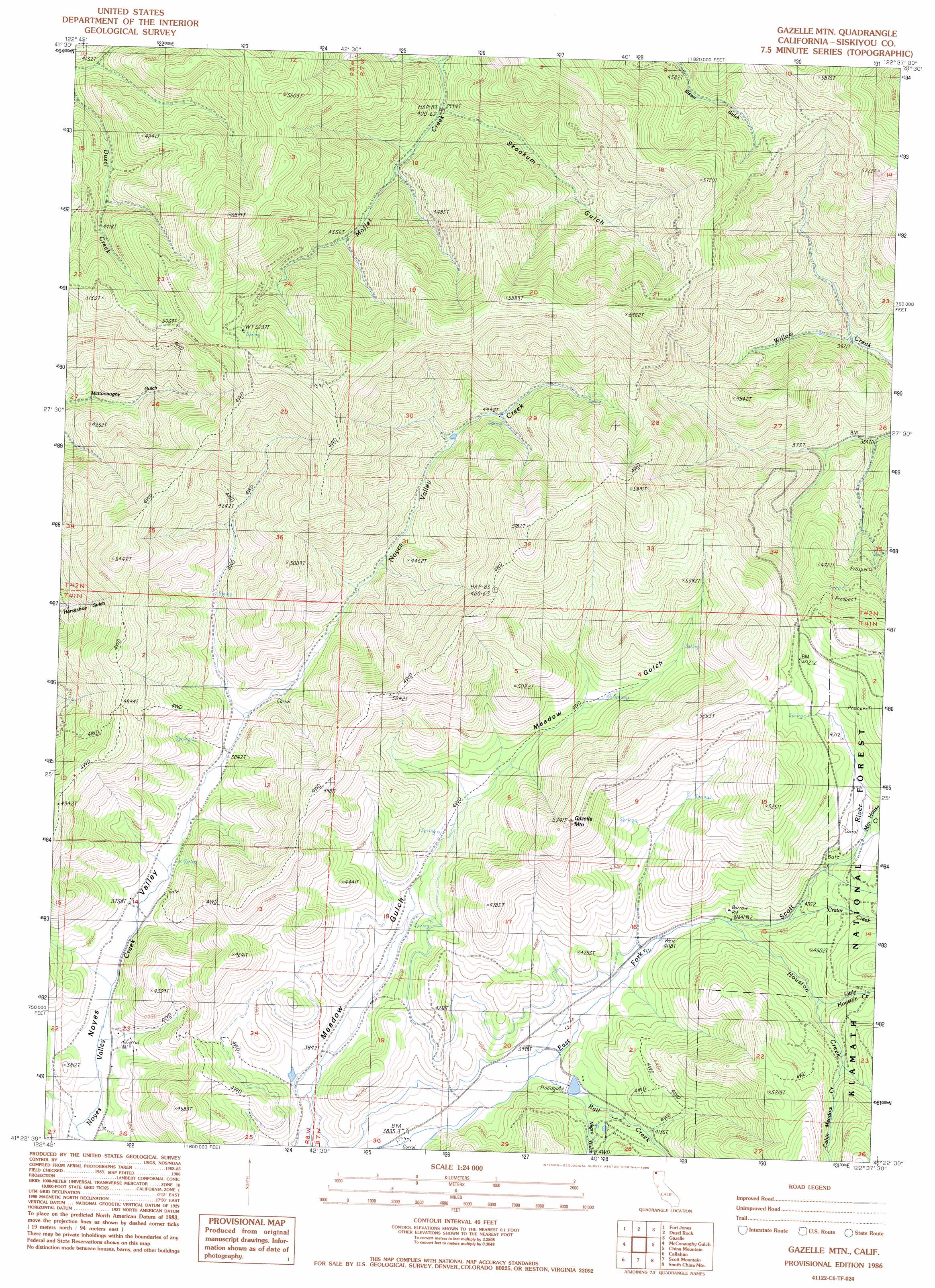
USGS Topo Quad 41122d6 - 1:24,000 scale
| Topo Map Name: | Gazelle Mountain |
| USGS Topo Quad ID: | 41122d6 |
| Print Size: | ca. 21 1/4" wide x 27" high |
| Southeast Coordinates: | 41.375° N latitude / 122.625° W longitude |
| Map Center Coordinates: | 41.4375° N latitude / 122.6875° W longitude |
| U.S. State: | CA |
| Filename: | o41122d6.jpg |
| Download Map JPG Image: | Gazelle Mountain topo map 1:24,000 scale |
| Map Type: | Topographic |
| Topo Series: | 7.5´ |
| Map Scale: | 1:24,000 |
| Source of Map Images: | United States Geological Survey (USGS) |
| Alternate Map Versions: |
Gazelle Mtn CA 1986, updated 1986 Download PDF Buy paper map Gazelle Mountain CA 2001, updated 2004 Download PDF Buy paper map Gazelle Mountain CA 2012 Download PDF Buy paper map Gazelle Mountain CA 2015 Download PDF Buy paper map |
| FStopo: | US Forest Service topo Gazelle Mountain is available: Download FStopo PDF Download FStopo TIF |
1:24,000 Topo Quads surrounding Gazelle Mountain
Russell Peak |
Indian Creek Baldy |
Yreka |
Montague |
Little Shasta |
Greenview |
Fort Jones |
Duzel Rock |
Gazelle |
Lake Shastina |
Etna |
Mcconaughy Gulch |
Gazelle Mountain |
China Mountain |
Weed |
Eaton Peak |
Callahan |
Scott Mountain |
South China Mountain |
Mount Eddy |
Deadman Peak |
Billys Peak |
Tangle Blue Lake |
Mumbo Basin |
Seven Lakes Basin |
> Back to 41122a1 at 1:100,000 scale
> Back to 41122a1 at 1:250,000 scale
> Back to U.S. Topo Maps home
Gazelle Mountain topo map: Gazetteer
Gazelle Mountain: Streams
Cabin Meadow Creek elevation 1467m 4812′Crater Creek elevation 1319m 4327′
Houston Creek elevation 1293m 4242′
Little Houston Creek elevation 1369m 4491′
Mountain House Creek elevation 1395m 4576′
Rail Creek elevation 1201m 3940′
Gazelle Mountain: Summits
Gazelle Mountain elevation 1591m 5219′Gazelle Mountain: Valleys
Meadow Gulch elevation 1169m 3835′Negro Gulch elevation 1231m 4038′
Skookum Gulch elevation 1238m 4061′
Gazelle Mountain digital topo map on disk
Buy this Gazelle Mountain topo map showing relief, roads, GPS coordinates and other geographical features, as a high-resolution digital map file on DVD: