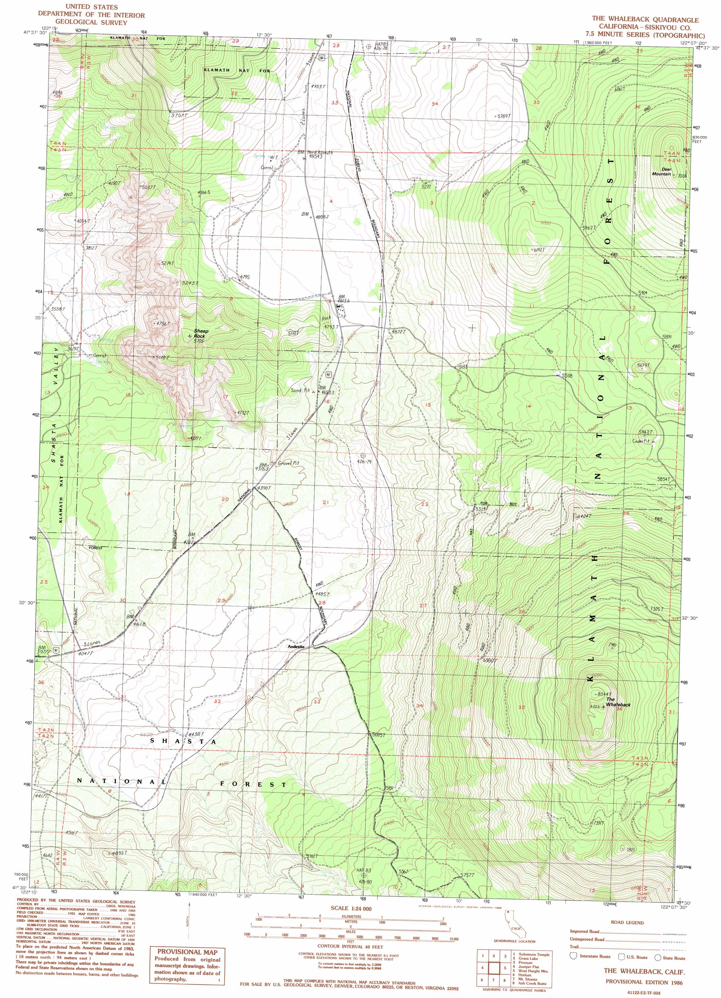
The Whaleback Topo Map California
To zoom in, hover over the map of The Whaleback
USGS Topo Quad 41122e2 - 1:24,000 scale
| Topo Map Name: | The Whaleback |
| USGS Topo Quad ID: | 41122e2 |
| Print Size: | ca. 21 1/4" wide x 27" high |
| Southeast Coordinates: | 41.5° N latitude / 122.125° W longitude |
| Map Center Coordinates: | 41.5625° N latitude / 122.1875° W longitude |
| U.S. State: | CA |
| Filename: | o41122e2.jpg |
| Download Map JPG Image: | The Whaleback topo map 1:24,000 scale |
| Map Type: | Topographic |
| Topo Series: | 7.5´ |
| Map Scale: | 1:24,000 |
| Source of Map Images: | United States Geological Survey (USGS) |
| Alternate Map Versions: |
The Whaleback CA 1986, updated 1986 Download PDF Buy paper map The Whaleback CA 2001, updated 2004 Download PDF Buy paper map The Whaleback CA 2001, updated 2004 Download PDF Buy paper map The Whaleback CA 2012 Download PDF Buy paper map The Whaleback CA 2015 Download PDF Buy paper map |
| FStopo: | US Forest Service topo The Whaleback is available: Download FStopo PDF Download FStopo TIF |
1:24,000 Topo Quads surrounding The Whaleback
Bogus Mountain |
Dewey Gulch |
Panther Rock |
Macdoel |
Sheep Mountain |
Little Shasta |
Solomons Temple |
Grass Lake |
Penoyar |
Bray |
Lake Shastina |
Juniper Flat |
The Whaleback |
West Haight Mountain |
Tennant |
Weed |
Hotlum |
Mount Shasta |
Ash Creek Butte |
Rainbow Mountain |
Mount Eddy |
City Of Mount Shasta |
Mccloud |
Elk Spring |
Kinyon |
> Back to 41122e1 at 1:100,000 scale
> Back to 41122a1 at 1:250,000 scale
> Back to U.S. Topo Maps home
The Whaleback topo map: Gazetteer
The Whaleback: Parks
Deer Mountain Snowmobile Park elevation 1762m 5780′The Whaleback: Pillars
Sheep Rock elevation 1721m 5646′The Whaleback: Populated Places
Andesite elevation 1391m 4563′Bolam elevation 1341m 4399′
Cougar elevation 1481m 4858′
Pomeroy (historical) elevation 1541m 5055′
The Whaleback: Summits
Deer Mountain elevation 2098m 6883′The Whaleback elevation 2601m 8533′
The Whaleback digital topo map on disk
Buy this The Whaleback topo map showing relief, roads, GPS coordinates and other geographical features, as a high-resolution digital map file on DVD: