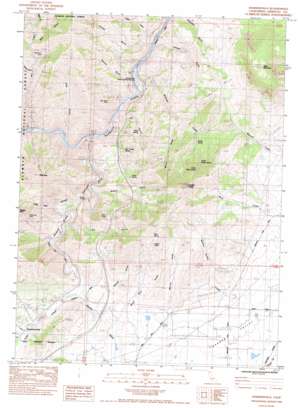
Hawkinsville Topo Map California
To zoom in, hover over the map of Hawkinsville
USGS Topo Quad 41122g5 - 1:24,000 scale
| Topo Map Name: | Hawkinsville |
| USGS Topo Quad ID: | 41122g5 |
| Print Size: | ca. 21 1/4" wide x 27" high |
| Southeast Coordinates: | 41.75° N latitude / 122.5° W longitude |
| Map Center Coordinates: | 41.8125° N latitude / 122.5625° W longitude |
| U.S. State: | CA |
| Filename: | o41122g5.jpg |
| Download Map JPG Image: | Hawkinsville topo map 1:24,000 scale |
| Map Type: | Topographic |
| Topo Series: | 7.5´ |
| Map Scale: | 1:24,000 |
| Source of Map Images: | United States Geological Survey (USGS) |
| Alternate Map Versions: |
Hawkinsville CA 1983, updated 1984 Download PDF Buy paper map Hawkinsville CA 2001, updated 2004 Download PDF Buy paper map Hawkinsville CA 2012 Download PDF Buy paper map Hawkinsville CA 2015 Download PDF Buy paper map |
| FStopo: | US Forest Service topo Hawkinsville is available: Download FStopo PDF Download FStopo TIF |
1:24,000 Topo Quads surrounding Hawkinsville
> Back to 41122e1 at 1:100,000 scale
> Back to 41122a1 at 1:250,000 scale
> Back to U.S. Topo Maps home
Hawkinsville topo map: Gazetteer
Hawkinsville: Bridges
Pioneer Bridge elevation 689m 2260′Hawkinsville: Dams
Lake Suzanne 1186 Dam elevation 780m 2559′Hawkinsville: Mines
Gold Leaf Mine elevation 1143m 3750′High Grade Mine elevation 852m 2795′
Indian Girl Mine elevation 662m 2171′
Negro Boy Mine elevation 953m 3126′
Union Mine elevation 921m 3021′
Hawkinsville: Parks
Randolf Collier Safety Roadside Rest Area elevation 637m 2089′Hawkinsville: Pillars
White Rock elevation 1103m 3618′Hawkinsville: Populated Places
Hawkinsville elevation 761m 2496′Jims Camp elevation 628m 2060′
Hawkinsville: Springs
Iron Trough Spring elevation 865m 2837′Lower Maple Spring elevation 975m 3198′
Maple Spring elevation 865m 2837′
Mud Spring elevation 1254m 4114′
Silvas Spring elevation 894m 2933′
Swabs Spring elevation 857m 2811′
Upper Maple Spring elevation 1289m 4229′
Hawkinsville: Streams
Ash Creek elevation 612m 2007′Bunton Hollow Creek elevation 733m 2404′
Shasta River elevation 621m 2037′
Williams Creek elevation 633m 2076′
Yreka Creek elevation 728m 2388′
Hawkinsville: Summits
Paradise Craggy elevation 1470m 4822′Riverview elevation 1365m 4478′
Hawkinsville: Valleys
Carson Gulch elevation 644m 2112′Cooley Gulch elevation 677m 2221′
Dry Gulch elevation 712m 2335′
Dutch Gulch elevation 664m 2178′
Jail Gulch elevation 649m 2129′
Long Gulch elevation 667m 2188′
Maple Gulch elevation 1026m 3366′
Modoc Gulch elevation 657m 2155′
Mutton Gulch elevation 836m 2742′
Osburger Gulch elevation 685m 2247′
Printer Gulch elevation 671m 2201′
Rattlesnake Gulch elevation 978m 3208′
Rocky Gulch elevation 773m 2536′
Shake Gulch elevation 815m 2673′
Sharps Gulch elevation 637m 2089′
Shelley Gulch elevation 743m 2437′
Stiffneck Gulch elevation 728m 2388′
White Rock Gulch elevation 740m 2427′
Wood Gulch elevation 776m 2545′
Hawkinsville digital topo map on disk
Buy this Hawkinsville topo map showing relief, roads, GPS coordinates and other geographical features, as a high-resolution digital map file on DVD:


