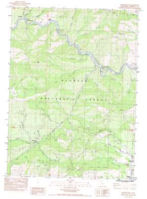
Badger Mountain Topo Map California
To zoom in, hover over the map of Badger Mountain
USGS Topo Quad 41122g6 - 1:24,000 scale
| Topo Map Name: | Badger Mountain |
| USGS Topo Quad ID: | 41122g6 |
| Print Size: | ca. 21 1/4" wide x 27" high |
| Southeast Coordinates: | 41.75° N latitude / 122.625° W longitude |
| Map Center Coordinates: | 41.8125° N latitude / 122.6875° W longitude |
| U.S. State: | CA |
| Filename: | o41122g6.jpg |
| Download Map JPG Image: | Badger Mountain topo map 1:24,000 scale |
| Map Type: | Topographic |
| Topo Series: | 7.5´ |
| Map Scale: | 1:24,000 |
| Source of Map Images: | United States Geological Survey (USGS) |
| Alternate Map Versions: |
Badger Mtn. CA 1984, updated 1984 Download PDF Buy paper map Badger Mountain CA 2001, updated 2004 Download PDF Buy paper map Badger Mountain CA 2012 Download PDF Buy paper map Badger Mountain CA 2015 Download PDF Buy paper map |
| FStopo: | US Forest Service topo Badger Mountain is available: Download FStopo PDF Download FStopo TIF |
1:24,000 Topo Quads surrounding Badger Mountain
> Back to 41122e1 at 1:100,000 scale
> Back to 41122a1 at 1:250,000 scale
> Back to U.S. Topo Maps home
Badger Mountain topo map: Gazetteer
Badger Mountain: Bars
Garvey Bar elevation 585m 1919′Kanaka Bar elevation 606m 1988′
Masonic Bar elevation 602m 1975′
Masonic Bar elevation 618m 2027′
McConnell Bar elevation 584m 1916′
Skeahan Bar elevation 582m 1909′
Swiss Bar elevation 577m 1893′
Woodrat Bar elevation 602m 1975′
Badger Mountain: Capes
Humbug Point elevation 618m 2027′Badger Mountain: Mines
Gold Bar Mine elevation 928m 3044′Hummingbird Mine elevation 1289m 4229′
Mono Mine elevation 1002m 3287′
Siskiyou Mine elevation 1012m 3320′
Badger Mountain: Populated Places
Gottsville elevation 574m 1883′Swiss Bar elevation 575m 1886′
Badger Mountain: Streams
Badger Creek elevation 607m 1991′Clear Creek elevation 617m 2024′
Dunns Gulch elevation 672m 2204′
Dutch Creek elevation 575m 1886′
Empire Creek elevation 562m 1843′
Humbug Creek elevation 584m 1916′
Keeler Creek elevation 970m 3182′
Lumgrey Creek elevation 557m 1827′
Middle Fork Humbug Creek elevation 830m 2723′
Punch Creek elevation 889m 2916′
Skunk Creek elevation 632m 2073′
South Fork Humbug Creek elevation 832m 2729′
Sucker Creek elevation 916m 3005′
Badger Mountain: Summits
Badger Mountain elevation 1508m 4947′China Peak elevation 1445m 4740′
Craggy Mountain elevation 1685m 5528′
Little Cottonwood Peak elevation 1577m 5173′
Badger Mountain: Trails
Clear Creek Trail elevation 1112m 3648′Badger Mountain: Valleys
Brushy Gulch elevation 651m 2135′Butcher Gulch elevation 663m 2175′
Canal Gulch elevation 770m 2526′
Cayuse Gulch elevation 622m 2040′
China Gulch elevation 577m 1893′
Croy Gulch elevation 614m 2014′
Deadman Gulch elevation 596m 1955′
Dowling Gulch elevation 796m 2611′
Garvey Gulch elevation 620m 2034′
Kennebec Gulch elevation 869m 2851′
Lime Gulch elevation 626m 2053′
Long Gulch elevation 770m 2526′
Schoolhouse Gulch elevation 809m 2654′
Sweetwater Gulch elevation 921m 3021′
Swiss Gulch elevation 609m 1998′
Tincup Gulch elevation 873m 2864′
Trail Gulch elevation 741m 2431′
Whites Gulch elevation 738m 2421′
Badger Mountain digital topo map on disk
Buy this Badger Mountain topo map showing relief, roads, GPS coordinates and other geographical features, as a high-resolution digital map file on DVD:


