Cecil Lake Topo Map California
To zoom in, hover over the map of Cecil Lake
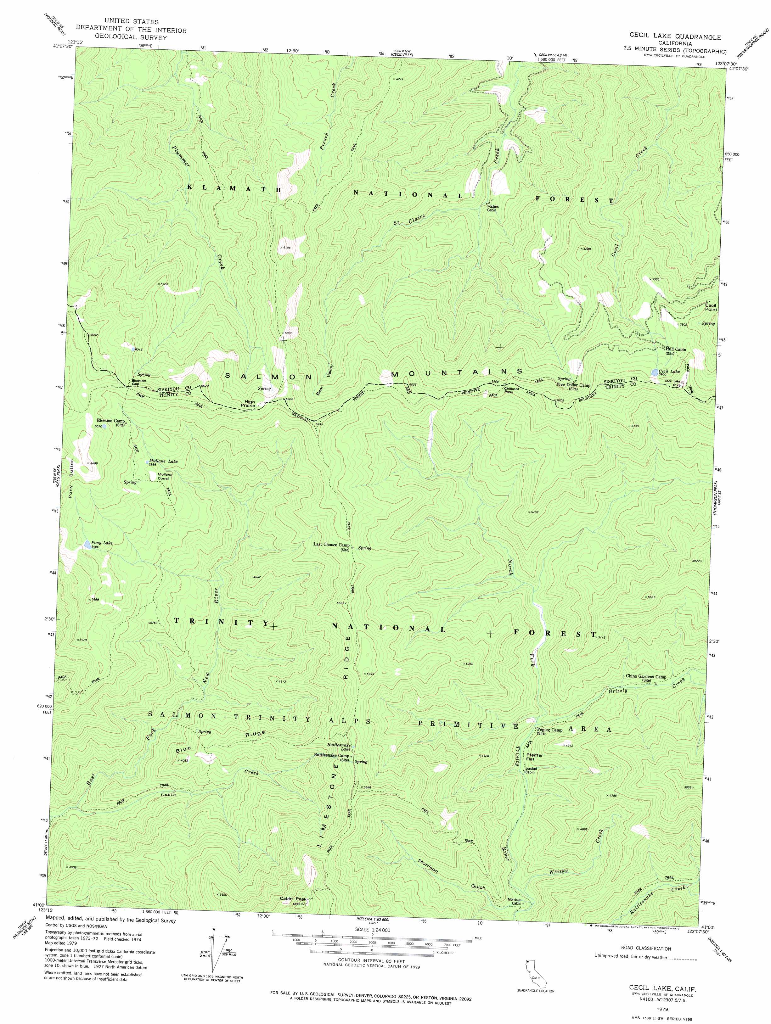
USGS Topo Quad 41123a2 - 1:24,000 scale
| Topo Map Name: | Cecil Lake |
| USGS Topo Quad ID: | 41123a2 |
| Print Size: | ca. 21 1/4" wide x 27" high |
| Southeast Coordinates: | 41° N latitude / 123.125° W longitude |
| Map Center Coordinates: | 41.0625° N latitude / 123.1875° W longitude |
| U.S. State: | CA |
| Filename: | o41123a2.jpg |
| Download Map JPG Image: | Cecil Lake topo map 1:24,000 scale |
| Map Type: | Topographic |
| Topo Series: | 7.5´ |
| Map Scale: | 1:24,000 |
| Source of Map Images: | United States Geological Survey (USGS) |
| Alternate Map Versions: |
Cecil Lake CA 1979, updated 1979 Download PDF Buy paper map Cecil Lake CA 1979, updated 1979 Download PDF Buy paper map Cecil Lake CA 1998, updated 2003 Download PDF Buy paper map Cecil Lake CA 2012 Download PDF Buy paper map Cecil Lake CA 2015 Download PDF Buy paper map |
| FStopo: | US Forest Service topo Cecil Lake is available: Download FStopo PDF Download FStopo TIF |
1:24,000 Topo Quads surrounding Cecil Lake
Orleans Mountain |
Forks Of Salmon |
Sawyers Bar |
Tanners Peak |
Eaton Peak |
Salmon Mountain |
Youngs Peak |
Cecilville |
Grasshopper Ridge |
Deadman Peak |
Trinity Mountain |
Dees Peak |
Cecil Lake |
Thompson Peak |
Caribou Lake |
Denny |
Jim Jam Ridge |
Thurston Peaks |
Mount Hilton |
Siligo Peak |
Ironside Mountain |
Del Loma |
Helena |
Dedrick |
Rush Creek Lakes |
> Back to 41123a1 at 1:100,000 scale
> Back to 41122a1 at 1:250,000 scale
> Back to U.S. Topo Maps home
Cecil Lake topo map: Gazetteer
Cecil Lake: Capes
Cecil Point elevation 1698m 5570′Cecil Lake: Flats
High Prairie elevation 1881m 6171′Cecil Lake: Gaps
Chikoot Pass elevation 1736m 5695′Election Gap elevation 1878m 6161′
Cecil Lake: Lakes
Cecil Lake elevation 1800m 5905′Mullane Lake elevation 1643m 5390′
Pony Lake elevation 1675m 5495′
Rattlesnake Lake elevation 1710m 5610′
Cecil Lake: Ridges
Blue Ridge elevation 1303m 4274′Cecil Lake: Springs
Last Chance Spring elevation 1670m 5479′Cecil Lake: Streams
Cabin Creek elevation 827m 2713′Grizzly Creek elevation 1063m 3487′
Whisky Creek elevation 1016m 3333′
Cecil Lake: Summits
Cabin Peak elevation 2081m 6827′Cecil Lake: Valleys
Bear Valley elevation 1440m 4724′Morrison Gulch elevation 1013m 3323′
Strause Gulch elevation 1101m 3612′
Cecil Lake digital topo map on disk
Buy this Cecil Lake topo map showing relief, roads, GPS coordinates and other geographical features, as a high-resolution digital map file on DVD: