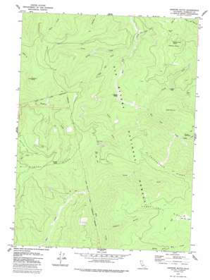
Hopkins Butte Topo Map California
To zoom in, hover over the map of Hopkins Butte
USGS Topo Quad 41123b5 - 1:24,000 scale
| Topo Map Name: | Hopkins Butte |
| USGS Topo Quad ID: | 41123b5 |
| Print Size: | ca. 21 1/4" wide x 27" high |
| Southeast Coordinates: | 41.125° N latitude / 123.5° W longitude |
| Map Center Coordinates: | 41.1875° N latitude / 123.5625° W longitude |
| U.S. State: | CA |
| Filename: | o41123b5.jpg |
| Download Map JPG Image: | Hopkins Butte topo map 1:24,000 scale |
| Map Type: | Topographic |
| Topo Series: | 7.5´ |
| Map Scale: | 1:24,000 |
| Source of Map Images: | United States Geological Survey (USGS) |
| Alternate Map Versions: |
Hopkins Butte CA 1979, updated 1986 Download PDF Buy paper map Hopkins Butte CA 1997, updated 2001 Download PDF Buy paper map Hopkins Butte CA 2012 Download PDF Buy paper map Hopkins Butte CA 2015 Download PDF Buy paper map |
| FStopo: | US Forest Service topo Hopkins Butte is available: Download FStopo PDF Download FStopo TIF |
1:24,000 Topo Quads surrounding Hopkins Butte
> Back to 41123a1 at 1:100,000 scale
> Back to 41122a1 at 1:250,000 scale
> Back to U.S. Topo Maps home
Hopkins Butte topo map: Gazetteer
Hopkins Butte: Flats
Le Perron Flat elevation 751m 2463′Hopkins Butte: Gaps
Mill Creek Gap elevation 859m 2818′Hopkins Butte: Mines
Ferris Mine elevation 904m 2965′Red Cap Central Mine elevation 530m 1738′
Hopkins Butte: Populated Places
Lockharts (historical) elevation 547m 1794′Hopkins Butte: Ridges
Packsaddle Ridge elevation 1480m 4855′Hopkins Butte: Springs
LePerron Peak Spring elevation 871m 2857′Tenmile Spring elevation 995m 3264′
Hopkins Butte: Streams
Bunchgrass Creek elevation 360m 1181′Colgrove Branch elevation 650m 2132′
Leary Creek elevation 204m 669′
Middle Fork Leary Creek elevation 263m 862′
Middle Fork Red Cap Creek elevation 486m 1594′
North Fork Mill Creek elevation 500m 1640′
North Fork Red Cap Creek elevation 355m 1164′
South Fork Leary Creek elevation 308m 1010′
South Fork Red Cap Creek elevation 289m 948′
Hopkins Butte: Summits
Black Mountain elevation 1104m 3622′Hopkins Butte elevation 1227m 4025′
Le Perron Peak elevation 1071m 3513′
Hopkins Butte: Valleys
Bear Wallow Gulch elevation 248m 813′Hopkins Butte digital topo map on disk
Buy this Hopkins Butte topo map showing relief, roads, GPS coordinates and other geographical features, as a high-resolution digital map file on DVD:


