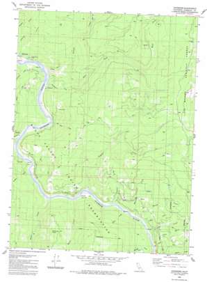
Johnsons Topo Map California
To zoom in, hover over the map of Johnsons
USGS Topo Quad 41123c7 - 1:24,000 scale
| Topo Map Name: | Johnsons |
| USGS Topo Quad ID: | 41123c7 |
| Print Size: | ca. 21 1/4" wide x 27" high |
| Southeast Coordinates: | 41.25° N latitude / 123.75° W longitude |
| Map Center Coordinates: | 41.3125° N latitude / 123.8125° W longitude |
| U.S. State: | CA |
| Filename: | o41123c7.jpg |
| Download Map JPG Image: | Johnsons topo map 1:24,000 scale |
| Map Type: | Topographic |
| Topo Series: | 7.5´ |
| Map Scale: | 1:24,000 |
| Source of Map Images: | United States Geological Survey (USGS) |
| Alternate Map Versions: |
Johnsons CA 1982, updated 1983 Download PDF Buy paper map Johnsons CA 1997, updated 2001 Download PDF Buy paper map Johnsons CA 2012 Download PDF Buy paper map Johnsons CA 2015 Download PDF Buy paper map |
| FStopo: | US Forest Service topo Johnsons is available: Download FStopo PDF Download FStopo TIF |
1:24,000 Topo Quads surrounding Johnsons
> Back to 41123a1 at 1:100,000 scale
> Back to 41122a1 at 1:250,000 scale
> Back to U.S. Topo Maps home
Johnsons topo map: Gazetteer
Johnsons: Areas
Racehorse Prairie elevation 565m 1853′Johnsons: Flats
Cappell Flat elevation 64m 209′Johnsons: Populated Places
Johnsons elevation 55m 180′Mettah elevation 63m 206′
Notchko elevation 46m 150′
Pecwan elevation 39m 127′
Pekwan (historical) elevation 26m 85′
Shregegon (historical) elevation 38m 124′
Surgone elevation 52m 170′
Johnsons: Streams
Cappell Creek elevation 35m 114′China Creek elevation 44m 144′
Chqui Creek elevation 38m 124′
Clirliah Creek elevation 43m 141′
Coon Creek elevation 47m 154′
Devil Creek elevation 35m 114′
East Fork Pecwan Creek elevation 43m 141′
Ha Amar Creek elevation 37m 121′
Johnson Creek elevation 33m 108′
Knulthkarm Creek elevation 19m 62′
Mareep Creek elevation 41m 134′
Mawah Creek elevation 39m 127′
Mettah Creek elevation 25m 82′
Morek Creek elevation 39m 127′
Nacko Creek elevation 37m 121′
Pecwan Creek elevation 18m 59′
Roach Creek elevation 43m 141′
Waukell Creek elevation 38m 124′
West Fork Pecwan Creek elevation 644m 2112′
Johnsons: Valleys
Dry Gulch elevation 170m 557′Lewis Gulch elevation 153m 501′
Johnsons digital topo map on disk
Buy this Johnsons topo map showing relief, roads, GPS coordinates and other geographical features, as a high-resolution digital map file on DVD:


