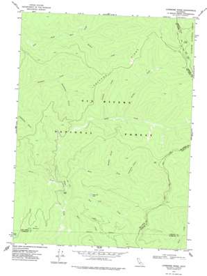
Lonesome Ridge Topo Map California
To zoom in, hover over the map of Lonesome Ridge
USGS Topo Quad 41123d6 - 1:24,000 scale
| Topo Map Name: | Lonesome Ridge |
| USGS Topo Quad ID: | 41123d6 |
| Print Size: | ca. 21 1/4" wide x 27" high |
| Southeast Coordinates: | 41.375° N latitude / 123.625° W longitude |
| Map Center Coordinates: | 41.4375° N latitude / 123.6875° W longitude |
| U.S. State: | CA |
| Filename: | o41123d6.jpg |
| Download Map JPG Image: | Lonesome Ridge topo map 1:24,000 scale |
| Map Type: | Topographic |
| Topo Series: | 7.5´ |
| Map Scale: | 1:24,000 |
| Source of Map Images: | United States Geological Survey (USGS) |
| Alternate Map Versions: |
Lonesome Ridge CA 1974, updated 1977 Download PDF Buy paper map Lonesome Ridge CA 1997, updated 2001 Download PDF Buy paper map Lonesome Ridge CA 2012 Download PDF Buy paper map Lonesome Ridge CA 2015 Download PDF Buy paper map |
| FStopo: | US Forest Service topo Lonesome Ridge is available: Download FStopo PDF Download FStopo TIF |
1:24,000 Topo Quads surrounding Lonesome Ridge
> Back to 41123a1 at 1:100,000 scale
> Back to 41122a1 at 1:250,000 scale
> Back to U.S. Topo Maps home
Lonesome Ridge topo map: Gazetteer
Lonesome Ridge: Flats
Laird Meadow elevation 1154m 3786′Lonesome Ridge: Lakes
Deer Lick Lake elevation 849m 2785′Onion Lake elevation 1358m 4455′
Lonesome Ridge: Ridges
Lonesome Ridge elevation 1130m 3707′Lonesome Ridge: Springs
Salal Spring elevation 1169m 3835′Lonesome Ridge: Streams
Dans Creek elevation 662m 2171′Deer Lick Creek elevation 680m 2230′
East Fork Bluff Creek elevation 673m 2208′
North Fork Bluff Creek elevation 835m 2739′
Notice Creek elevation 704m 2309′
Scorpion Creek elevation 844m 2769′
Wildcat Creek elevation 720m 2362′
Lonesome Ridge: Valleys
Brushy Gulch elevation 814m 2670′Dogwood Gulch elevation 828m 2716′
Woodtick Gulch elevation 598m 1961′
Lonesome Ridge digital topo map on disk
Buy this Lonesome Ridge topo map showing relief, roads, GPS coordinates and other geographical features, as a high-resolution digital map file on DVD:


