Ah Pah Ridge Topo Map California
To zoom in, hover over the map of Ah Pah Ridge
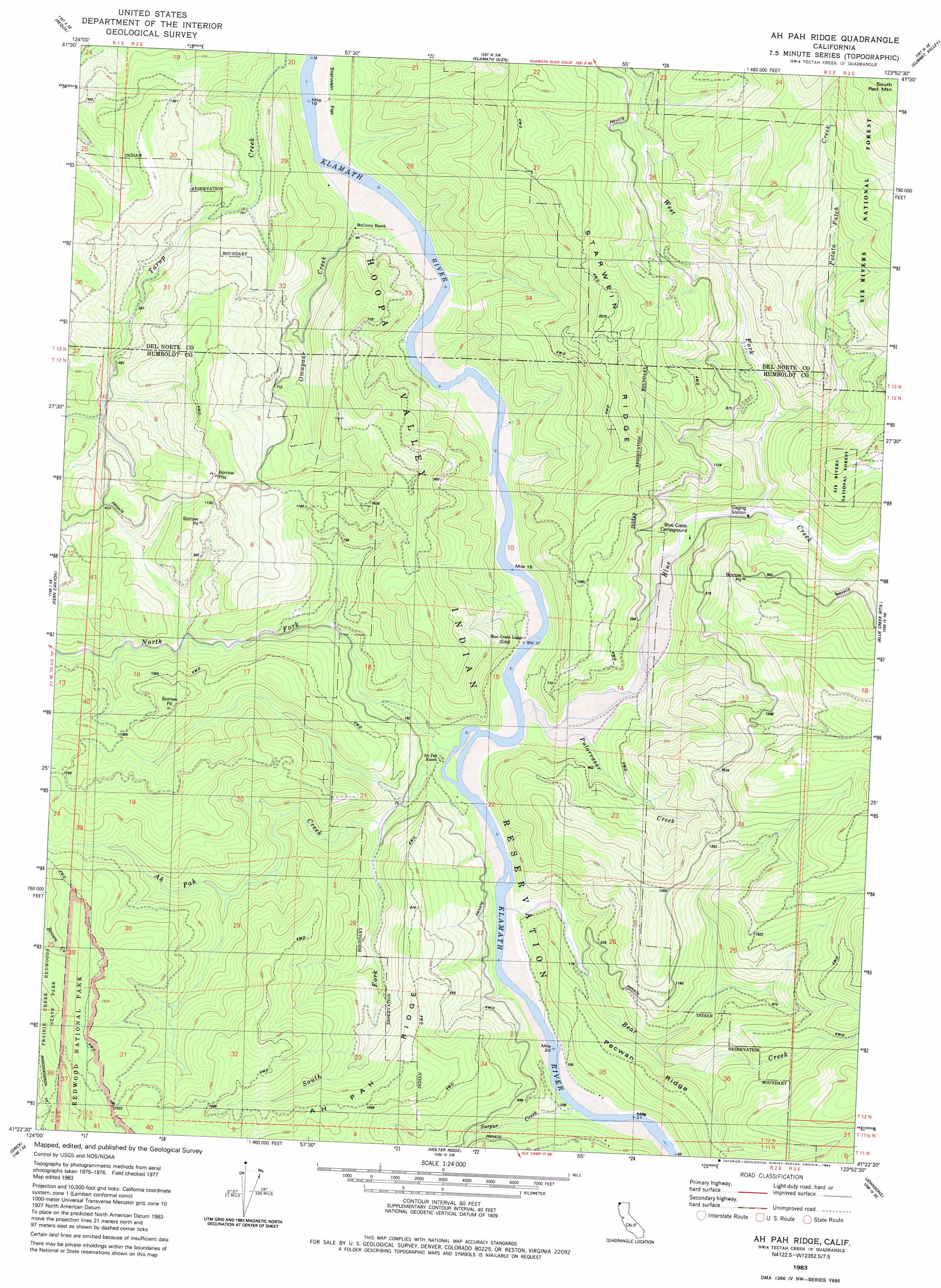
USGS Topo Quad 41123d8 - 1:24,000 scale
| Topo Map Name: | Ah Pah Ridge |
| USGS Topo Quad ID: | 41123d8 |
| Print Size: | ca. 21 1/4" wide x 27" high |
| Southeast Coordinates: | 41.375° N latitude / 123.875° W longitude |
| Map Center Coordinates: | 41.4375° N latitude / 123.9375° W longitude |
| U.S. State: | CA |
| Filename: | o41123d8.jpg |
| Download Map JPG Image: | Ah Pah Ridge topo map 1:24,000 scale |
| Map Type: | Topographic |
| Topo Series: | 7.5´ |
| Map Scale: | 1:24,000 |
| Source of Map Images: | United States Geological Survey (USGS) |
| Alternate Map Versions: |
Ah Pah Ridge CA 1983, updated 1983 Download PDF Buy paper map Ah Pah Ridge CA 1997, updated 2001 Download PDF Buy paper map Ah Pah Ridge CA 2012 Download PDF Buy paper map Ah Pah Ridge CA 2015 Download PDF Buy paper map |
| FStopo: | US Forest Service topo Ah Pah Ridge is available: Download FStopo PDF Download FStopo TIF |
1:24,000 Topo Quads surrounding Ah Pah Ridge
Sister Rocks |
Childs Hill |
Cant Hook Mountain |
Ship Mountain |
Prescott Mountain |
Requa |
Klamath Glen |
Summit Valley |
Chimney Rock |
|
Fern Canyon |
Ah Pah Ridge |
Blue Creek Mountain |
Lonesome Ridge |
|
Orick |
Holter Ridge |
Johnsons |
Fish Lake |
|
Rodgers Peak |
Bald Hills |
French Camp Ridge |
Weitchpec |
> Back to 41123a1 at 1:100,000 scale
> Back to 41122a1 at 1:250,000 scale
> Back to U.S. Topo Maps home
Ah Pah Ridge topo map: Gazetteer
Ah Pah Ridge: Flats
Starwein Flat elevation 16m 52′Ah Pah Ridge: Populated Places
Erner (historical) elevation 32m 104′Ah Pah Ridge: Ridges
Ah Pah Ridge elevation 325m 1066′Starwein Ridge elevation 786m 2578′
Ah Pah Ridge: Streams
Ah Pah Creek elevation 15m 49′Bear Creek elevation 14m 45′
Blue Creek elevation 21m 68′
North Fork Ah Pah Creek elevation 17m 55′
Omogar Creek elevation 7m 22′
Potato Patch Creek elevation 96m 314′
Pularvasar Creek elevation 21m 68′
South Fork Ah Pah Creek elevation 25m 82′
Surpur Creek elevation 15m 49′
West Fork Blue Creek elevation 67m 219′
Ah Pah Ridge digital topo map on disk
Buy this Ah Pah Ridge topo map showing relief, roads, GPS coordinates and other geographical features, as a high-resolution digital map file on DVD: