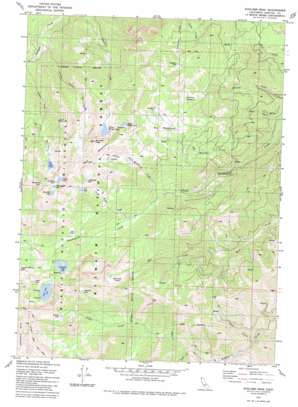
Boulder Peak Topo Map California
To zoom in, hover over the map of Boulder Peak
USGS Topo Quad 41123e1 - 1:24,000 scale
| Topo Map Name: | Boulder Peak |
| USGS Topo Quad ID: | 41123e1 |
| Print Size: | ca. 21 1/4" wide x 27" high |
| Southeast Coordinates: | 41.5° N latitude / 123° W longitude |
| Map Center Coordinates: | 41.5625° N latitude / 123.0625° W longitude |
| U.S. State: | CA |
| Filename: | o41123e1.jpg |
| Download Map JPG Image: | Boulder Peak topo map 1:24,000 scale |
| Map Type: | Topographic |
| Topo Series: | 7.5´ |
| Map Scale: | 1:24,000 |
| Source of Map Images: | United States Geological Survey (USGS) |
| Alternate Map Versions: |
Boulder Peak CA 1981, updated 1981 Download PDF Buy paper map Boulder Peak CA 1981, updated 1981 Download PDF Buy paper map Boulder Peak CA 2001, updated 2004 Download PDF Buy paper map Boulder Peak CA 2012 Download PDF Buy paper map Boulder Peak CA 2015 Download PDF Buy paper map |
| FStopo: | US Forest Service topo Boulder Peak is available: Download FStopo PDF Download FStopo TIF |
1:24,000 Topo Quads surrounding Boulder Peak
> Back to 41123e1 at 1:100,000 scale
> Back to 41122a1 at 1:250,000 scale
> Back to U.S. Topo Maps home
Boulder Peak topo map: Gazetteer
Boulder Peak: Dams
Campbell Lake 180 Dam elevation 1781m 5843′Boulder Peak: Flats
Back Meadows elevation 2123m 6965′Big Meadows elevation 2061m 6761′
Muse Meadow elevation 1864m 6115′
Sniktaw Meadow elevation 2089m 6853′
Boulder Peak: Lakes
Angel Lake elevation 2002m 6568′Aspen Lake elevation 2149m 7050′
Buckhorn Lake elevation 2159m 7083′
Buzzard Lake elevation 2032m 6666′
Calf Lake elevation 2125m 6971′
Campbell Lake elevation 1755m 5757′
Chinquapin Lake elevation 2179m 7148′
Cliff Lake elevation 1863m 6112′
Deep Lake elevation 1930m 6332′
Dogwood Lake elevation 2199m 7214′
Isinglass Lake elevation 1987m 6519′
Kidder Lake elevation 1797m 5895′
Log Lake elevation 1644m 5393′
Long High Lake elevation 2211m 7253′
Lower Wright Lake elevation 2100m 6889′
Mill Creek Ponds elevation 1958m 6423′
Upper Wright Lake elevation 2261m 7417′
Wolverine Lake elevation 2140m 7020′
Boulder Peak: Ranges
Marble Mountains elevation 2516m 8254′Boulder Peak: Ridges
Red Mountain elevation 2516m 8254′Boulder Peak: Streams
Babs Fork elevation 1148m 3766′Back Meadows Creek elevation 1439m 4721′
Big Meadows Creek elevation 1113m 3651′
Glendenning Fork elevation 1148m 3766′
Hayes Creek elevation 1088m 3569′
Long High Creek elevation 1490m 4888′
Second Valley Creek elevation 853m 2798′
Shelly Fork elevation 1241m 4071′
Boulder Peak: Summits
Boulder Peak elevation 2512m 8241′Boulder Peak: Valleys
Alder Gulch elevation 981m 3218′Boulder Peak digital topo map on disk
Buy this Boulder Peak topo map showing relief, roads, GPS coordinates and other geographical features, as a high-resolution digital map file on DVD:


