Ukonom Mountain Topo Map California
To zoom in, hover over the map of Ukonom Mountain
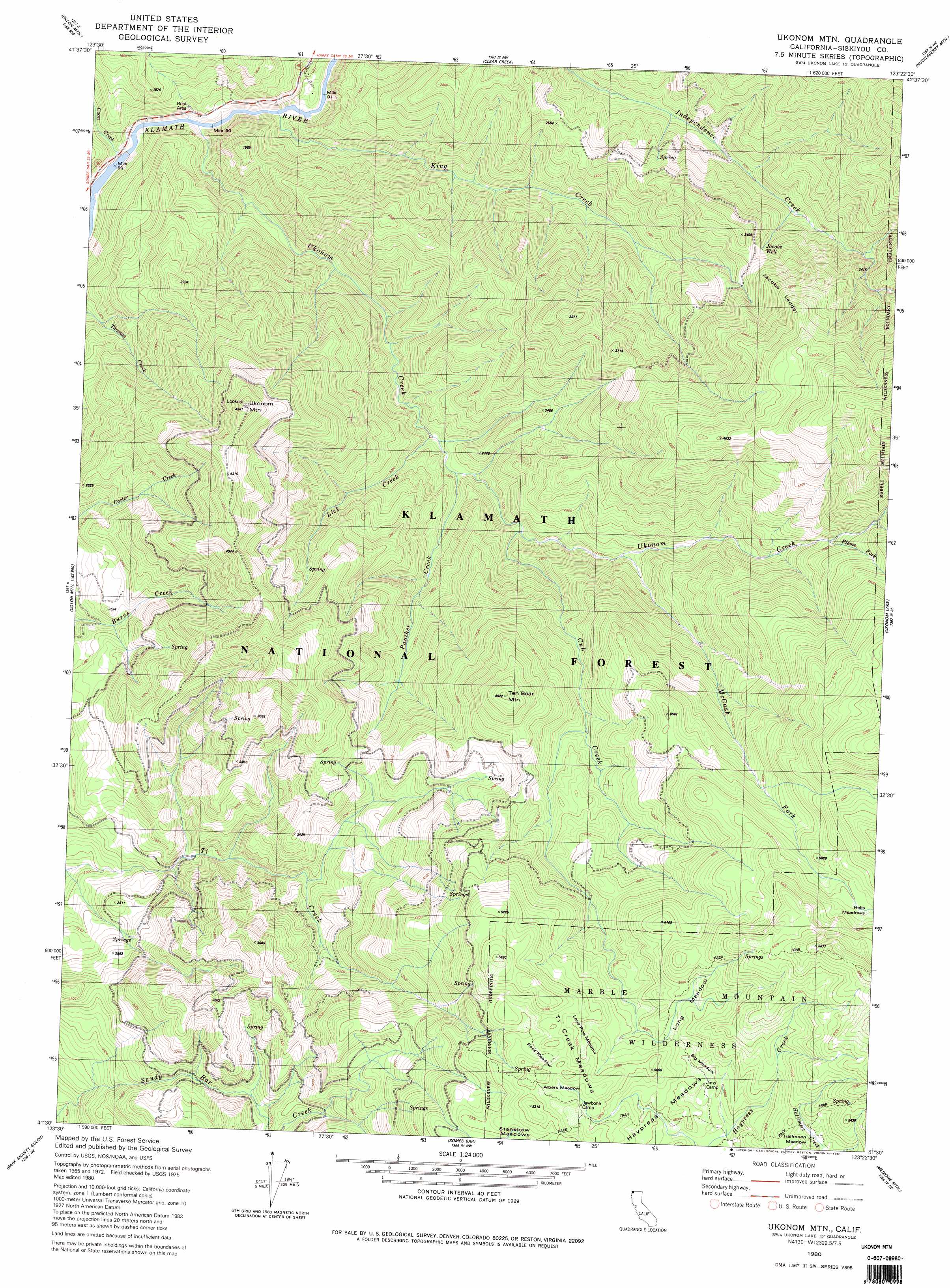
USGS Topo Quad 41123e4 - 1:24,000 scale
| Topo Map Name: | Ukonom Mountain |
| USGS Topo Quad ID: | 41123e4 |
| Print Size: | ca. 21 1/4" wide x 27" high |
| Southeast Coordinates: | 41.5° N latitude / 123.375° W longitude |
| Map Center Coordinates: | 41.5625° N latitude / 123.4375° W longitude |
| U.S. State: | CA |
| Filename: | o41123e4.jpg |
| Download Map JPG Image: | Ukonom Mountain topo map 1:24,000 scale |
| Map Type: | Topographic |
| Topo Series: | 7.5´ |
| Map Scale: | 1:24,000 |
| Source of Map Images: | United States Geological Survey (USGS) |
| Alternate Map Versions: |
Ukonom Mountain CA 1980, updated 1981 Download PDF Buy paper map Ukonom Mountain CA 2001, updated 2004 Download PDF Buy paper map Ukonom Mountain CA 2012 Download PDF Buy paper map Ukonom Mountain CA 2015 Download PDF Buy paper map |
| FStopo: | US Forest Service topo Ukonom Mountain is available: Download FStopo PDF Download FStopo TIF |
1:24,000 Topo Quads surrounding Ukonom Mountain
Devils Punchbowl |
Preston Peak |
Happy Camp |
Slater Butte |
Seiad Valley |
Prescott Mountain |
Bear Peak |
Clear Creek |
Huckleberry Mountain |
Grider Valley |
Chimney Rock |
Dillon Mountain |
Ukonom Mountain |
Ukonom Lake |
Marble Mountain |
Lonesome Ridge |
Bark Shanty Gulch |
Somes Bar |
Medicine Mountain |
English Peak |
Fish Lake |
Orleans |
Orleans Mountain |
Forks Of Salmon |
Sawyers Bar |
> Back to 41123e1 at 1:100,000 scale
> Back to 41122a1 at 1:250,000 scale
> Back to U.S. Topo Maps home
Ukonom Mountain topo map: Gazetteer
Ukonom Mountain: Flats
Albers Meadow elevation 1556m 5104′Big Meadow elevation 1468m 4816′
Haypress Meadows elevation 1510m 4954′
Lone Pine Meadow elevation 1512m 4960′
Long Meadow elevation 1509m 4950′
Ross Meadow elevation 1548m 5078′
Ti Creek Meadows elevation 1539m 5049′
Ukonom Mountain: Streams
Coon Creek elevation 238m 780′Cub Creek elevation 616m 2020′
Flems Fork elevation 1132m 3713′
King Creek elevation 252m 826′
Lick Creek elevation 488m 1601′
McCash Fork elevation 750m 2460′
Onemile Creek elevation 1282m 4206′
Panther Creek elevation 536m 1758′
Ukonom Creek elevation 245m 803′
Ukonom Mountain: Summits
Ten Bear Mountain elevation 1468m 4816′Ukonom Mountain elevation 1369m 4491′
Ukonom Mountain: Trails
Jacobs Ladder elevation 1199m 3933′Ukonom Mountain: Wells
Jacobs Well elevation 906m 2972′Ukonom Mountain digital topo map on disk
Buy this Ukonom Mountain topo map showing relief, roads, GPS coordinates and other geographical features, as a high-resolution digital map file on DVD: