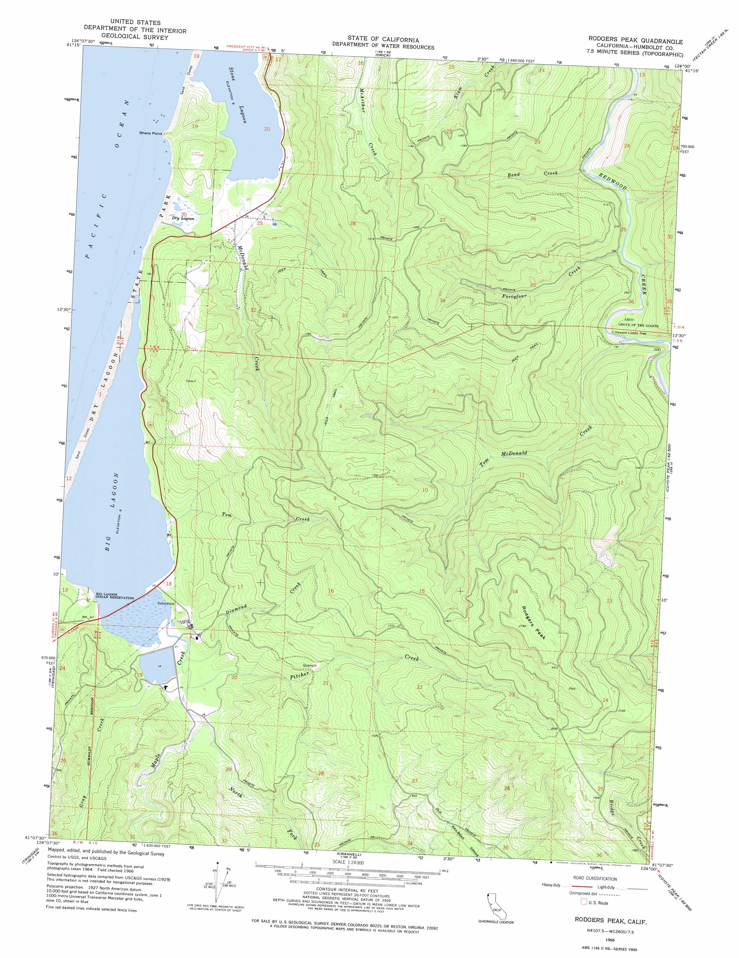
Rodgers Peak Topo Map California
To zoom in, hover over the map of Rodgers Peak
USGS Topo Quad 41124b1 - 1:24,000 scale
| Topo Map Name: | Rodgers Peak |
| USGS Topo Quad ID: | 41124b1 |
| Print Size: | ca. 21 1/4" wide x 27" high |
| Southeast Coordinates: | 41.125° N latitude / 124° W longitude |
| Map Center Coordinates: | 41.1875° N latitude / 124.0625° W longitude |
| U.S. State: | CA |
| Filename: | o41124b1.jpg |
| Download Map JPG Image: | Rodgers Peak topo map 1:24,000 scale |
| Map Type: | Topographic |
| Topo Series: | 7.5´ |
| Map Scale: | 1:24,000 |
| Source of Map Images: | United States Geological Survey (USGS) |
| Alternate Map Versions: |
Rodgers Peak CA 1966, updated 1968 Download PDF Buy paper map Rodgers Peak CA 1966, updated 1975 Download PDF Buy paper map Rodgers Peak CA 2012 Download PDF Buy paper map Rodgers Peak CA 2015 Download PDF Buy paper map |
1:24,000 Topo Quads surrounding Rodgers Peak
Fern Canyon |
Ah Pah Ridge |
Blue Creek Mountain |
||
Orick |
Holter Ridge |
Johnsons |
||
Rodgers Peak |
Bald Hills |
French Camp Ridge |
||
Trinidad |
Crannell |
Panther Creek |
Hupa Mountain |
|
Tyee City |
Arcata North |
Blue Lake |
Lord-Ellis Summit |
> Back to 41124a1 at 1:100,000 scale
> Back to 41124a1 at 1:250,000 scale
> Back to U.S. Topo Maps home
Rodgers Peak topo map: Gazetteer
Rodgers Peak: Areas
Arco Grove of the Giants elevation 48m 157′Rodgers Peak: Bars
Big Lagoon Spit elevation 2m 6′Rodgers Peak: Capes
Sharp Point elevation 0m 0′Rodgers Peak: Dams
Big Lagoon 203 Dam elevation 7m 22′Rodgers Peak: Lakes
Big Lagoon elevation 3m 9′Dry Lagoon elevation 4m 13′
Stone Lagoon elevation 3m 9′
Rodgers Peak: Parks
Harry A. Merlo State Recreation Area elevation 9m 29′Humboldt Lagoons State Park elevation 2m 6′
Rodgers Peak: Streams
Bond Creek elevation 26m 85′Diamond Creek elevation 5m 16′
Fortyfour Creek elevation 29m 95′
Gray Creek elevation 3m 9′
Maple Creek elevation 3m 9′
McDonald Creek elevation 3m 9′
North Fork Maple Creek elevation 7m 22′
Pitcher Creek elevation 7m 22′
Tom Creek elevation 3m 9′
Tom McDonald Creek elevation 34m 111′
Rodgers Peak: Summits
Rodgers Peak elevation 847m 2778′Rodgers Peak: Swamps
Big Lagoon Marsh elevation 3m 9′Rodgers Peak digital topo map on disk
Buy this Rodgers Peak topo map showing relief, roads, GPS coordinates and other geographical features, as a high-resolution digital map file on DVD: