Hiouchi Topo Map California
To zoom in, hover over the map of Hiouchi
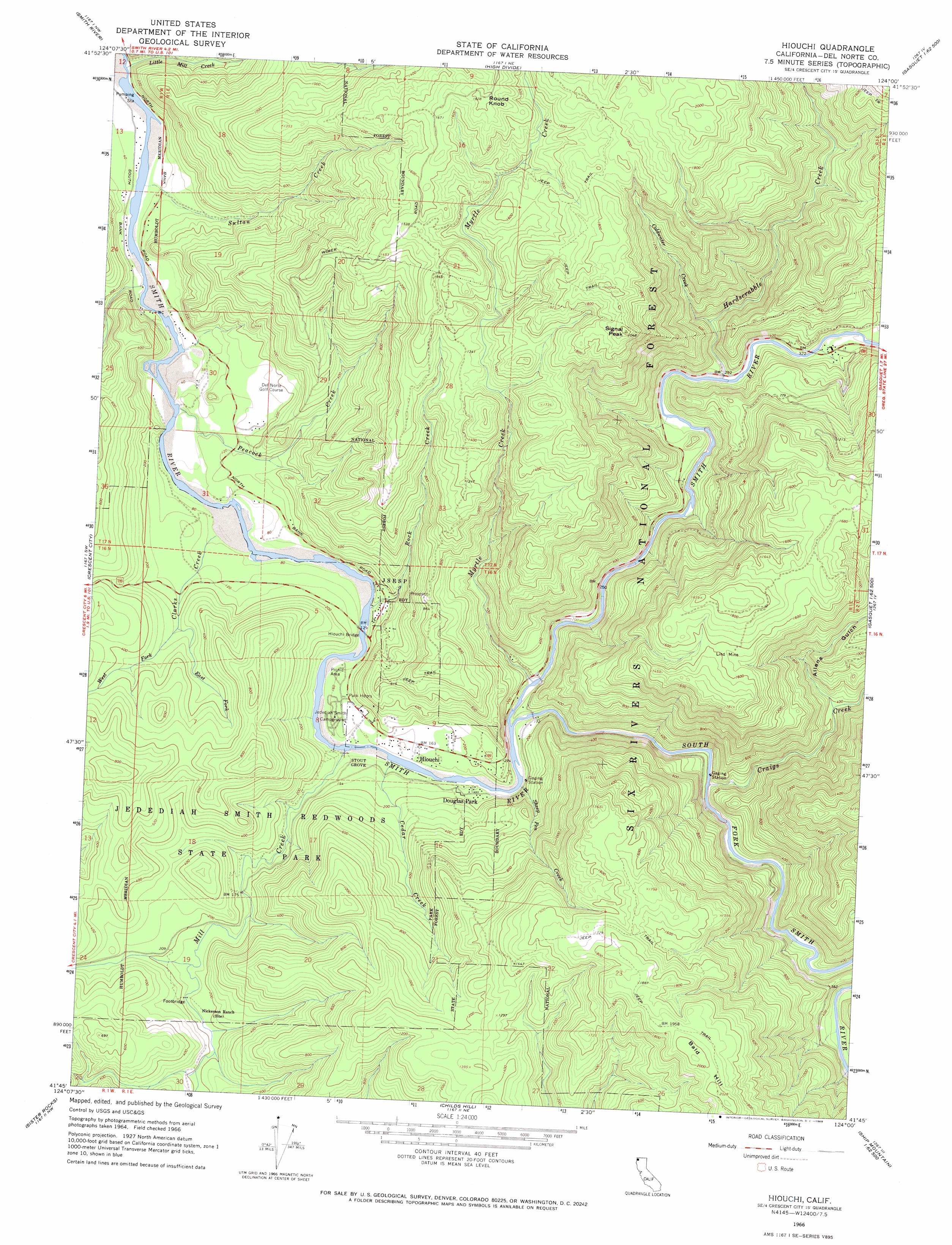
USGS Topo Quad 41124g1 - 1:24,000 scale
| Topo Map Name: | Hiouchi |
| USGS Topo Quad ID: | 41124g1 |
| Print Size: | ca. 21 1/4" wide x 27" high |
| Southeast Coordinates: | 41.75° N latitude / 124° W longitude |
| Map Center Coordinates: | 41.8125° N latitude / 124.0625° W longitude |
| U.S. State: | CA |
| Filename: | o41124g1.jpg |
| Download Map JPG Image: | Hiouchi topo map 1:24,000 scale |
| Map Type: | Topographic |
| Topo Series: | 7.5´ |
| Map Scale: | 1:24,000 |
| Source of Map Images: | United States Geological Survey (USGS) |
| Alternate Map Versions: |
Hiouchi CA 1966, updated 1968 Download PDF Buy paper map Hiouchi CA 1966, updated 1968 Download PDF Buy paper map Hiouchi CA 1997, updated 2001 Download PDF Buy paper map Hiouchi CA 2012 Download PDF Buy paper map Hiouchi CA 2015 Download PDF Buy paper map |
| FStopo: | US Forest Service topo Hiouchi is available: Download FStopo PDF Download FStopo TIF |
1:24,000 Topo Quads surrounding Hiouchi
Brookings |
Mount Emily |
Fourth Of July Creek |
Biscuit Hill |
Buckskin Peak |
Smith River |
High Divide |
High Plateau Mountain |
Shelly Creek Ridge |
|
Crescent City |
Hiouchi |
Gasquet |
Hurdygurdy Butte |
|
Sister Rocks |
Childs Hill |
Cant Hook Mountain |
Ship Mountain |
|
Requa |
Klamath Glen |
Summit Valley |
> Back to 41124e1 at 1:100,000 scale
> Back to 41124a1 at 1:250,000 scale
> Back to U.S. Topo Maps home
Hiouchi topo map: Gazetteer
Hiouchi: Bridges
Hiouchi Bridge elevation 27m 88′Hiouchi: Crossings
Peacocks Ferry (historical) elevation 13m 42′Hiouchi: Mines
Lind Mine elevation 482m 1581′Hiouchi: Parks
Jedediah Smith Redwoods State Park elevation 135m 442′Redwood National Park elevation 459m 1505′
Hiouchi: Populated Places
Douglas Park elevation 42m 137′Hiouchi elevation 52m 170′
Hiouchi: Streams
Cedar Creek elevation 27m 88′Clarks Creek elevation 19m 62′
Coldwater Creek elevation 96m 314′
Craigs Creek elevation 65m 213′
East Fork Clarks Creek elevation 70m 229′
Hardscrabble Creek elevation 74m 242′
Little Mill Creek elevation 8m 26′
Mill Creek elevation 25m 82′
Myrtle Creek elevation 38m 124′
Peacock Creek elevation 15m 49′
Rock Creek elevation 32m 104′
Sheep Pen Creek elevation 55m 180′
South Fork Smith River elevation 41m 134′
Sultan Creek elevation 10m 32′
West Fork Clarks Creek elevation 72m 236′
Hiouchi: Summits
Bald Hill elevation 614m 2014′Round Knob elevation 549m 1801′
Signal Peak elevation 611m 2004′
Hiouchi: Valleys
Allens Gulch elevation 120m 393′Hiouchi: Woods
Daughters of the American Revolution Grove elevation 65m 213′Ferrel Grove elevation 58m 190′
Krause Grove North elevation 39m 127′
Stout Grove elevation 38m 124′
Wellman Grove elevation 107m 351′
Hiouchi digital topo map on disk
Buy this Hiouchi topo map showing relief, roads, GPS coordinates and other geographical features, as a high-resolution digital map file on DVD: