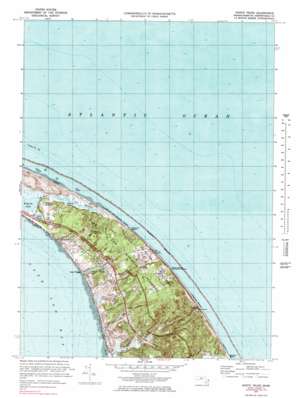
North Truro Topo Map Massachusetts
To zoom in, hover over the map of North Truro
USGS Topo Quad 42070a1 - 1:25,000 scale
| Topo Map Name: | North Truro |
| USGS Topo Quad ID: | 42070a1 |
| Print Size: | ca. 21 1/4" wide x 27" high |
| Southeast Coordinates: | 42° N latitude / 70° W longitude |
| Map Center Coordinates: | 42.0625° N latitude / 70.0625° W longitude |
| U.S. State: | MA |
| Filename: | l42070a1.jpg |
| Download Map JPG Image: | North Truro topo map 1:25,000 scale |
| Map Type: | Topographic |
| Topo Series: | 7.5´ |
| Map Scale: | 1:25,000 |
| Source of Map Images: | United States Geological Survey (USGS) |
| Alternate Map Versions: |
North Truro MA 1972, updated 1978 Download PDF Buy paper map North Truro MA 1972, updated 1983 Download PDF Buy paper map North Truro MA 1977, updated 1981 Download PDF Buy paper map |
1:24,000 Topo Quads surrounding North Truro
Provincetown |
North Truro |
|||
Wellfleet |
||||
Orleans |
> Back to 42070a1 at 1:100,000 scale
> Back to 42070a1 at 1:250,000 scale
> Back to U.S. Topo Maps home
North Truro topo map: Gazetteer
North Truro: Beaches
Ballston Beach elevation 3m 9′Great Hollow Beach elevation 0m 0′
Head of the Meadow Beach elevation 2m 6′
Highland Beach elevation 10m 32′
Longnook Beach elevation 3m 9′
North Truro: Cliffs
High Head elevation 1m 3′North Truro: Flats
Moon Pond Meadow elevation 3m 9′North Truro: Islands
Pilgrim Beach elevation 3m 9′North Truro: Lakes
Moon Pond elevation 5m 16′Village Pond elevation 1m 3′
North Truro: Parks
Snows Field elevation 37m 121′North Truro: Populated Places
North Truro elevation 16m 52′Pilgrim Heights elevation 17m 55′
Pond Village elevation 0m 0′
North Truro: Springs
Pilgrim Spring elevation 2m 6′North Truro: Summits
Corn Hill elevation 34m 111′Green Hill elevation 38m 124′
Peters Hill elevation 34m 111′
Smalls Hill elevation 34m 111′
The Highlands elevation 41m 134′
North Truro: Swamps
Great Swamp elevation 21m 68′Little Pamet River Marshes elevation 1m 3′
Salt Meadow elevation 1m 3′
North Truro: Trails
Pamet Cranberry Bog Trail elevation 17m 55′Pilgrim Spring Trail elevation 1m 3′
Small Swamp Trail elevation 10m 32′
North Truro: Valleys
Great Hollow elevation 0m 0′Hanging Valley elevation 17m 55′
Higgins Hollow elevation 5m 16′
Long Nook Valley elevation 16m 52′
North Truro digital topo map on disk
Buy this North Truro topo map showing relief, roads, GPS coordinates and other geographical features, as a high-resolution digital map file on DVD:
Maine, New Hampshire, Rhode Island & Eastern Massachusetts
Buy digital topo maps: Maine, New Hampshire, Rhode Island & Eastern Massachusetts


