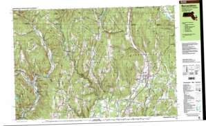
Bernardston Topo Map Massachusetts
To zoom in, hover over the map of Bernardston
USGS Topo Quad 42072f5 - 1:25,000 scale
| Topo Map Name: | Bernardston |
| USGS Topo Quad ID: | 42072f5 |
| Print Size: | ca. 39" wide x 24" high |
| Southeast Coordinates: | 42.625° N latitude / 72.5° W longitude |
| Map Center Coordinates: | 42.6875° N latitude / 72.625° W longitude |
| U.S. States: | MA, VT |
| Filename: | k42072f5.jpg |
| Download Map JPG Image: | Bernardston topo map 1:25,000 scale |
| Map Type: | Topographic |
| Topo Series: | 7.5´x15´ |
| Map Scale: | 1:25,000 |
| Source of Map Images: | United States Geological Survey (USGS) |
| Alternate Map Versions: |
Bernardston MA 1990, updated 1990 Download PDF Buy paper map Bernardston MA 1990, updated 1990 Download PDF Buy paper map Bernardston MA 1998, updated 2000 Download PDF Buy paper map |
1:24,000 Topo Quads surrounding Bernardston
West Dover |
Putney |
Keene |
||
Jacksonville |
Brattleboro |
West Swanzey |
||
Heath |
Bernardston |
Mount Grace |
||
Ashfield |
Greenfield |
Orange |
||
Goshen |
Mount Toby |
Quabbin Reservoir |
> Back to 42072e1 at 1:100,000 scale
> Back to 42072a1 at 1:250,000 scale
> Back to U.S. Topo Maps home
Bernardston topo map: Gazetteer
Bernardston: Basins
The Basin elevation 238m 780′Bernardston: Benches
Olden Ledges elevation 301m 987′Bernardston: Bridges
Arthur Smith Covered Bridge elevation 163m 534′Bernardston: Crossings
Interchange Twenty Eight elevation 108m 354′Bernardston: Dams
Greenfield Reservoir Dam elevation 148m 485′J B Dunnell Dam elevation 89m 291′
Kendall Company Number 1 Dam elevation 161m 528′
Lower Glen Reservoir Dam elevation 137m 449′
McLeod Pond Dam elevation 340m 1115′
Shelburne Falls Fire District Dam elevation 264m 866′
Weatherhead Hollow Pond Dam elevation 205m 672′
Wood Dam elevation 108m 354′
Bernardston: Flats
Beaver Meadow elevation 227m 744′Greenfield Meadows elevation 68m 223′
Bernardston: Forests
Leyden State Forest elevation 400m 1312′Bernardston: Lakes
Deane Pond elevation 110m 360′Lily Pond elevation 112m 367′
Newell Pond elevation 99m 324′
Otter Pond elevation 111m 364′
Bernardston: Parks
Cushman Park elevation 112m 367′Satans Kingdom Wildlife Management Area elevation 311m 1020′
Bernardston: Pillars
Amidon Pinnacle elevation 371m 1217′Gallup Pinnacle elevation 343m 1125′
Bernardston: Populated Places
Adamsville elevation 210m 688′Bernardston elevation 109m 357′
Cold Spring elevation 113m 370′
Colrain elevation 187m 613′
East Shelburne elevation 206m 675′
Elm Grove elevation 221m 725′
Fort Lucas elevation 281m 921′
Fort Morris elevation 341m 1118′
Fort Morrison elevation 209m 685′
Foundry Village elevation 171m 561′
Griswoldville elevation 169m 554′
Hales Crossing elevation 111m 364′
Leyden elevation 294m 964′
Lyonsville elevation 174m 570′
North Bernardston elevation 135m 442′
Packer Corner elevation 332m 1089′
Shattuckville elevation 143m 469′
Stewartville elevation 150m 492′
West Leyden elevation 161m 528′
Bernardston: Ranges
Catamount Hills elevation 383m 1256′Bernardston: Reservoirs
Fall River Reservoir elevation 89m 291′Fall River Reservoir elevation 108m 354′
Greenfield Reservoir elevation 148m 485′
Greenfield Reservoir - Lower Glen elevation 137m 449′
McLeod Pond elevation 340m 1115′
North River Reservoir elevation 161m 528′
Shelburne Falls Fire District Reservoir elevation 264m 866′
Weatherhead Hollow Pond elevation 205m 672′
Bernardston: Streams
Beaver Meadow Brook elevation 198m 649′Borden Brook elevation 171m 561′
Borden Brook elevation 169m 554′
Brandy Brook elevation 220m 721′
Browning Brook elevation 102m 334′
Cary Brook elevation 161m 528′
Couch Brook elevation 124m 406′
East Branch North River elevation 159m 521′
East Branch North River elevation 158m 518′
East Glen Brook elevation 160m 524′
Foundry Brook elevation 166m 544′
Fox Brook elevation 139m 456′
Glen Brook elevation 57m 187′
Harris Brook elevation 163m 534′
Hibbard Brook elevation 134m 439′
Holden Brook elevation 170m 557′
Houghton Brook elevation 137m 449′
Johnson Brook elevation 192m 629′
Johnson Brook elevation 143m 469′
Katley Brook elevation 112m 367′
Keets Brook elevation 200m 656′
McCard Brook elevation 77m 252′
McClellan Brook elevation 152m 498′
Meadow Brook elevation 138m 452′
Miller Brook elevation 200m 656′
North River elevation 337m 1105′
Otter Brook elevation 83m 272′
Roaring Brook elevation 150m 492′
Roaring Brook elevation 183m 600′
Shatluck Brook elevation 132m 433′
Shattuck Brook elevation 132m 433′
Spur Brook elevation 221m 725′
Stafford Brook elevation 119m 390′
Stewart Brook elevation 127m 416′
Stowe Brook elevation 253m 830′
Taylor Brook elevation 188m 616′
Thorne Brook elevation 166m 544′
Thorne Brook elevation 170m 557′
Vaughn Brook elevation 235m 770′
West Branch North River elevation 159m 521′
West Brook elevation 138m 452′
West Brook elevation 138m 452′
Workman Brook elevation 83m 272′
Bernardston: Summits
Aunt Sophies Peak elevation 317m 1040′Avery Hill elevation 368m 1207′
Bald Hill elevation 392m 1286′
Bald Mountain elevation 380m 1246′
Ball Mountain elevation 314m 1030′
Barber Hill elevation 364m 1194′
Belden Hill elevation 437m 1433′
Chandler Hill elevation 359m 1177′
Charles Hill elevation 256m 839′
Colrain Mountain elevation 374m 1227′
Colwell Hill elevation 357m 1171′
Copeland Hill elevation 277m 908′
Daniels Peak elevation 374m 1227′
Darby Hill elevation 223m 731′
East Hill elevation 310m 1017′
East Mountain elevation 339m 1112′
Everett Hill elevation 331m 1085′
Fairbanks Hill elevation 450m 1476′
Franklin Hill elevation 380m 1246′
Frizzell Hill elevation 399m 1309′
Gates Hill elevation 373m 1223′
Houghton Hill elevation 423m 1387′
Katley Hill elevation 296m 971′
Mason Hill elevation 198m 649′
Mount Hope elevation 422m 1384′
Patten Hill elevation 418m 1371′
Pine Hill elevation 366m 1200′
Pond Mountain elevation 375m 1230′
Shearer Hill elevation 268m 879′
Snow Hill elevation 182m 597′
Spencer Mountain elevation 344m 1128′
Taggard Hill elevation 358m 1174′
The Pinnacle elevation 319m 1046′
West Hill elevation 287m 941′
West Mountain elevation 366m 1200′
Wildcat Mountain elevation 340m 1115′
Wilson Hill elevation 464m 1522′
Bernardston: Woods
Long Woods elevation 287m 941′Bernardston digital topo map on disk
Buy this Bernardston topo map showing relief, roads, GPS coordinates and other geographical features, as a high-resolution digital map file on DVD:
New York, Vermont, Connecticut & Western Massachusetts
Buy digital topo maps: New York, Vermont, Connecticut & Western Massachusetts


