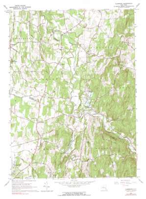
Clermont Topo Map New York
To zoom in, hover over the map of Clermont
USGS Topo Quad 42073a7 - 1:24,000 scale
| Topo Map Name: | Clermont |
| USGS Topo Quad ID: | 42073a7 |
| Print Size: | ca. 21 1/4" wide x 27" high |
| Southeast Coordinates: | 42° N latitude / 73.75° W longitude |
| Map Center Coordinates: | 42.0625° N latitude / 73.8125° W longitude |
| U.S. State: | NY |
| Filename: | o42073a7.jpg |
| Download Map JPG Image: | Clermont topo map 1:24,000 scale |
| Map Type: | Topographic |
| Topo Series: | 7.5´ |
| Map Scale: | 1:24,000 |
| Source of Map Images: | United States Geological Survey (USGS) |
| Alternate Map Versions: |
Clermont NY 1963, updated 1964 Download PDF Buy paper map Clermont NY 1963, updated 1972 Download PDF Buy paper map Clermont NY 1963, updated 1973 Download PDF Buy paper map Clermont NY 1963, updated 1991 Download PDF Buy paper map Clermont NY 2010 Download PDF Buy paper map Clermont NY 2013 Download PDF Buy paper map Clermont NY 2016 Download PDF Buy paper map |
1:24,000 Topo Quads surrounding Clermont
> Back to 42073a1 at 1:100,000 scale
> Back to 42072a1 at 1:250,000 scale
> Back to U.S. Topo Maps home
Clermont topo map: Gazetteer
Clermont: Airports
SOP Airport elevation 57m 187′Clermont: Lakes
Spring Lakes elevation 75m 246′Twin Lakes elevation 80m 262′
Warackamac Lake elevation 91m 298′
Clermont: Populated Places
Bingham Mills elevation 38m 124′Blue Store elevation 56m 183′
Clermont elevation 68m 223′
Cokertown elevation 79m 259′
Elizaville elevation 88m 288′
Fraleighs elevation 74m 242′
Kerleys Corners elevation 57m 187′
Manorton elevation 76m 249′
Nevis elevation 66m 216′
Red Hook Mills elevation 61m 200′
Snyderville elevation 139m 456′
Upper Red Hook elevation 70m 229′
Viewmonte elevation 69m 226′
Clermont: Streams
Doove Kill elevation 58m 190′Clermont: Summits
Little Roundtop elevation 92m 301′Tory Hill elevation 215m 705′
Turkey Hill elevation 183m 600′
Clermont digital topo map on disk
Buy this Clermont topo map showing relief, roads, GPS coordinates and other geographical features, as a high-resolution digital map file on DVD:
New York, Vermont, Connecticut & Western Massachusetts
Buy digital topo maps: New York, Vermont, Connecticut & Western Massachusetts


