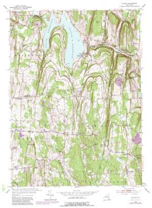
Alcove Topo Map New York
To zoom in, hover over the map of Alcove
USGS Topo Quad 42073d8 - 1:24,000 scale
| Topo Map Name: | Alcove |
| USGS Topo Quad ID: | 42073d8 |
| Print Size: | ca. 21 1/4" wide x 27" high |
| Southeast Coordinates: | 42.375° N latitude / 73.875° W longitude |
| Map Center Coordinates: | 42.4375° N latitude / 73.9375° W longitude |
| U.S. State: | NY |
| Filename: | o42073d8.jpg |
| Download Map JPG Image: | Alcove topo map 1:24,000 scale |
| Map Type: | Topographic |
| Topo Series: | 7.5´ |
| Map Scale: | 1:24,000 |
| Source of Map Images: | United States Geological Survey (USGS) |
| Alternate Map Versions: |
Alcove NY 1953, updated 1955 Download PDF Buy paper map Alcove NY 1953, updated 1967 Download PDF Buy paper map Alcove NY 1953, updated 1981 Download PDF Buy paper map Alcove NY 2010 Download PDF Buy paper map Alcove NY 2013 Download PDF Buy paper map Alcove NY 2016 Download PDF Buy paper map |
1:24,000 Topo Quads surrounding Alcove
> Back to 42073a1 at 1:100,000 scale
> Back to 42072a1 at 1:250,000 scale
> Back to U.S. Topo Maps home
Alcove topo map: Gazetteer
Alcove: Falls
Dickinson Falls elevation 201m 659′Alcove: Lakes
Beaver Dam Lake elevation 199m 652′Mirror Lake elevation 175m 574′
Alcove: Mines
Mossy Hill Quarry elevation 210m 688′Alcove: Populated Places
Alcove elevation 166m 544′Coeymans Hollow elevation 126m 413′
Dormansville elevation 309m 1013′
East Greenville elevation 227m 744′
Grapeville elevation 195m 639′
Indian Fields (historical) elevation 189m 620′
Medway elevation 210m 688′
Newrys elevation 254m 833′
Paradise Hill elevation 202m 662′
Surprise elevation 167m 547′
Alcove: Reservoirs
Alcove Reservoir elevation 188m 616′Ravena Reservoir (historical) elevation 188m 616′
Silver Lake elevation 187m 613′
Alcove: Streams
Gulf Creek elevation 188m 616′Silver Creek elevation 216m 708′
Alcove: Summits
King Hill elevation 272m 892′Mud Hill elevation 235m 770′
Murder Bridge Hill elevation 254m 833′
Stanton Hill elevation 260m 853′
Alcove: Valleys
Cole Hollow elevation 123m 403′Alcove digital topo map on disk
Buy this Alcove topo map showing relief, roads, GPS coordinates and other geographical features, as a high-resolution digital map file on DVD:
New York, Vermont, Connecticut & Western Massachusetts
Buy digital topo maps: New York, Vermont, Connecticut & Western Massachusetts


