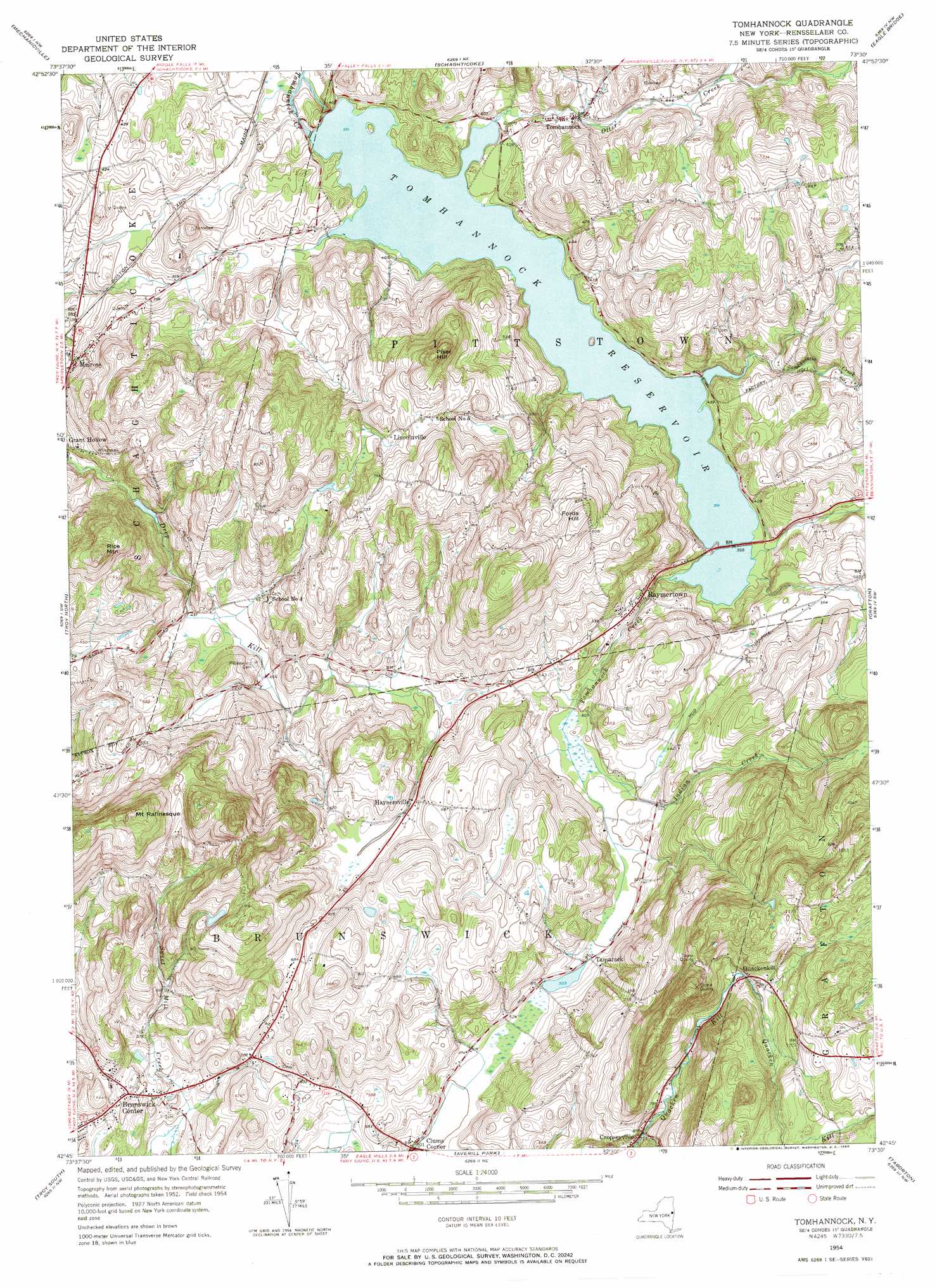
Tomhannock Topo Map New York
To zoom in, hover over the map of Tomhannock
USGS Topo Quad 42073g5 - 1:24,000 scale
| Topo Map Name: | Tomhannock |
| USGS Topo Quad ID: | 42073g5 |
| Print Size: | ca. 21 1/4" wide x 27" high |
| Southeast Coordinates: | 42.75° N latitude / 73.5° W longitude |
| Map Center Coordinates: | 42.8125° N latitude / 73.5625° W longitude |
| U.S. State: | NY |
| Filename: | o42073g5.jpg |
| Download Map JPG Image: | Tomhannock topo map 1:24,000 scale |
| Map Type: | Topographic |
| Topo Series: | 7.5´ |
| Map Scale: | 1:24,000 |
| Source of Map Images: | United States Geological Survey (USGS) |
| Alternate Map Versions: |
Tomhannock NY 1954, updated 1956 Download PDF Buy paper map Tomhannock NY 1954, updated 1968 Download PDF Buy paper map Tomhannock NY 2010 Download PDF Buy paper map Tomhannock NY 2013 Download PDF Buy paper map Tomhannock NY 2016 Download PDF Buy paper map |
1:24,000 Topo Quads surrounding Tomhannock
Saratoga Springs |
Quaker Springs |
Schuylerville |
Cambridge |
Shushan |
Round Lake |
Mechanicville |
Schaghticoke |
Eagle Bridge |
Hoosick Falls |
Niskayuna |
Troy North |
Tomhannock |
Grafton |
North Pownal |
Albany |
Troy South |
Averill Park |
Berlin |
|
Delmar |
East Greenbush |
Nassau |
Hancock |
> Back to 42073e1 at 1:100,000 scale
> Back to 42072a1 at 1:250,000 scale
> Back to U.S. Topo Maps home
Tomhannock topo map: Gazetteer
Tomhannock: Populated Places
Brunswick Center elevation 173m 567′Clums Corner elevation 152m 498′
Haynersville elevation 185m 606′
Lincolnville elevation 205m 672′
Melrose elevation 119m 390′
Quackenkill elevation 283m 928′
Raymertown elevation 145m 475′
Tamarack elevation 154m 505′
Terrace Haven Mobile Home Park elevation 187m 613′
Tomhannock elevation 129m 423′
Tomhannock: Reservoirs
Tomhannock Reservoir elevation 119m 390′Tomhannock: Streams
Indian Creek elevation 149m 488′Otter Creek elevation 119m 390′
Sunkauissia Creek elevation 119m 390′
Tomhannock: Summits
Fords Hill elevation 269m 882′Mount Rafinesque elevation 356m 1167′
Piser Hill elevation 280m 918′
Rice Mountain elevation 273m 895′
Tomhannock digital topo map on disk
Buy this Tomhannock topo map showing relief, roads, GPS coordinates and other geographical features, as a high-resolution digital map file on DVD:
New York, Vermont, Connecticut & Western Massachusetts
Buy digital topo maps: New York, Vermont, Connecticut & Western Massachusetts