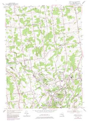
Burnt Hills Topo Map New York
To zoom in, hover over the map of Burnt Hills
USGS Topo Quad 42073h8 - 1:24,000 scale
| Topo Map Name: | Burnt Hills |
| USGS Topo Quad ID: | 42073h8 |
| Print Size: | ca. 21 1/4" wide x 27" high |
| Southeast Coordinates: | 42.875° N latitude / 73.875° W longitude |
| Map Center Coordinates: | 42.9375° N latitude / 73.9375° W longitude |
| U.S. State: | NY |
| Filename: | o42073h8.jpg |
| Download Map JPG Image: | Burnt Hills topo map 1:24,000 scale |
| Map Type: | Topographic |
| Topo Series: | 7.5´ |
| Map Scale: | 1:24,000 |
| Source of Map Images: | United States Geological Survey (USGS) |
| Alternate Map Versions: |
Burnt Hills NY 1954, updated 1956 Download PDF Buy paper map Burnt Hills NY 1954, updated 1967 Download PDF Buy paper map Burnt Hills NY 1954, updated 1976 Download PDF Buy paper map Burnt Hills NY 1954, updated 1981 Download PDF Buy paper map Burnt Hills NY 1954, updated 1981 Download PDF Buy paper map Burnt Hills NY 2010 Download PDF Buy paper map Burnt Hills NY 2013 Download PDF Buy paper map Burnt Hills NY 2016 Download PDF Buy paper map |
1:24,000 Topo Quads surrounding Burnt Hills
> Back to 42073e1 at 1:100,000 scale
> Back to 42072a1 at 1:250,000 scale
> Back to U.S. Topo Maps home
Burnt Hills topo map: Gazetteer
Burnt Hills: Lakes
Taylor Pond elevation 145m 475′Burnt Hills: Populated Places
Burnt Hills elevation 124m 406′Charlton elevation 151m 495′
East Glenville elevation 110m 360′
Fruitwood Acres elevation 129m 423′
Garrison Manor elevation 127m 416′
Glenville Center elevation 187m 613′
Harmon Park elevation 110m 360′
Harmony Corners elevation 164m 538′
High Mills elevation 108m 354′
Holbrook Corners elevation 179m 587′
Kays Trailer Court elevation 131m 429′
Komar Park elevation 124m 406′
Mourningkill Estates elevation 130m 426′
Orchard Park elevation 129m 423′
Ralmar Park elevation 108m 354′
Silver Springs elevation 144m 472′
Tucker Heights elevation 123m 403′
Vienna Heights elevation 135m 442′
Wheeler Estates elevation 120m 393′
Willow Brook Park elevation 107m 351′
Woodruff Heights elevation 109m 357′
Burnt Hills: Streams
La Rue Creek elevation 99m 324′Burnt Hills: Summits
Glenville Hill elevation 259m 849′Burnt Hills digital topo map on disk
Buy this Burnt Hills topo map showing relief, roads, GPS coordinates and other geographical features, as a high-resolution digital map file on DVD:
New York, Vermont, Connecticut & Western Massachusetts
Buy digital topo maps: New York, Vermont, Connecticut & Western Massachusetts


