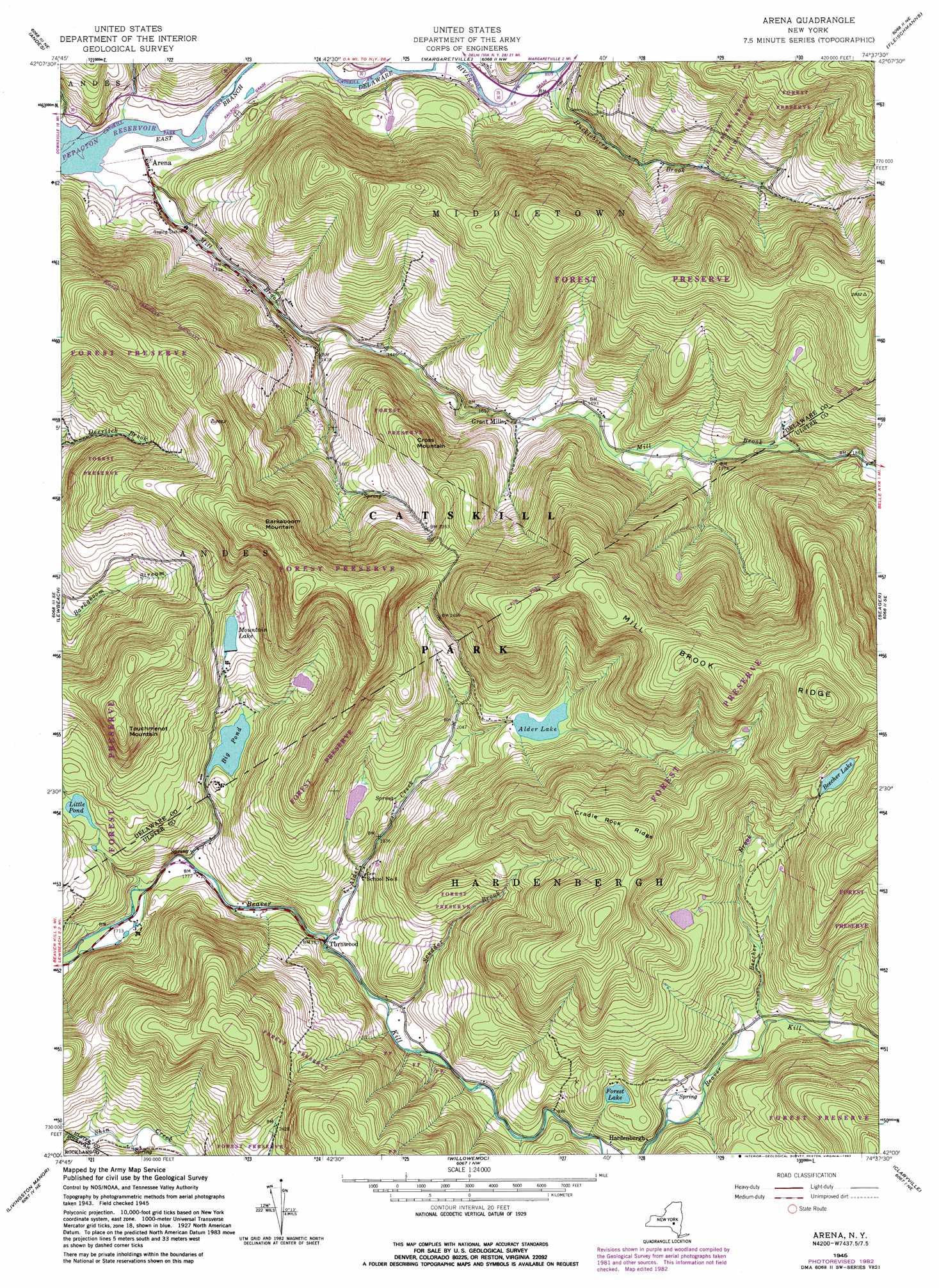
Arena Topo Map New York
To zoom in, hover over the map of Arena
USGS Topo Quad 42074a6 - 1:24,000 scale
| Topo Map Name: | Arena |
| USGS Topo Quad ID: | 42074a6 |
| Print Size: | ca. 21 1/4" wide x 27" high |
| Southeast Coordinates: | 42° N latitude / 74.625° W longitude |
| Map Center Coordinates: | 42.0625° N latitude / 74.6875° W longitude |
| U.S. State: | NY |
| Filename: | o42074a6.jpg |
| Download Map JPG Image: | Arena topo map 1:24,000 scale |
| Map Type: | Topographic |
| Topo Series: | 7.5´ |
| Map Scale: | 1:24,000 |
| Source of Map Images: | United States Geological Survey (USGS) |
| Alternate Map Versions: |
Arena NY 1945, updated 1960 Download PDF Buy paper map Arena NY 1945, updated 1965 Download PDF Buy paper map Arena NY 1945, updated 1974 Download PDF Buy paper map Arena NY 1945, updated 1983 Download PDF Buy paper map Arena NY 1946 Download PDF Buy paper map Arena NY 1946 Download PDF Buy paper map Arena NY 2010 Download PDF Buy paper map Arena NY 2013 Download PDF Buy paper map Arena NY 2016 Download PDF Buy paper map |
1:24,000 Topo Quads surrounding Arena
Delhi |
Bloomville |
Hobart |
Roxbury |
Prattsville |
Hamden |
Andes |
Margaretville |
Fleischmanns |
West Kill |
Downsville |
Lewbeach |
Arena |
Seager |
Shandaken |
Roscoe |
Livingston Manor |
Willowemoc |
Claryville |
Peekamoose Mountain |
Jeffersonville |
Liberty West |
Liberty East |
Grahamsville |
Rondout Reservoir |
> Back to 42074a1 at 1:100,000 scale
> Back to 42074a1 at 1:250,000 scale
> Back to U.S. Topo Maps home
Arena topo map: Gazetteer
Arena: Bridges
Grants Mills Covered Bridge elevation 555m 1820′Tuscarora Club Bridge elevation 452m 1482′
Arena: Lakes
Alder Lake elevation 673m 2208′Forest Lake elevation 662m 2171′
Little Pond elevation 607m 1991′
Arena: Populated Places
Arena elevation 391m 1282′Grant Mills elevation 500m 1640′
Hardenburg elevation 614m 2014′
Turnwood elevation 556m 1824′
Arena: Reservoirs
Beecher Lake elevation 825m 2706′Big Pond elevation 589m 1932′
Mountain Lake elevation 655m 2148′
Arena: Ridges
Cradle Rock Ridge elevation 966m 3169′Mill Brook Ridge elevation 996m 3267′
Arena: Streams
Alder Creek elevation 550m 1804′Beecher Brook elevation 639m 2096′
Huckleberry Brook elevation 391m 1282′
Mill Brook elevation 390m 1279′
Scudder Brook elevation 561m 1840′
Arena: Summits
Barkaboom Mountain elevation 916m 3005′Cross Mountain elevation 714m 2342′
Touchmenot Mountain elevation 842m 2762′
Arena: Valleys
Cold Spring Hollow elevation 400m 1312′Arena digital topo map on disk
Buy this Arena topo map showing relief, roads, GPS coordinates and other geographical features, as a high-resolution digital map file on DVD:
New York, Vermont, Connecticut & Western Massachusetts
Buy digital topo maps: New York, Vermont, Connecticut & Western Massachusetts