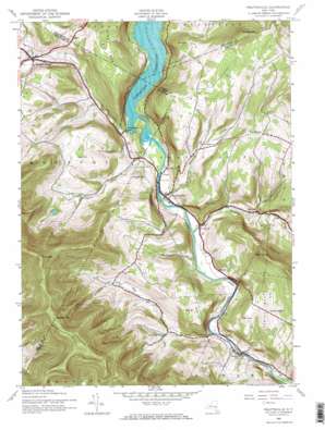
Prattsville Topo Map New York
To zoom in, hover over the map of Prattsville
USGS Topo Quad 42074c4 - 1:24,000 scale
| Topo Map Name: | Prattsville |
| USGS Topo Quad ID: | 42074c4 |
| Print Size: | ca. 21 1/4" wide x 27" high |
| Southeast Coordinates: | 42.25° N latitude / 74.375° W longitude |
| Map Center Coordinates: | 42.3125° N latitude / 74.4375° W longitude |
| U.S. State: | NY |
| Filename: | o42074c4.jpg |
| Download Map JPG Image: | Prattsville topo map 1:24,000 scale |
| Map Type: | Topographic |
| Topo Series: | 7.5´ |
| Map Scale: | 1:24,000 |
| Source of Map Images: | United States Geological Survey (USGS) |
| Alternate Map Versions: |
Prattsville NY 1945, updated 1960 Download PDF Buy paper map Prattsville NY 1945, updated 1966 Download PDF Buy paper map Prattsville NY 1945, updated 1966 Download PDF Buy paper map Prattsville NY 1946 Download PDF Buy paper map Prattsville NY 2010 Download PDF Buy paper map Prattsville NY 2013 Download PDF Buy paper map Prattsville NY 2016 Download PDF Buy paper map |
1:24,000 Topo Quads surrounding Prattsville
> Back to 42074a1 at 1:100,000 scale
> Back to 42074a1 at 1:250,000 scale
> Back to U.S. Topo Maps home
Prattsville topo map: Gazetteer
Prattsville: Airports
Maben Airport elevation 533m 1748′Prattsville: Cliffs
Pratt Rocks elevation 463m 1519′Prattsville: Falls
Hardenburgh Falls elevation 349m 1145′Prattsville: Mines
Falke's Quarry elevation 396m 1299′Prattsville: Populated Places
Grand Gorge elevation 427m 1400′Moores Mobile Home Park elevation 351m 1151′
Mosquito Point elevation 386m 1266′
North Lexington elevation 582m 1909′
Prattsville elevation 354m 1161′
Red Falls elevation 398m 1305′
Prattsville: Ridges
Patterson Ridge elevation 768m 2519′Prattsville: Streams
Batavia Kill elevation 353m 1158′Bear Kill elevation 344m 1128′
Fall Brook elevation 396m 1299′
Huntersfield Creek elevation 344m 1128′
Johnson Hollow Brook elevation 344m 1128′
Little West Kill elevation 372m 1220′
Prattsville: Summits
Bald Mountain elevation 766m 2513′Bearpen Mountain elevation 1076m 3530′
Clay Hill elevation 393m 1289′
Dog Hill elevation 617m 2024′
Ferris Hill elevation 588m 1929′
Kipp Hill elevation 610m 2001′
Maben Hill elevation 557m 1827′
Mount Royal elevation 560m 1837′
Negro Hill elevation 591m 1938′
Pine Mountain elevation 592m 1942′
Prospect Hill elevation 470m 1541′
Roundtop elevation 1052m 3451′
Sicklers Mountain elevation 702m 2303′
Prattsville: Valleys
Toad Hollow elevation 398m 1305′Prattsville digital topo map on disk
Buy this Prattsville topo map showing relief, roads, GPS coordinates and other geographical features, as a high-resolution digital map file on DVD:
New York, Vermont, Connecticut & Western Massachusetts
Buy digital topo maps: New York, Vermont, Connecticut & Western Massachusetts


