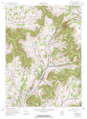
Roxbury Topo Map New York
To zoom in, hover over the map of Roxbury
USGS Topo Quad 42074c5 - 1:24,000 scale
| Topo Map Name: | Roxbury |
| USGS Topo Quad ID: | 42074c5 |
| Print Size: | ca. 21 1/4" wide x 27" high |
| Southeast Coordinates: | 42.25° N latitude / 74.5° W longitude |
| Map Center Coordinates: | 42.3125° N latitude / 74.5625° W longitude |
| U.S. State: | NY |
| Filename: | o42074c5.jpg |
| Download Map JPG Image: | Roxbury topo map 1:24,000 scale |
| Map Type: | Topographic |
| Topo Series: | 7.5´ |
| Map Scale: | 1:24,000 |
| Source of Map Images: | United States Geological Survey (USGS) |
| Alternate Map Versions: |
Roxbury NY 1945, updated 1960 Download PDF Buy paper map Roxbury NY 1945, updated 1968 Download PDF Buy paper map Roxbury NY 1945, updated 1985 Download PDF Buy paper map Roxbury NY 1945, updated 1985 Download PDF Buy paper map Roxbury NY 2010 Download PDF Buy paper map Roxbury NY 2013 Download PDF Buy paper map Roxbury NY 2016 Download PDF Buy paper map |
1:24,000 Topo Quads surrounding Roxbury
> Back to 42074a1 at 1:100,000 scale
> Back to 42074a1 at 1:250,000 scale
> Back to U.S. Topo Maps home
Roxbury topo map: Gazetteer
Roxbury: Airports
Roxbury Runway Airport elevation 495m 1624′Roxbury: Falls
Straton Falls elevation 465m 1525′Roxbury: Flats
Hack Flats elevation 960m 3149′Roxbury: Populated Places
Grand Gorge elevation 476m 1561′Hardscrabble elevation 549m 1801′
Hubbell Corners elevation 460m 1509′
Roxbury elevation 455m 1492′
Vega elevation 555m 1820′
West Settlement elevation 553m 1814′
Roxbury: Ranges
Moresville Range elevation 905m 2969′Roxbury: Streams
Jump Brook elevation 439m 1440′Pleasant Valley Brook elevation 450m 1476′
Roxbury: Summits
Cator Roundtop elevation 874m 2867′Irish Mountain elevation 934m 3064′
Jump Hill elevation 661m 2168′
Schultice Mountain elevation 1001m 3284′
White Man Mountain elevation 959m 3146′
Roxbury: Valleys
Bed Hollow elevation 564m 1850′Buffalo Hollow elevation 564m 1850′
Moffit Settlement Hollow elevation 439m 1440′
Montgomery Hollow elevation 461m 1512′
Roxbury digital topo map on disk
Buy this Roxbury topo map showing relief, roads, GPS coordinates and other geographical features, as a high-resolution digital map file on DVD:
New York, Vermont, Connecticut & Western Massachusetts
Buy digital topo maps: New York, Vermont, Connecticut & Western Massachusetts


