Durham Topo Map New York
To zoom in, hover over the map of Durham
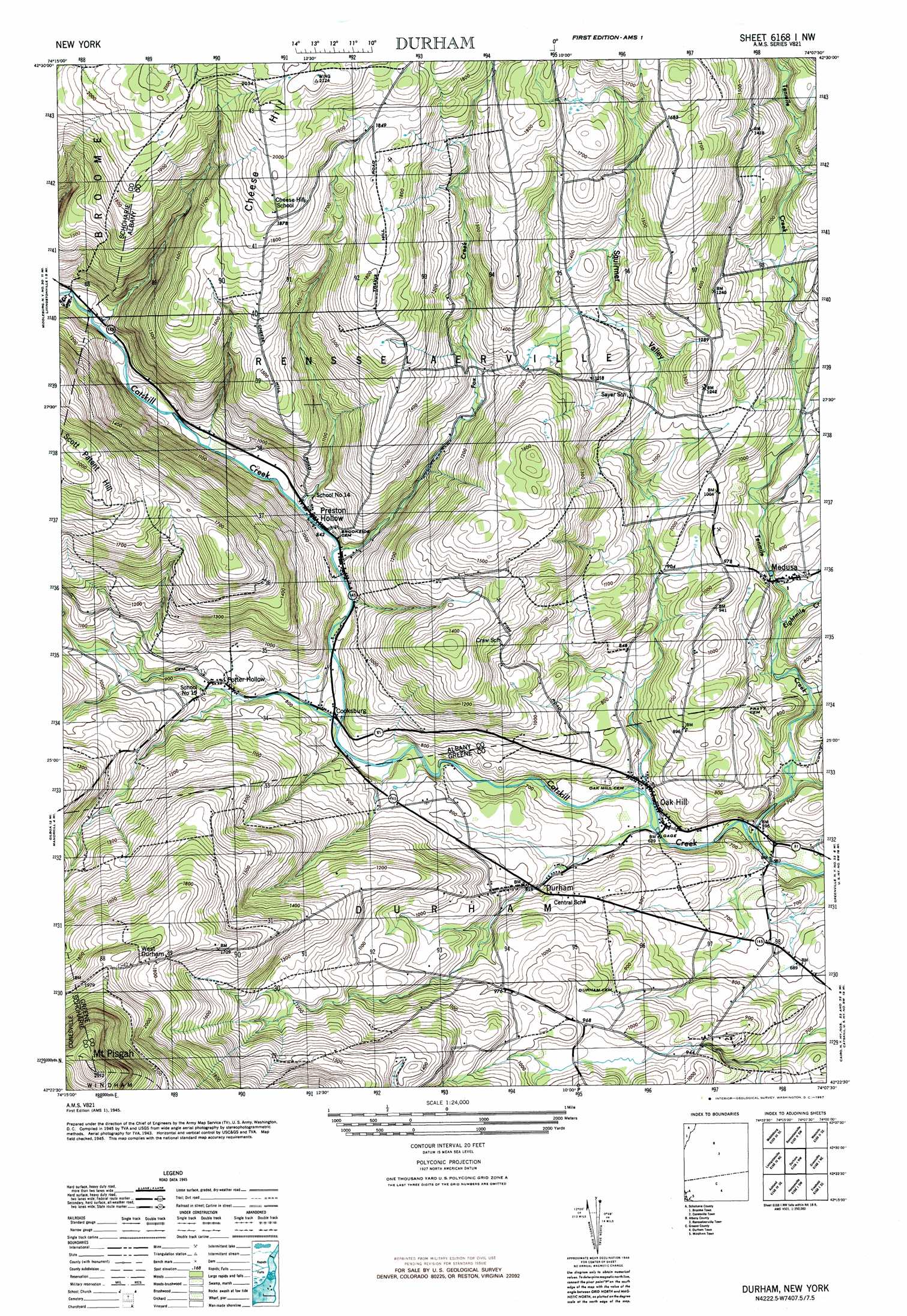
USGS Topo Quad 42074d2 - 1:24,000 scale
| Topo Map Name: | Durham |
| USGS Topo Quad ID: | 42074d2 |
| Print Size: | ca. 21 1/4" wide x 27" high |
| Southeast Coordinates: | 42.375° N latitude / 74.125° W longitude |
| Map Center Coordinates: | 42.4375° N latitude / 74.1875° W longitude |
| U.S. State: | NY |
| Filename: | o42074d2.jpg |
| Download Map JPG Image: | Durham topo map 1:24,000 scale |
| Map Type: | Topographic |
| Topo Series: | 7.5´ |
| Map Scale: | 1:24,000 |
| Source of Map Images: | United States Geological Survey (USGS) |
| Alternate Map Versions: |
Durham NY 1945, updated 1967 Download PDF Buy paper map Durham NY 1946, updated 1946 Download PDF Buy paper map Durham NY 1946, updated 1946 Download PDF Buy paper map Durham NY 1967 Download PDF Buy paper map Durham NY 2010 Download PDF Buy paper map Durham NY 2013 Download PDF Buy paper map Durham NY 2016 Download PDF Buy paper map |
1:24,000 Topo Quads surrounding Durham
Cobleskill |
Schoharie |
Gallupville |
Altamont |
Voorheesville |
Breakabeen |
Middleburgh |
Rensselaerville |
Westerlo |
Clarksville |
Gilboa |
Livingstonville |
Durham |
Greenville |
Alcove |
Prattsville |
Ashland |
Hensonville |
Freehold |
Leeds |
West Kill |
Lexington |
Hunter |
Kaaterskill |
Cementon |
> Back to 42074a1 at 1:100,000 scale
> Back to 42074a1 at 1:250,000 scale
> Back to U.S. Topo Maps home
Durham topo map: Gazetteer
Durham: Populated Places
Cooksburg elevation 233m 764′Durham elevation 235m 770′
Medusa elevation 245m 803′
Oak Hill elevation 196m 643′
Potter Hollow elevation 262m 859′
Preston Hollow elevation 258m 846′
West Durham elevation 559m 1833′
Durham: Streams
Eightmile Creek elevation 222m 728′Fox Creek elevation 257m 843′
Tenmile Creek elevation 172m 564′
Durham: Summits
Cheese Hill elevation 610m 2001′Mount Pisgah elevation 887m 2910′
Durham: Valleys
Squirmer Valley elevation 190m 623′Durham digital topo map on disk
Buy this Durham topo map showing relief, roads, GPS coordinates and other geographical features, as a high-resolution digital map file on DVD:
New York, Vermont, Connecticut & Western Massachusetts
Buy digital topo maps: New York, Vermont, Connecticut & Western Massachusetts