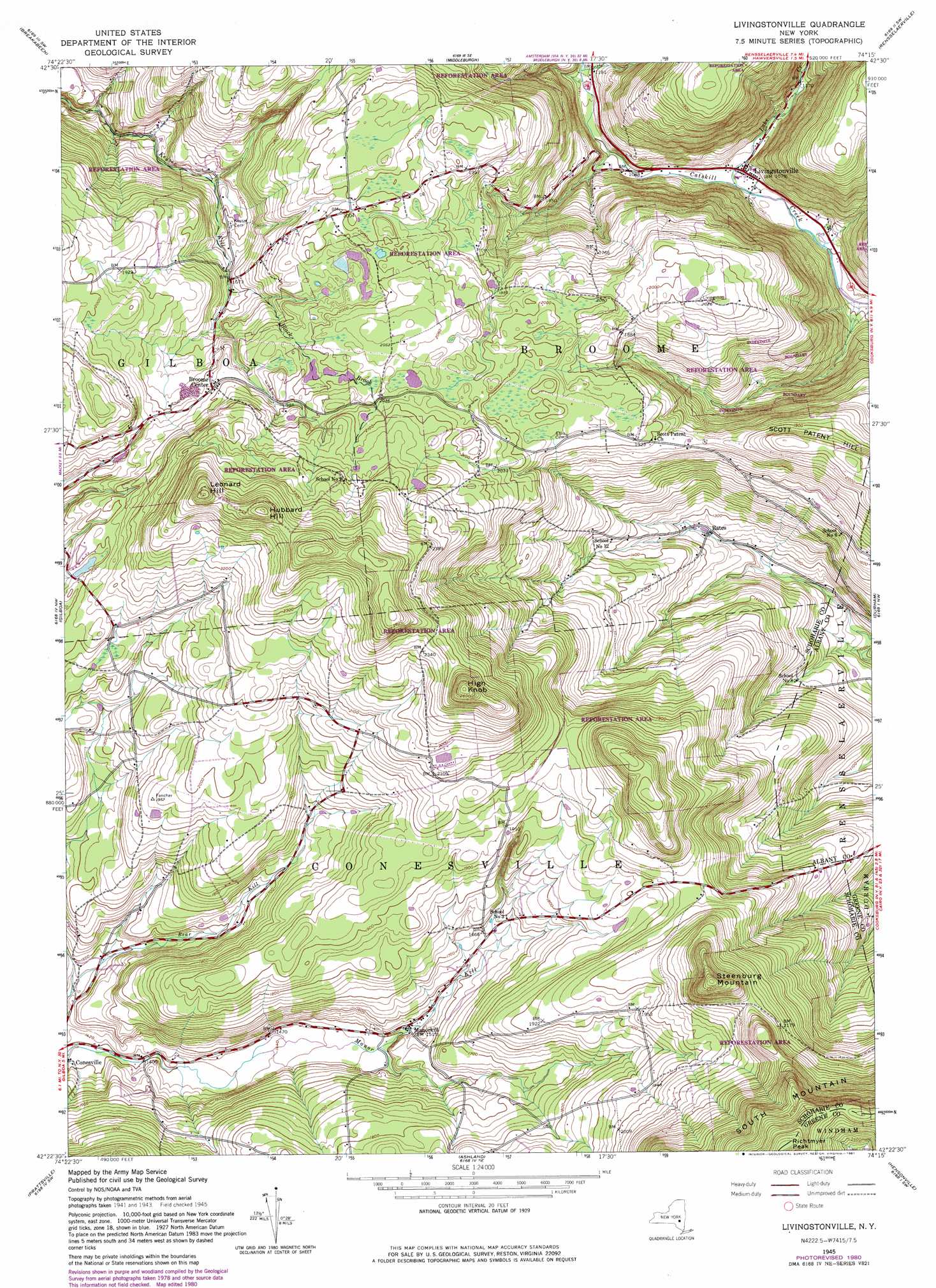
Livingstonville Topo Map New York
To zoom in, hover over the map of Livingstonville
USGS Topo Quad 42074d3 - 1:24,000 scale
| Topo Map Name: | Livingstonville |
| USGS Topo Quad ID: | 42074d3 |
| Print Size: | ca. 21 1/4" wide x 27" high |
| Southeast Coordinates: | 42.375° N latitude / 74.25° W longitude |
| Map Center Coordinates: | 42.4375° N latitude / 74.3125° W longitude |
| U.S. State: | NY |
| Filename: | o42074d3.jpg |
| Download Map JPG Image: | Livingstonville topo map 1:24,000 scale |
| Map Type: | Topographic |
| Topo Series: | 7.5´ |
| Map Scale: | 1:24,000 |
| Source of Map Images: | United States Geological Survey (USGS) |
| Alternate Map Versions: |
Livingstonville NY 1945, updated 1966 Download PDF Buy paper map Livingstonville NY 1945, updated 1981 Download PDF Buy paper map Livingstonville NY 1946 Download PDF Buy paper map Livingstonville NY 1962 Download PDF Buy paper map Livingstonville NY 2010 Download PDF Buy paper map Livingstonville NY 2013 Download PDF Buy paper map Livingstonville NY 2016 Download PDF Buy paper map |
1:24,000 Topo Quads surrounding Livingstonville
Richmondville |
Cobleskill |
Schoharie |
Gallupville |
Altamont |
Summit |
Breakabeen |
Middleburgh |
Rensselaerville |
Westerlo |
Stamford |
Gilboa |
Livingstonville |
Durham |
Greenville |
Roxbury |
Prattsville |
Ashland |
Hensonville |
Freehold |
Fleischmanns |
West Kill |
Lexington |
Hunter |
Kaaterskill |
> Back to 42074a1 at 1:100,000 scale
> Back to 42074a1 at 1:250,000 scale
> Back to U.S. Topo Maps home
Livingstonville topo map: Gazetteer
Livingstonville: Populated Places
Bates elevation 380m 1246′Broome Center elevation 600m 1968′
Livingstonville elevation 326m 1069′
Manorkill elevation 461m 1512′
Livingstonville: Streams
Black Brook elevation 507m 1663′Lake Creek elevation 316m 1036′
Livingstonville: Summits
High Knob elevation 812m 2664′Hubbard Hill elevation 800m 2624′
Leonard Hill elevation 794m 2604′
Richtmyer Peak elevation 910m 2985′
Scott Patent Hill elevation 629m 2063′
Steenburg Mountain elevation 782m 2565′
Livingstonville digital topo map on disk
Buy this Livingstonville topo map showing relief, roads, GPS coordinates and other geographical features, as a high-resolution digital map file on DVD:
New York, Vermont, Connecticut & Western Massachusetts
Buy digital topo maps: New York, Vermont, Connecticut & Western Massachusetts