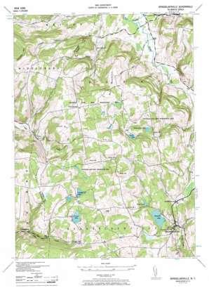
Rensselaerville Topo Map New York
To zoom in, hover over the map of Rensselaerville
USGS Topo Quad 42074e2 - 1:24,000 scale
| Topo Map Name: | Rensselaerville |
| USGS Topo Quad ID: | 42074e2 |
| Print Size: | ca. 21 1/4" wide x 27" high |
| Southeast Coordinates: | 42.5° N latitude / 74.125° W longitude |
| Map Center Coordinates: | 42.5625° N latitude / 74.1875° W longitude |
| U.S. State: | NY |
| Filename: | o42074e2.jpg |
| Download Map JPG Image: | Rensselaerville topo map 1:24,000 scale |
| Map Type: | Topographic |
| Topo Series: | 7.5´ |
| Map Scale: | 1:24,000 |
| Source of Map Images: | United States Geological Survey (USGS) |
| Alternate Map Versions: |
Rensselaerville NY 1946, updated 1957 Download PDF Buy paper map Rensselaerville NY 1946, updated 1968 Download PDF Buy paper map Rensselaerville NY 2010 Download PDF Buy paper map Rensselaerville NY 2013 Download PDF Buy paper map Rensselaerville NY 2016 Download PDF Buy paper map |
1:24,000 Topo Quads surrounding Rensselaerville
> Back to 42074e1 at 1:100,000 scale
> Back to 42074a1 at 1:250,000 scale
> Back to U.S. Topo Maps home
Rensselaerville topo map: Gazetteer
Rensselaerville: Falls
Rensselaerville Falls elevation 450m 1476′Rensselaerville: Lakes
Crystal Lake elevation 621m 2037′Fawn Lake elevation 495m 1624′
Myosotis Lake elevation 466m 1528′
Triangle Lake elevation 609m 1998′
White Birch Pond elevation 469m 1538′
Rensselaerville: Parks
Partridge Run Game Management Area elevation 468m 1535′Rensselaerville: Populated Places
Hawversville elevation 427m 1400′Rensselaerville elevation 416m 1364′
Rensselaerville: Reservoirs
Hicks Pond elevation 475m 1558′Rensselaerville: Streams
Switz Kill elevation 281m 921′Rensselaerville: Summits
Cannady Hill elevation 645m 2116′Cook Hill elevation 604m 1981′
East Hill elevation 448m 1469′
Garver Hill elevation 629m 2063′
Henry Hill elevation 659m 2162′
North Hill elevation 606m 1988′
West Mountain elevation 597m 1958′
Rensselaerville: Valleys
Brat Hollow elevation 345m 1131′The Gulf elevation 297m 974′
Rensselaerville digital topo map on disk
Buy this Rensselaerville topo map showing relief, roads, GPS coordinates and other geographical features, as a high-resolution digital map file on DVD:
New York, Vermont, Connecticut & Western Massachusetts
Buy digital topo maps: New York, Vermont, Connecticut & Western Massachusetts


