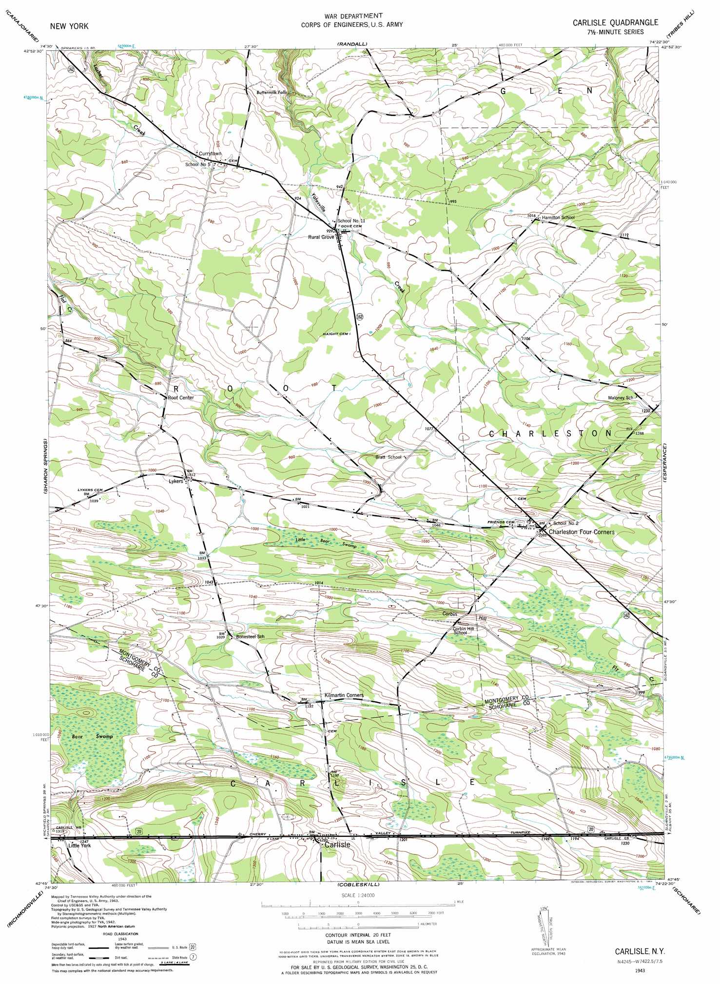
Carlisle Topo Map New York
To zoom in, hover over the map of Carlisle
USGS Topo Quad 42074g4 - 1:24,000 scale
| Topo Map Name: | Carlisle |
| USGS Topo Quad ID: | 42074g4 |
| Print Size: | ca. 21 1/4" wide x 27" high |
| Southeast Coordinates: | 42.75° N latitude / 74.375° W longitude |
| Map Center Coordinates: | 42.8125° N latitude / 74.4375° W longitude |
| U.S. State: | NY |
| Filename: | o42074g4.jpg |
| Download Map JPG Image: | Carlisle topo map 1:24,000 scale |
| Map Type: | Topographic |
| Topo Series: | 7.5´ |
| Map Scale: | 1:24,000 |
| Source of Map Images: | United States Geological Survey (USGS) |
| Alternate Map Versions: |
Carlisle NY 1943, updated 1957 Download PDF Buy paper map Carlisle NY 1943, updated 1964 Download PDF Buy paper map Carlisle NY 2010 Download PDF Buy paper map Carlisle NY 2013 Download PDF Buy paper map Carlisle NY 2016 Download PDF Buy paper map |
1:24,000 Topo Quads surrounding Carlisle
Oppenheim |
Lassellsville |
Peck Lake |
Gloversville |
Broadalbin |
Fort Plain |
Canajoharie |
Randall |
Tribes Hill |
Amsterdam |
Sprout Brook |
Sharon Springs |
Carlisle |
Esperance |
Duanesburg |
South Valley |
Richmondville |
Cobleskill |
Schoharie |
Gallupville |
Charlotteville |
Summit |
Breakabeen |
Middleburgh |
Rensselaerville |
> Back to 42074e1 at 1:100,000 scale
> Back to 42074a1 at 1:250,000 scale
> Back to U.S. Topo Maps home
Carlisle topo map: Gazetteer
Carlisle: Airports
Russell Airport elevation 225m 738′Carlisle: Falls
Buttermilk Falls elevation 249m 816′Carlisle: Populated Places
Carlisle elevation 391m 1282′Charleston Four Corners elevation 333m 1092′
Currytown elevation 276m 905′
Little York elevation 393m 1289′
Lykers elevation 310m 1017′
Root Center elevation 270m 885′
Rural Grove elevation 285m 935′
Carlisle: Summits
Corbin Hill elevation 343m 1125′Carlisle: Swamps
Bear Swamp elevation 322m 1056′Little Bear Swamp elevation 302m 990′
Carlisle digital topo map on disk
Buy this Carlisle topo map showing relief, roads, GPS coordinates and other geographical features, as a high-resolution digital map file on DVD:
New York, Vermont, Connecticut & Western Massachusetts
Buy digital topo maps: New York, Vermont, Connecticut & Western Massachusetts