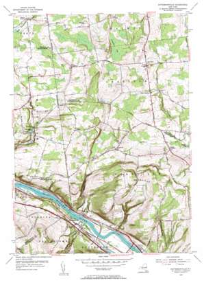
Pattersonville Topo Map New York
To zoom in, hover over the map of Pattersonville
USGS Topo Quad 42074h1 - 1:24,000 scale
| Topo Map Name: | Pattersonville |
| USGS Topo Quad ID: | 42074h1 |
| Print Size: | ca. 21 1/4" wide x 27" high |
| Southeast Coordinates: | 42.875° N latitude / 74° W longitude |
| Map Center Coordinates: | 42.9375° N latitude / 74.0625° W longitude |
| U.S. State: | NY |
| Filename: | o42074h1.jpg |
| Download Map JPG Image: | Pattersonville topo map 1:24,000 scale |
| Map Type: | Topographic |
| Topo Series: | 7.5´ |
| Map Scale: | 1:24,000 |
| Source of Map Images: | United States Geological Survey (USGS) |
| Alternate Map Versions: |
Pattersonville NY 1954, updated 1956 Download PDF Buy paper map Pattersonville NY 1954, updated 1956 Download PDF Buy paper map Pattersonville NY 2010 Download PDF Buy paper map Pattersonville NY 2013 Download PDF Buy paper map Pattersonville NY 2016 Download PDF Buy paper map |
1:24,000 Topo Quads surrounding Pattersonville
> Back to 42074e1 at 1:100,000 scale
> Back to 42074a1 at 1:250,000 scale
> Back to U.S. Topo Maps home
Pattersonville topo map: Gazetteer
Pattersonville: Airports
Snow Field elevation 234m 767′Westwind Farm Airport elevation 228m 748′
Pattersonville: Dams
Lock Number 9 elevation 71m 232′Pattersonville: Islands
Swart Island elevation 76m 249′Pattersonville: Lakes
McLachlan Pond elevation 172m 564′Pattersonville: Populated Places
Beyers Corners elevation 228m 748′Glenville elevation 215m 705′
Green Corners elevation 235m 770′
Hoffmans elevation 81m 265′
Lower Corners elevation 182m 597′
Pattersonville elevation 82m 269′
West Charlton elevation 209m 685′
Pattersonville: Streams
Chaughtanoonda Creek elevation 73m 239′Compaanen Kill elevation 73m 239′
Crabb Kill elevation 145m 475′
Fallentree Kill elevation 158m 518′
Healy Kill elevation 221m 725′
Sandsea Kill elevation 73m 239′
Verf Kill elevation 73m 239′
Pattersonville: Summits
Dennison Hill elevation 292m 958′Glenville Hill elevation 336m 1102′
Jersey Hill elevation 282m 925′
Patton Hill elevation 206m 675′
Swart Hill elevation 168m 551′
Pattersonville: Swamps
Consalus Vly elevation 255m 836′Pattersonville: Valleys
Wolf Hollow elevation 132m 433′Pattersonville digital topo map on disk
Buy this Pattersonville topo map showing relief, roads, GPS coordinates and other geographical features, as a high-resolution digital map file on DVD:
New York, Vermont, Connecticut & Western Massachusetts
Buy digital topo maps: New York, Vermont, Connecticut & Western Massachusetts


