Randall Topo Map New York
To zoom in, hover over the map of Randall
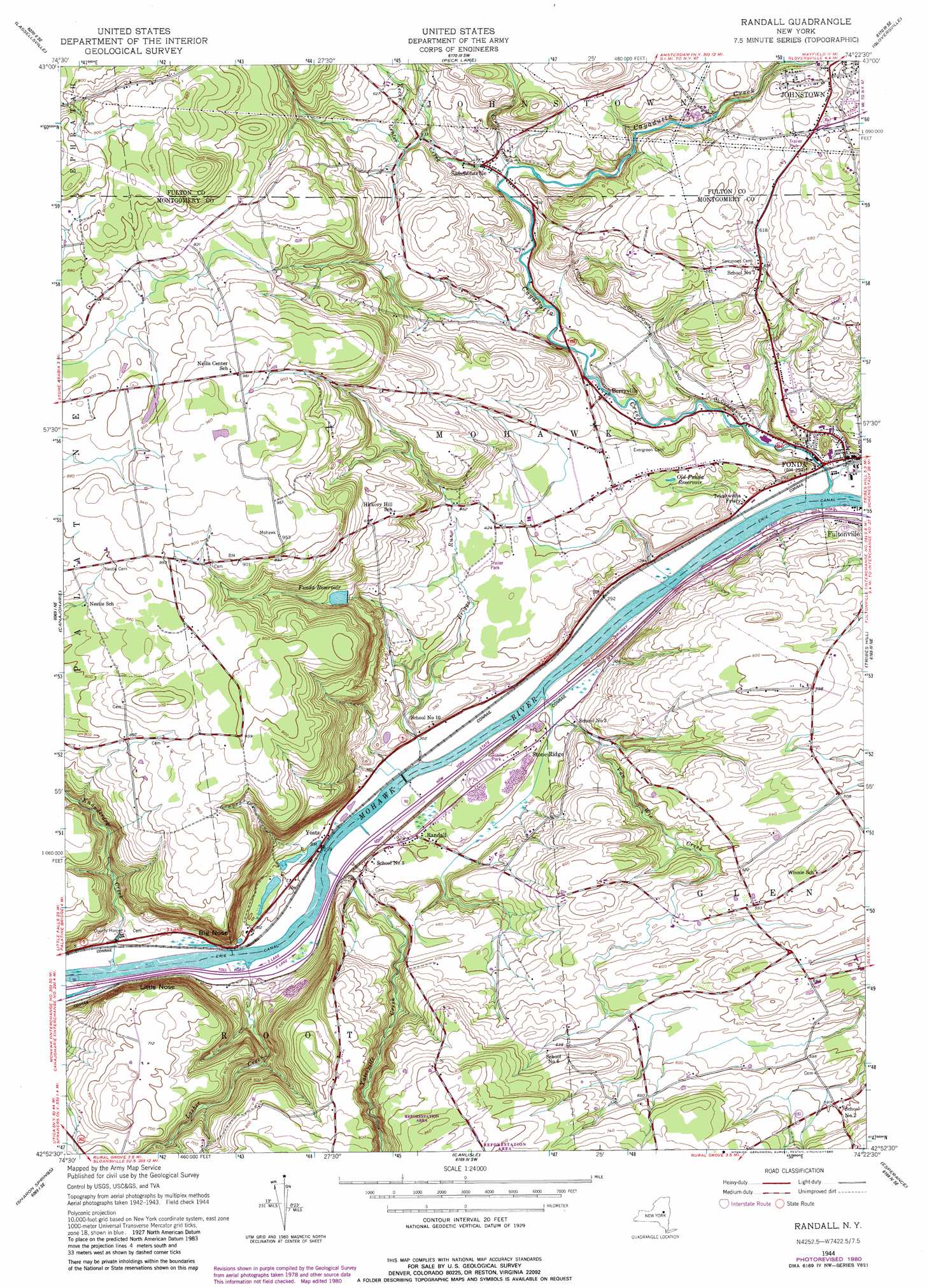
USGS Topo Quad 42074h4 - 1:24,000 scale
| Topo Map Name: | Randall |
| USGS Topo Quad ID: | 42074h4 |
| Print Size: | ca. 21 1/4" wide x 27" high |
| Southeast Coordinates: | 42.875° N latitude / 74.375° W longitude |
| Map Center Coordinates: | 42.9375° N latitude / 74.4375° W longitude |
| U.S. State: | NY |
| Filename: | o42074h4.jpg |
| Download Map JPG Image: | Randall topo map 1:24,000 scale |
| Map Type: | Topographic |
| Topo Series: | 7.5´ |
| Map Scale: | 1:24,000 |
| Source of Map Images: | United States Geological Survey (USGS) |
| Alternate Map Versions: |
Randall NY 1944, updated 1959 Download PDF Buy paper map Randall NY 1944, updated 1977 Download PDF Buy paper map Randall NY 1944, updated 1980 Download PDF Buy paper map Randall NY 2010 Download PDF Buy paper map Randall NY 2013 Download PDF Buy paper map Randall NY 2016 Download PDF Buy paper map |
1:24,000 Topo Quads surrounding Randall
Stratford |
Canada Lake |
Caroga Lake |
Jackson Summit |
Northville |
Oppenheim |
Lassellsville |
Peck Lake |
Gloversville |
Broadalbin |
Fort Plain |
Canajoharie |
Randall |
Tribes Hill |
Amsterdam |
Sprout Brook |
Sharon Springs |
Carlisle |
Esperance |
Duanesburg |
South Valley |
Richmondville |
Cobleskill |
Schoharie |
Gallupville |
> Back to 42074e1 at 1:100,000 scale
> Back to 42074a1 at 1:250,000 scale
> Back to U.S. Topo Maps home
Randall topo map: Gazetteer
Randall: Cliffs
Big Nose elevation 120m 393′Little Nose elevation 160m 524′
Randall: Populated Places
Berryville elevation 115m 377′Fonda elevation 90m 295′
Randall elevation 92m 301′
Sammonsville elevation 144m 472′
Stone Ridge elevation 96m 314′
Yosts elevation 88m 288′
Randall: Reservoirs
Fonda Reservoir elevation 184m 603′Old Fonda Reservoir elevation 123m 403′
Randall: Streams
Briggs Run elevation 85m 278′Cayadutta Creek elevation 84m 275′
Crum Creek elevation 140m 459′
Kecks Center Creek elevation 134m 439′
Knauderack Creek elevation 150m 492′
Lasher Creek elevation 87m 285′
Van Wie Creek elevation 84m 275′
Yatesville Creek elevation 87m 285′
Randall digital topo map on disk
Buy this Randall topo map showing relief, roads, GPS coordinates and other geographical features, as a high-resolution digital map file on DVD:
New York, Vermont, Connecticut & Western Massachusetts
Buy digital topo maps: New York, Vermont, Connecticut & Western Massachusetts