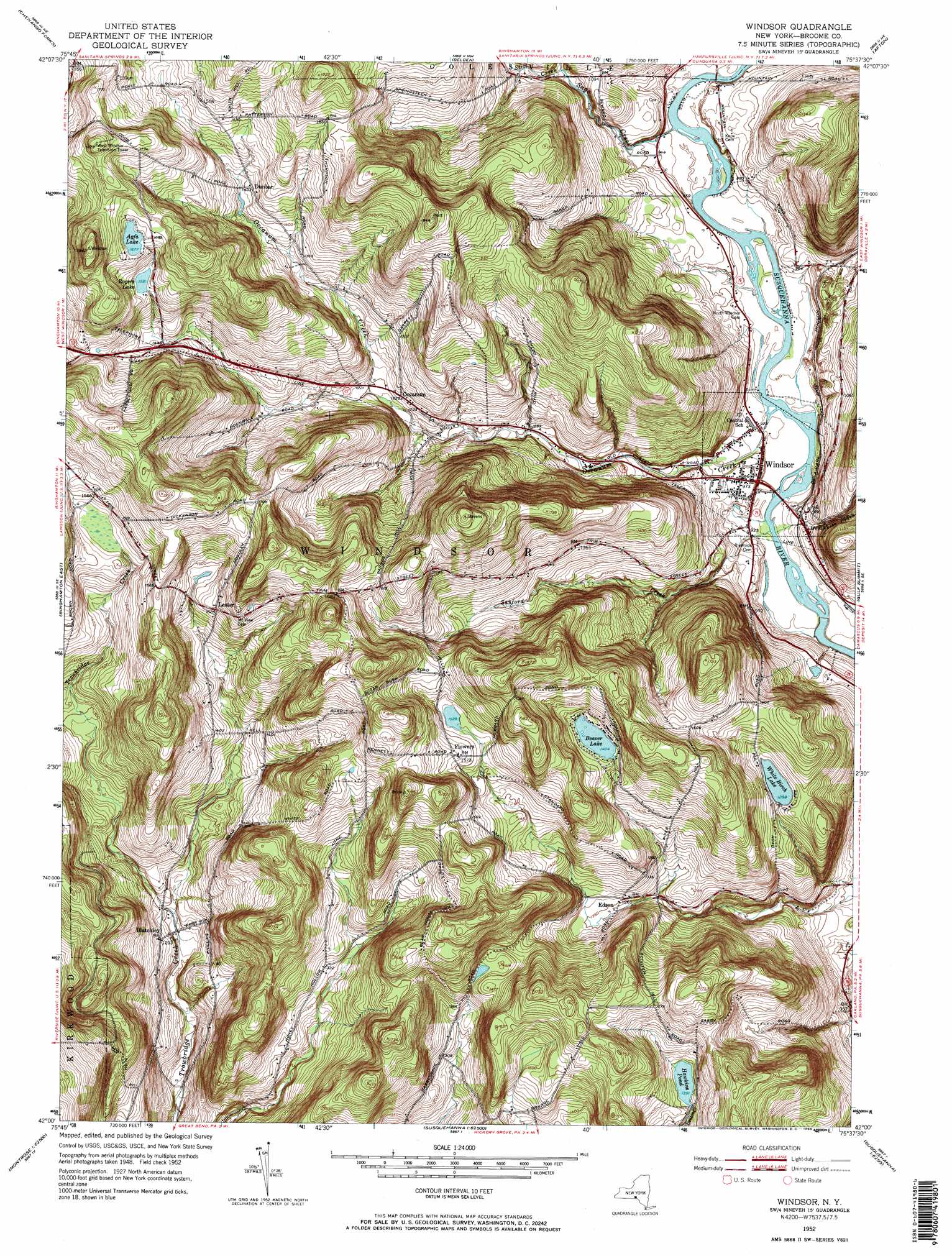
Windsor Topo Map New York
To zoom in, hover over the map of Windsor
USGS Topo Quad 42075a6 - 1:24,000 scale
| Topo Map Name: | Windsor |
| USGS Topo Quad ID: | 42075a6 |
| Print Size: | ca. 21 1/4" wide x 27" high |
| Southeast Coordinates: | 42° N latitude / 75.625° W longitude |
| Map Center Coordinates: | 42.0625° N latitude / 75.6875° W longitude |
| U.S. State: | NY |
| Filename: | o42075a6.jpg |
| Download Map JPG Image: | Windsor topo map 1:24,000 scale |
| Map Type: | Topographic |
| Topo Series: | 7.5´ |
| Map Scale: | 1:24,000 |
| Source of Map Images: | United States Geological Survey (USGS) |
| Alternate Map Versions: |
Windsor NY 1952, updated 1955 Download PDF Buy paper map Windsor NY 1952, updated 1969 Download PDF Buy paper map Windsor NY 1952, updated 1969 Download PDF Buy paper map Windsor NY 2010 Download PDF Buy paper map Windsor NY 2013 Download PDF Buy paper map Windsor NY 2016 Download PDF Buy paper map |
1:24,000 Topo Quads surrounding Windsor
Whitney Point |
Greene |
Brisben |
West Bainbridge |
Sidney |
Castle Creek |
Chenango Forks |
Belden |
Afton |
North Sanford |
Binghamton West |
Binghamton East |
Windsor |
Gulf Summit |
Deposit |
Laurel Lake |
Franklin Forks |
Great Bend |
Susquehanna |
Starrucca |
Montrose West |
Montrose East |
Harford |
Thompson |
Orson |
> Back to 42075a1 at 1:100,000 scale
> Back to 42074a1 at 1:250,000 scale
> Back to U.S. Topo Maps home
Windsor topo map: Gazetteer
Windsor: Lakes
Agfa Lake elevation 511m 1676′Beaver Lake elevation 446m 1463′
Hawkins Pond elevation 424m 1391′
Rogers Lake elevation 482m 1581′
White Birch Lake elevation 396m 1299′
Windsor: Mines
Bell Road Quarry elevation 476m 1561′Hawkins Pond Quarry elevation 512m 1679′
Windsor: Populated Places
Blatchley elevation 367m 1204′Dunbar elevation 427m 1400′
Edson elevation 383m 1256′
Flowers elevation 484m 1587′
Forest View Mobile Home Park elevation 478m 1568′
Lester elevation 463m 1519′
Occanum elevation 372m 1220′
Occanum Falls Mobile Home Park elevation 320m 1049′
Windsor elevation 289m 948′
Windsor: Streams
Hotchkiss Creek elevation 276m 905′Occanum Creek elevation 277m 908′
Sage Creek elevation 281m 921′
Sanford Creek elevation 275m 902′
Still Creek elevation 315m 1033′
Windsor digital topo map on disk
Buy this Windsor topo map showing relief, roads, GPS coordinates and other geographical features, as a high-resolution digital map file on DVD:
New York, Vermont, Connecticut & Western Massachusetts
Buy digital topo maps: New York, Vermont, Connecticut & Western Massachusetts