New Berlin South Topo Map New York
To zoom in, hover over the map of New Berlin South
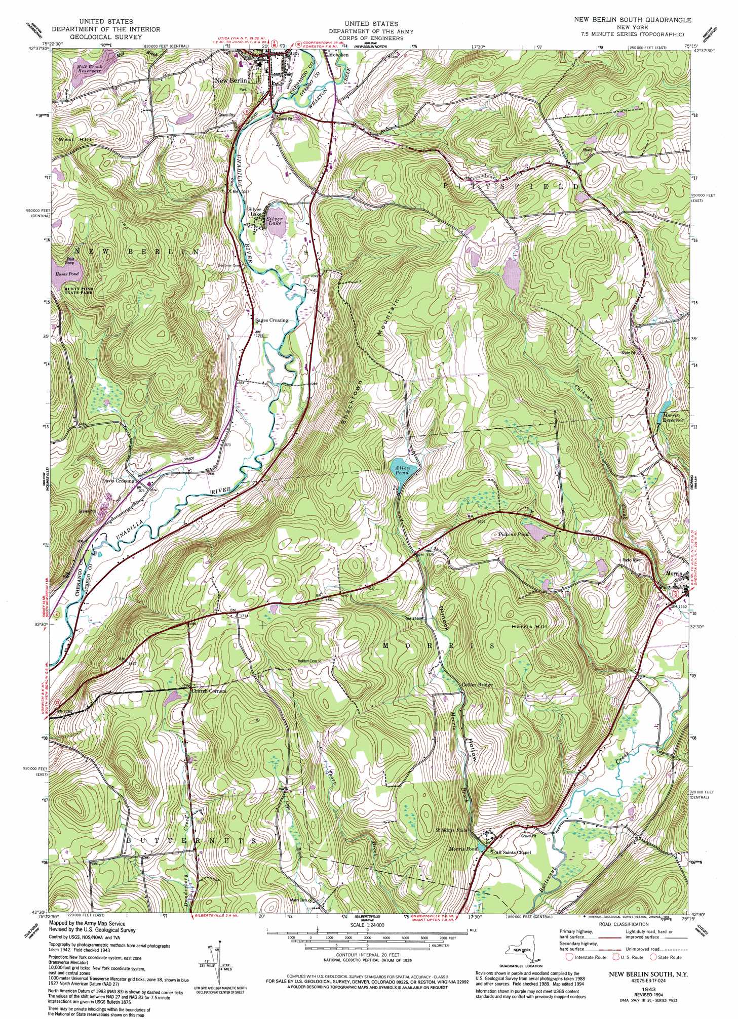
USGS Topo Quad 42075e3 - 1:24,000 scale
| Topo Map Name: | New Berlin South |
| USGS Topo Quad ID: | 42075e3 |
| Print Size: | ca. 21 1/4" wide x 27" high |
| Southeast Coordinates: | 42.5° N latitude / 75.25° W longitude |
| Map Center Coordinates: | 42.5625° N latitude / 75.3125° W longitude |
| U.S. State: | NY |
| Filename: | o42075e3.jpg |
| Download Map JPG Image: | New Berlin South topo map 1:24,000 scale |
| Map Type: | Topographic |
| Topo Series: | 7.5´ |
| Map Scale: | 1:24,000 |
| Source of Map Images: | United States Geological Survey (USGS) |
| Alternate Map Versions: |
New Berlin South NY 1943, updated 1960 Download PDF Buy paper map New Berlin South NY 1943, updated 1983 Download PDF Buy paper map New Berlin South NY 1943, updated 1994 Download PDF Buy paper map New Berlin South NY 2010 Download PDF Buy paper map New Berlin South NY 2013 Download PDF Buy paper map New Berlin South NY 2016 Download PDF Buy paper map |
1:24,000 Topo Quads surrounding New Berlin South
Hamilton |
Hubbardsville |
Brookfield |
Unadilla Forks |
Schuyler Lake |
Earlville |
Sherburne |
New Berlin North |
Edmeston |
Hartwick |
Norwich |
Holmesville |
New Berlin South |
Morris |
Mount Vision |
Oxford |
Guilford |
Gilbertsville |
Otego |
Oneonta |
West Bainbridge |
Sidney |
Unadilla |
Franklin |
Treadwell |
> Back to 42075e1 at 1:100,000 scale
> Back to 42074a1 at 1:250,000 scale
> Back to U.S. Topo Maps home
New Berlin South topo map: Gazetteer
New Berlin South: Falls
Saint Marys Falls elevation 351m 1151′New Berlin South: Lakes
Allen Pond elevation 454m 1489′Hunt Pond elevation 435m 1427′
Morris Pond elevation 345m 1131′
Pickens Pond elevation 472m 1548′
Silver Lake elevation 328m 1076′
New Berlin South: Parks
Hunt's Pond State Park elevation 435m 1427′New Berlin South: Populated Places
Davis Crossing elevation 327m 1072′New Berlin elevation 339m 1112′
Sages Crossing elevation 331m 1085′
Silver Lake elevation 328m 1076′
New Berlin South: Reservoirs
Morris Reservoir elevation 415m 1361′New Berlin South: Streams
Morris Brook elevation 327m 1072′Wharton Creek elevation 323m 1059′
New Berlin South: Summits
Harris Hill elevation 526m 1725′Shacktown Mountain elevation 559m 1833′
West Hill elevation 548m 1797′
New Berlin South: Valleys
Dimock Hollow elevation 328m 1076′New Berlin South digital topo map on disk
Buy this New Berlin South topo map showing relief, roads, GPS coordinates and other geographical features, as a high-resolution digital map file on DVD:
New York, Vermont, Connecticut & Western Massachusetts
Buy digital topo maps: New York, Vermont, Connecticut & Western Massachusetts