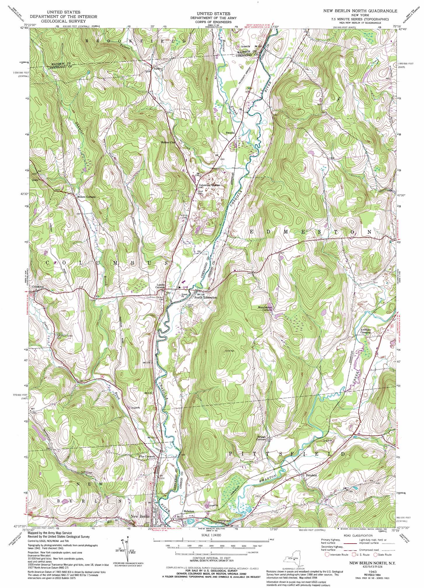
New Berlin North Topo Map New York
To zoom in, hover over the map of New Berlin North
USGS Topo Quad 42075f3 - 1:24,000 scale
| Topo Map Name: | New Berlin North |
| USGS Topo Quad ID: | 42075f3 |
| Print Size: | ca. 21 1/4" wide x 27" high |
| Southeast Coordinates: | 42.625° N latitude / 75.25° W longitude |
| Map Center Coordinates: | 42.6875° N latitude / 75.3125° W longitude |
| U.S. State: | NY |
| Filename: | o42075f3.jpg |
| Download Map JPG Image: | New Berlin North topo map 1:24,000 scale |
| Map Type: | Topographic |
| Topo Series: | 7.5´ |
| Map Scale: | 1:24,000 |
| Source of Map Images: | United States Geological Survey (USGS) |
| Alternate Map Versions: |
New Berlin North NY 1943, updated 1957 Download PDF Buy paper map New Berlin North NY 1943, updated 1972 Download PDF Buy paper map New Berlin North NY 1943, updated 1990 Download PDF Buy paper map New Berlin North NY 1943, updated 1994 Download PDF Buy paper map New Berlin North NY 2010 Download PDF Buy paper map New Berlin North NY 2013 Download PDF Buy paper map New Berlin North NY 2016 Download PDF Buy paper map |
1:24,000 Topo Quads surrounding New Berlin North
Munnsville |
Oriskany Falls |
Cassville |
West Winfield |
Millers Mills |
Hamilton |
Hubbardsville |
Brookfield |
Unadilla Forks |
Schuyler Lake |
Earlville |
Sherburne |
New Berlin North |
Edmeston |
Hartwick |
Norwich |
Holmesville |
New Berlin South |
Morris |
Mount Vision |
Oxford |
Guilford |
Gilbertsville |
Otego |
Oneonta |
> Back to 42075e1 at 1:100,000 scale
> Back to 42074a1 at 1:250,000 scale
> Back to U.S. Topo Maps home
New Berlin North topo map: Gazetteer
New Berlin North: Airports
Tri County Airways Airport elevation 348m 1141′New Berlin North: Dams
Hoboken Dam elevation 336m 1102′New Berlin North: Populated Places
Amblers Crossing elevation 349m 1145′Button City elevation 387m 1269′
Columbus elevation 395m 1295′
Columbus Quarter elevation 374m 1227′
Five Corners elevation 339m 1112′
Hoboken elevation 340m 1115′
Pittsfield elevation 352m 1154′
South Edmeston elevation 341m 1118′
Sweets elevation 343m 1125′
Tallette elevation 396m 1299′
New Berlin North: Streams
Beaver Creek elevation 335m 1099′Center Brook elevation 329m 1079′
Shawler Brook elevation 356m 1167′
Tallette Creek elevation 337m 1105′
New Berlin North digital topo map on disk
Buy this New Berlin North topo map showing relief, roads, GPS coordinates and other geographical features, as a high-resolution digital map file on DVD:
New York, Vermont, Connecticut & Western Massachusetts
Buy digital topo maps: New York, Vermont, Connecticut & Western Massachusetts