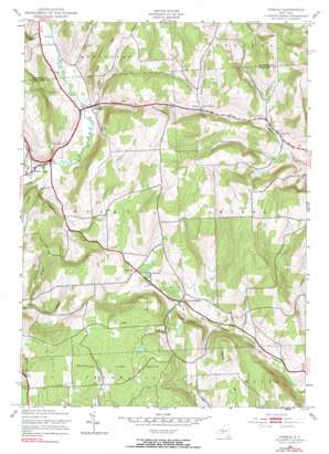
Otselic Topo Map New York
To zoom in, hover over the map of Otselic
USGS Topo Quad 42075f6 - 1:24,000 scale
| Topo Map Name: | Otselic |
| USGS Topo Quad ID: | 42075f6 |
| Print Size: | ca. 21 1/4" wide x 27" high |
| Southeast Coordinates: | 42.625° N latitude / 75.625° W longitude |
| Map Center Coordinates: | 42.6875° N latitude / 75.6875° W longitude |
| U.S. State: | NY |
| Filename: | o42075f6.jpg |
| Download Map JPG Image: | Otselic topo map 1:24,000 scale |
| Map Type: | Topographic |
| Topo Series: | 7.5´ |
| Map Scale: | 1:24,000 |
| Source of Map Images: | United States Geological Survey (USGS) |
| Alternate Map Versions: |
Otselic NY 1943, updated 1954 Download PDF Buy paper map Otselic NY 1943, updated 1968 Download PDF Buy paper map Otselic NY 1943, updated 1990 Download PDF Buy paper map Otselic NY 2010 Download PDF Buy paper map Otselic NY 2013 Download PDF Buy paper map Otselic NY 2016 Download PDF Buy paper map |
1:24,000 Topo Quads surrounding Otselic
> Back to 42075e1 at 1:100,000 scale
> Back to 42074a1 at 1:250,000 scale
> Back to U.S. Topo Maps home
Otselic topo map: Gazetteer
Otselic: Parks
Pharsalia Game Refuge elevation 586m 1922′Otselic: Populated Places
Beaver Meadow elevation 451m 1479′Bonney elevation 458m 1502′
Otselic elevation 413m 1354′
Otselic Center elevation 401m 1315′
Stanbro elevation 463m 1519′
Otselic: Reservoirs
Perkins Pond elevation 578m 1896′Otselic: Streams
Alder Meadow Brook elevation 443m 1453′Coit Brook elevation 419m 1374′
Mann Brook elevation 396m 1299′
Middletown Brook elevation 397m 1302′
Muller Brook elevation 408m 1338′
Otselic: Summits
Cole Hill elevation 580m 1902′Pigeon Hill elevation 606m 1988′
Otselic digital topo map on disk
Buy this Otselic topo map showing relief, roads, GPS coordinates and other geographical features, as a high-resolution digital map file on DVD:
New York, Vermont, Connecticut & Western Massachusetts
Buy digital topo maps: New York, Vermont, Connecticut & Western Massachusetts


