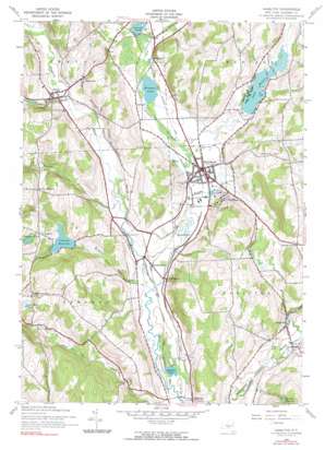
Hamilton Topo Map New York
To zoom in, hover over the map of Hamilton
USGS Topo Quad 42075g5 - 1:24,000 scale
| Topo Map Name: | Hamilton |
| USGS Topo Quad ID: | 42075g5 |
| Print Size: | ca. 21 1/4" wide x 27" high |
| Southeast Coordinates: | 42.75° N latitude / 75.5° W longitude |
| Map Center Coordinates: | 42.8125° N latitude / 75.5625° W longitude |
| U.S. State: | NY |
| Filename: | o42075g5.jpg |
| Download Map JPG Image: | Hamilton topo map 1:24,000 scale |
| Map Type: | Topographic |
| Topo Series: | 7.5´ |
| Map Scale: | 1:24,000 |
| Source of Map Images: | United States Geological Survey (USGS) |
| Alternate Map Versions: |
Hamilton NY 1943, updated 1960 Download PDF Buy paper map Hamilton NY 1943, updated 1971 Download PDF Buy paper map Hamilton NY 1943, updated 1990 Download PDF Buy paper map Hamilton NY 2010 Download PDF Buy paper map Hamilton NY 2013 Download PDF Buy paper map Hamilton NY 2016 Download PDF Buy paper map |
1:24,000 Topo Quads surrounding Hamilton
> Back to 42075e1 at 1:100,000 scale
> Back to 42074a1 at 1:250,000 scale
> Back to U.S. Topo Maps home
Hamilton topo map: Gazetteer
Hamilton: Airports
Elisha Payne Airport elevation 344m 1128′Hamilton: Lakes
Earlville Lake elevation 330m 1082′Lake Moraine elevation 369m 1210′
Mud Pond elevation 335m 1099′
Seymour Pond elevation 455m 1492′
Stone Mill Pond elevation 393m 1289′
Taylor Lake elevation 339m 1112′
Woodman Pond elevation 342m 1122′
Hamilton: Parks
Andy Kerr Stadium elevation 337m 1105′Van Doren Field elevation 338m 1108′
Whitnall Field elevation 340m 1115′
Hamilton: Populated Places
Campbell elevation 445m 1459′Eaton elevation 367m 1204′
Hamilton elevation 342m 1122′
Lebanon Center elevation 411m 1348′
Middleport elevation 341m 1118′
Pecksport elevation 349m 1145′
Poolville elevation 339m 1112′
Randallsville elevation 338m 1108′
Hamilton: Reservoirs
Earlville Reservoir elevation 396m 1299′Lebanon Reservoir elevation 398m 1305′
Hamilton: Streams
Bradley Brook elevation 346m 1135′Eaton Brook elevation 359m 1177′
Kingsley Brook elevation 329m 1079′
Lebanon Brook elevation 395m 1295′
Payne Brook elevation 329m 1079′
Hamilton digital topo map on disk
Buy this Hamilton topo map showing relief, roads, GPS coordinates and other geographical features, as a high-resolution digital map file on DVD:
New York, Vermont, Connecticut & Western Massachusetts
Buy digital topo maps: New York, Vermont, Connecticut & Western Massachusetts


